1:45 PM | **Showers and storms in the Mid-Atlantic region tonight, tomorrow, and tomorrow night...some of the storms can be strong-to-severe...a look ahead to Memorial Day and it looks wet**
Paul Dorian

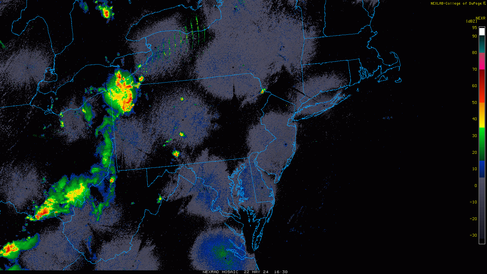
Showers and embedded thunderstorms are popping in the early afternoon across central and western PA and some of this activity can make it all the way into the I-95 corridor by this evening. Images courtesy College of DuPage, NOAA
Overview
Yesterday and today featured plenty of sunshine in the Mid-Atlantic region with very warm and rain-free conditions – not too common in recent weeks – and the dry weather is about to change. The approach of a cold front will bring about an increased chance of showers and thunderstorms this evening across the Mid-Atlantic region and the threat of rain will continue on Thursday and Thursday night. Any thunderstorm in this stretch between this evening and tomorrow night can be on the strong-to-severe side with heavy rain, gusty winds and perhaps even some hail. The period between Friday and Sunday will likely feature some shower activity, but the weekend will not be a total washout. Looking ahead to Monday, Memorial Day, an unusually strong upper-level low for late May will be pushing in this direction and the holiday may turn out to be quite wet in the Mid-Atlantic region.

The threat of showers and thunderstorms will increase this evening along the DC-to-Philly-to-NYC corridor and continue on Thursday and Thursday night. Any thunderstorm that forms in this time period from late today to late tomorrow can reach strong-to-severe levels with heavy rain, gusty winds, and perhaps even some hail. Maps courtesy NOAA/SPC
Details
A cold front is slowly approaching the Mid-Atlantic region this afternoon and it is already generating some shower and thunderstorm activity across the central and western parts of Pennsylvania. Some of the activity will make it into the I-95 corridor region from DC-to-Philly-to-NYC by the end of the day or early part of tonight. This frontal system will grudgingly slide across the region on Thursday and showers and thunderstorms can occur at just about anytime through the day and into tomorrow night. In this stretch from late today through tomorrow night, any thunderstorm that forms can reach strong-to-severe levels with heavy rainfall, gusty winds and perhaps even some hail.

Strong upper-level low will push eastward towards the Mid-Atlantic region early next week and it could result in some rain on Monday, Memorial Day, which can be heavy at times. The threat of rain is likely to continue on Tuesday as well as this system aloft will be a slow-mover. Map courtesy NOAA, tropicaltidbits.com
This same front will stall out in the southern Mid-Atlantic by the end of the week and disturbances will ride along the frontal boundary zone between later Friday and Sunday. These disturbances can produce showers this weekend in the Mid-Atlantic, but it will not be a total washout. BY early next week, an unusually strong upper-level low will slide eastward towards the Mid-Atlantic region and increase the chance of showers and thunderstorms on Monday, Memorial Day. In fact, there is the chance that this system generates some heavy rain at times on the holiday across the DC-to-Philly-to-NYC corridor. The threat of rain is likely to continue into Tuesday as well with this system only moving along slowly in the upper part of the atmosphere.
Meteorologist Paul Dorian
Arcfield
arcfieldweather.com
Follow us on Facebook, Twitter, YouTube