
Friday AM - **Possible strong-to-severe storms later today/early tonight…a comfortable weekend...hot stretch of weather begins early next week and it could last awhile**
Paul Dorian

Upper-level ridging will dominate next week in the eastern and central states leading to an extended period of hot weather. Map courtesy ECMWF, tropicaltidbits.com
Overview
Washington, D.C. reached the 90 degree mark on Thursday for only the first time this month, but that is about to change in a big way as an extended hot spell is coming to the Mid-Atlantic region. The hot stretch begins early next week, but before we get there we’ll have to deal with possible strong-to-severe thunderstorms later today and early tonight and these will be followed by a comfortable Father’s Day weekend with lower humidity.
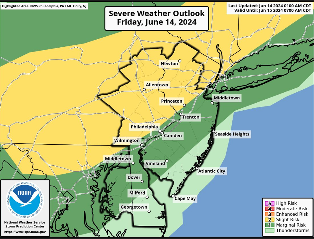
A cold front can spark some strong-to-severe thunderstorm activity later today/early tonight in the Mid-Atlantic region. Map courtesy NOAA/SPC
Details
Temperatures have not reached 90 degrees so far this month in Philly (PHL) and for just the first time on Thursday in Washington, D.C. (DCA), but these low totals will be added to in a big way in coming days. In fact, temperatures today can reach 90+ degrees in some of the DC-to-Philly-to-NYC corridor, but the real heat begins early next week and it is likely to last for an extended period of time as high pressure ridging takes control across the eastern half of the nation. While the eastern and central states turn hot, there will be some colder-than-normal weather out across the Pacific Northwest where they may actually deal with some accumulating snow as we move through the middle of June.

Snow is still on the table in at least portions of the nation as the Pacific NW can see some accumulations during the next several days. Map courtesy Weather Bell, ECMWF
Before we get to the heat of next week, we have a cold frontal passage to deal with in the Mid-Atlantic region that will likely produce some strong-to-severe thunderstorm activity later today and early tonight. Those storms, however, will set the stage for a nice Father’s Day weekend featuring comfortable temperatures and humidity levels and plenty of sunshine on each day. Temperatures on Monday should climb to 90 degrees in much of the I-95 corridor and then likely well into the 90’s on Tuesday, Wednesday, and Thursday and humidity will become a noticeable factor…get the A/C ready, we’ve been pretty lucky so far this season.
Meteorologist Paul Dorian
Arcfield
arcfieldweather.com