12:45 PM (Thursday) | ***A tropical system in the Atlantic Basin that is likely to become quite an important player in about 7-10 days***
Paul Dorian

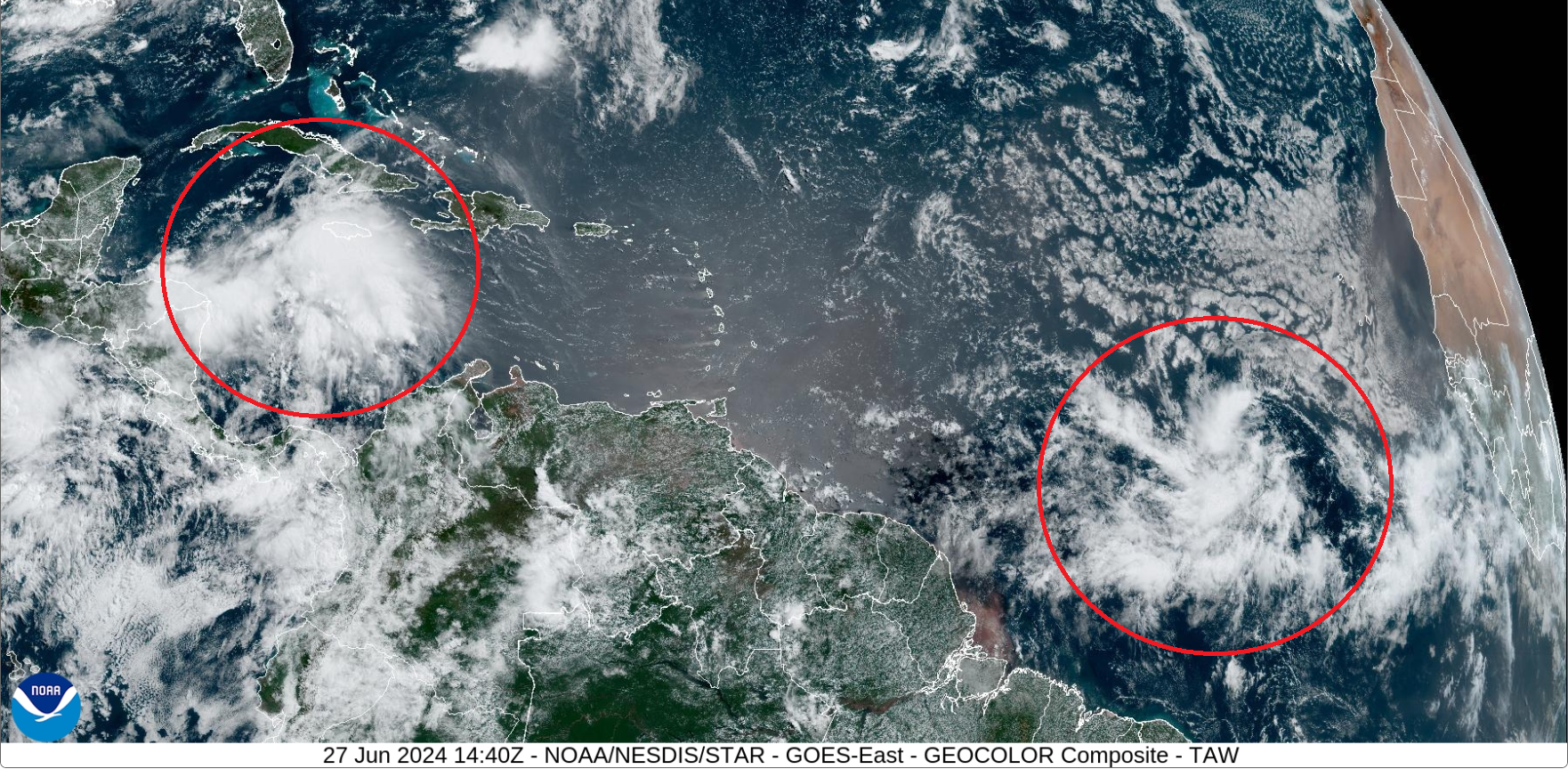
There are two tropical waves currently visible on satellite in the Atlantic Basin (circled), but it is the trailing system over the eastern tropical Atlantic Ocean that may eventually become the bigger concern. Image courtesy NOAA/GOES-East
Overview
There are currently two tropical systems in the Atlantic Basin with one located over the western Caribbean Sea and the other positioned in the eastern tropical Atlantic. While the frontrunner tropical system may indeed generate lots of rainfall for the Yucatan Peninsula and then eastern Mexico, it is the trailing system that may ultimately become more of a concern. The tropical system still well out in the Atlantic has a good chance for intensification in coming days and it very well could become quite an important player on the tropical scene in about 7-10 days or so.

There has been some dry desert air (shown in red, orange) in recent days over the tropical Atlantic that pushed westward from the Sahara Desert region of northern Africa. This inhibiting factor for tropical storm development will likely have little impact on the tropical system now out over the eastern Atlantic. Graphic courtesy University of Wisconsin/CIMSS, NOAA
Details
There is currently a rather poorly organized tropical wave located several hundred miles west of the Cabo Verde Islands, but environmental conditions are likely to become much more conducive for development and intensification and by the later part of the upcoming weekend, we could very well have a named tropical storm to monitor. There has been some dry air in recent days over the tropical Atlantic that originated over the Sahara Desert region of northern Africa and this has been an inhibiting factor for tropical storm development. However, over the next few days, it appears that its impact will be minimal as this tropical system moves on a general west-to-northwest track thanks to clockwise flow of air around a strong high pressure system located over the central Atlantic. As such, this tropical system will likely end up over the Caribbean Sea in coming days where sea surface temperatures are quite high.
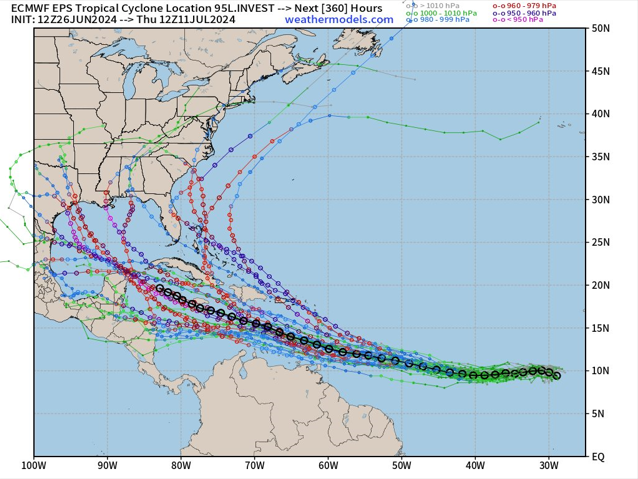
The consensus of forecasted tracks of the tropical system now over the eastern Atlantic place the system somewhere over the western Caribbean Sea in about ten days or so. Map courtesy ECMWF, weathermodels.com
One of the factors to monitor down the road with respect to the movement and potential intensification of this tropical system will be the overall height pattern in the middle layers of the atmosphere. In several days, this wave may find itself over the warm waters of the central or western Caribbean Sea and surrounded by strong high pressure ridging aloft. As such, the movement of this tropical system could slow and if it is sitting over the warm waters of the Caribbean Sea, there potentially could be significant intensification with “major” hurricane status on the table...something to closely monitor in coming days.
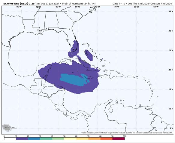
The ensemble version of the Euro model indicates there is a rather decent probability of a hurricane in about 7-10 days that would be positioned somewhere over the western Caribbean Sea. Map courtesy ECMWF, Weather Bell Analytics
Meteorologist Paul Dorian
Arcfield
arcfieldweather.com
Follow us on Facebook, Twitter, YouTube
Video discussion: