1:45 PM | *Deep freeze grips the nation as we close out 2014...brutal cold coming to central and eastern US next week*
Paul Dorian
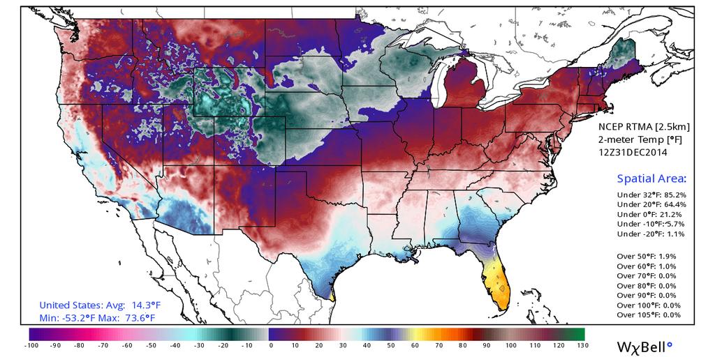 [7AM temperature map across the nation with average CONUS temperature of 14.3°F; map and data courtesy Ryan Maue of Weather Bell Analytics at "weatherbell.com"]
Discussion
It is certainly not too unusual to have cold air across parts of the nation at the end of the month of December; however, today’s nationwide deep freeze is indeed quite impressive. First of all, the average temperature this morning across the Lower 48 bottomed out at 14.3°F (at 7am ET). This is the lowest reading during the month of December since December 23, 1998 – some 16 years ago (data and temperature map above courtesy Ryan Maue of Weather Bell Analytics at "weatherbell.com"). In addition, about 85% of the nation was below freezing as of 7am (ET) this morning. The 12-hour 2-meter temperature anomaly forecast map from this morning’s GFS model run shows almost all “blues and purples” across the nation representing all areas predicted to experience below-normal temperatures (forecast map below courtesy “tropicaltidbits.com”). The current deep freeze extends virtually from coast-to-coast with the only exception being the Florida Peninsula where temperatures will remain above-normal (oranges/yellows).
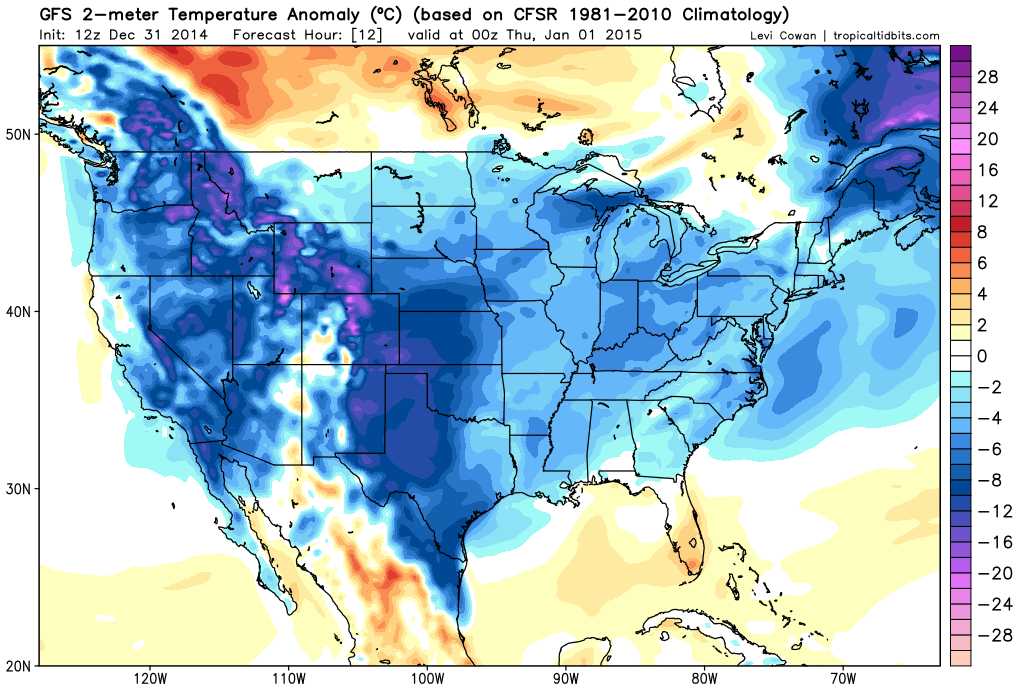 [12Z GFS 2-meter temperature anomaly forecast map for early tonight; map courtesy "tropicaltidbits.com"]
In addition to the widespread cold which has even extended into southern California, a rare snow is occurring today across the Southwest US at such locations as Lake Havasu, Arizona, Las Vegas, Nevada, and the southern California San Bernardino mountains. Today’s cold and snow is being fueled by intense upper-level low pressure over the Desert Southwest and a very strong Arctic high pressure system over the Northern Plains and Rockies.
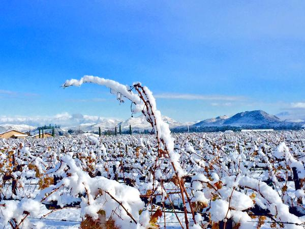 [Southern California (Temecula) vineyard in the deep freeze this morning]
Looking ahead to next week, after a brief spike in temperatures on Sunday across the east coast, colder air will again make a move from Canada into the northern US anchored by more strong high pressure. This time the cold air outbreak is likely to spare the western US, but by the second half of next week, the central and eastern US could be in the deep freeze once again and this time Florida may not be so lucky. Next week’s outbreak could very well cause a freeze problem way down the Florida Peninsula and places in the Upper Midwest like Chicago, Illinois could experience sub-zero temperatures.