12:40 PM | *Soaking rain event on Thursday to be followed by cold blast for the weekend…coldest weather so far for Sunday and Monday...looking ahead to Turkey Day*
Paul Dorian

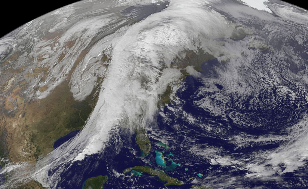
[Today's satellite image of major storm that is headed into the eastern US; courtesy NASA, Capital Weather Gang]
Discussion
Thursday rain event
A powerful storm system that currently extends from Mexico to Canada is headed towards the eastern US and it will produce a significant rain event for much of the region on Thursday (satellite image above). This is the same storm system that produced heavy snow and winter cold in Colorado and Kansas earlier in the week as well as tornadoes in its warm sector across parts of the central US. The rain is likely to arrive here late tonight and continue through the morning and it could very well have a negative impact on the morning commute in DC, Philly and perhaps even New York City (could hold off there until just afterward rush hour). The winds will be quite gusty tomorrow ahead of a strong cold front and there can be an isolated thunderstorm or two during this upcoming event.
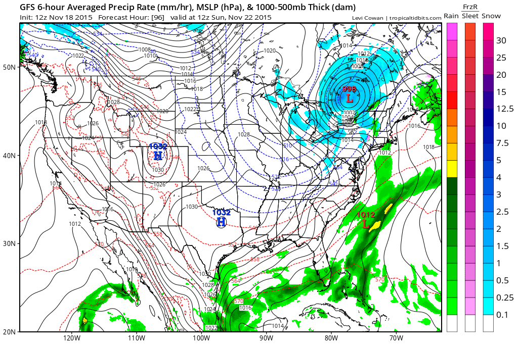
[12Z GFS surface forecast map for Sunday morning (blues=snow); courtesy NOAA, tropicaltidbits.com]
Progressively colder Friday, Saturday and Sunday
This significant rain event will be followed by a colder air mass in the Mid-Atlantic region to close out the work week on Friday, but this will be just the first "step-down" in temperatures in coming days. Another storm system will move quickly from the Rockies this weekend and head towards the Great Lakes region likely producing the first accumulating snow of the season in places like Chicago, Detroit and Madison. This next storm will slide a secondary cold front through here on Saturday night and the coldest air mass of the season will arrive on Sunday. In fact, Sunday promises to be the coldest day of the season so far and snow flurries/snow showers are not out of the question across portions of the Mid-Atlantic and Northeast US (forecast surface map above; blue=snow). Well-below normal temperatures will remain stuck in place across the eastern US on Monday as we begin the new work week (temperature anomaly forecast map below).

[12Z GFS temperature anomaly forecast map for Monday morning; courtesy NOAA, tropicaltidbits.com]
Looking ahead to Turkey Day and beyond
While still chilly next Tuesday, it is likely that the second half of next week will see a turn to milder conditions in the eastern US following this weekend’s cold blast and before another cold blast arrives late in the weekend following Thanksgiving Day. This next cold blast which will arrive near the end of November is likely to be even colder than this weekend’s outbreak.