Contact Us

Use the form on the right to contact us.

You can edit the text in this area, and change where the contact form on the right submits to, by entering edit mode using the modes on the bottom right. 


123 Street Avenue, City Town, 99999

(123) 555-6789

email@address.com


You can set your address, phone number, email and site description in the settings tab.
Link to read me page with more information.

backlit-stratus-clouds-2013-04-05.jpg

Blog

Weather forecasting and analysis, space and historic events, climate information

Filtering by Category: DC

7:00 AM | Nice weather pattern continues through tomorrow...warmer and more humid this weekend

Paul Dorian

6-Day DC Forecast

Today

Mostly sunny, comfortable, highs in the low 80’s

Tonight

Mostly clear, cool, lows not far from 60 degrees

Friday

Mainly sunny, nice, low-to-mid 80’s

Friday Night

Mainly clear, mild, low-to-mid 60’s

Saturday

Mostly sunny, warmer, upper 80’s

Sunday

Partly sunny, very warm, more humid, near 90 degrees

Monday

Mostly sunny, very warm, humid, near 90 degrees

Tuesday

Mostly sunny, very warm, humid, near 90 degrees

Discussion

High pressure will control the weather in the Mid-Atlantic region right through the upcoming weekend. Temperatures and humidity levels will remain comfortable for this time of year through tomorrow, but it’ll become increasingly uncomfortable this weekend with rising temperatures and humidity levels as the high pressure system shifts off the east coast. This shift in location of the high will allow for the development of a southwesterly flow of air this weekend and high temperatures will flirt with the 90 degree mark. Elsewhere, Tropical Storm Erika continues on a track that will likely bring this tropical system towards the Bahamas and then Florida by early next week.

Video

httpv://youtu.be/8Lc__pNR41A

7:00 AM | The beat goes on...nice weather for the rest of the week

Paul Dorian

6-Day DC Forecast

Today

Mostly sunny, comfortable, highs not far from 80 degrees

Tonight

Mostly clear, cool, lows near 60 degrees

Thursday

Mainly sunny, nice, low 80’s

Thursday Night

Mainly clear, cool, low 60’s

Friday

Mainly sunny, pleasant, low 80’s

Saturday

Partly sunny, warmer, more humid, mid-to-upper 80’s

Sunday

Partly sunny, quite warm, humid, chance for a shower or thunderstorm, upper 80’s

Monday

Mostly sunny, hot, humid, near 90 degrees

Discussion

High pressure builds in from the Midwest today and controls the weather around here for the rest of the week. Temperatures and humidity levels will be very comfortable for this time of year right through Friday, but it’ll become increasingly uncomfortable this weekend as the high pressure system shifts off the east coast and generates a low-level southwesterly flow of air.

7:00 AM | Another comfortable stretch of weather for the Mid-Atlantic

Paul Dorian

6-Day DC Forecast

Today

Mostly sunny, becoming more comfortable, highs in the low 80’s

Tonight

Mostly clear, comfortable, lows not far from 60 degrees

Wednesday

Mainly sunny, nice, low 80’s

Wednesday Night

Mainly clear, cool, near 60 degrees

Thursday

Mainly sunny, pleasant, low 80's

Friday

Mostly sunny, nice, low 80’s

Saturday

Mostly sunny, warmer, mid 80’s

Sunday

Mostly sunny, warm, mid-to-upper 80’s

Discussion

A weak frontal system is currently pushing towards the east coast and its passage will usher in another comfortable air mass for the Mid-Atlantic region. High pressure will control the weather from later today through the end of the week providing us with comfortable temperatures and humidity values.

7:00 AM | More humid today, but comfortable air is headed our way for much of the week

Paul Dorian

6-Day DC Forecast

Today

Partly sunny, warmer and more humid, chance for PM showers and thunderstorms, highs in the mid-to-upper 80’s

Tonight

Chance for an evening shower or thunderstorm; otherwise, mostly cloudy, mild, muggy, lows in the mid-to-upper 60’s

Tuesday

Becoming mainly sunny, more comfortable, low 80’s

Tuesday Night

Mainly clear, cool, low 60’s

Wednesday

Mainly sunny, pleasant, low 80’s

Thursday

Mostly sunny, nice, near 80 degrees

Friday

Mostly sunny, nice, low 80’s

Saturday

Mostly sunny, warm, mid 80’s

Discussion

All in all, this looks like a pretty nice week in the Mid-Atlantic region. High pressure remains in control this morning across the Northeast US, but an approaching weak cool front should generate a few showers and thunderstorms later today and tonight. Humidity levels will climb somewhat ahead of the front, but it should turn more comfortable again post-frontal passage later tomorrow, and the rest of the week looks quite comfortable.

Elsewhere, Danny reached a peak in intensity on Friday briefly reaching category 3 (major hurricane) status, but an increase in vertical wind shear and an encounter with dry air weakened the system to "tropical storm" status over the weekend. It will head into the area near or just south of Puerto Rico and Hispaniola during the next couple of days. Two more tropical waves are going to follow Danny across the tropical Atlantic over the next several days, but they also will battle some dry air in the overall environment.

Video

httpv://youtu.be/wQo2VXkEy1g

7:00 AM | Lots of improvement for the end of the work week and the weekend with less humid air

Paul Dorian

6-Day DC Forecast

Today

Mainly sunny skies, comfortable humidity levels, highs in the low-to-mid 80’s

Tonight

Mainly clear, pleasant, lows in the lower 60’s

Saturday

Mainly sunny, comfortably warm, mid 80’s

Saturday Night

Partly cloudy, mild, low 60’s

Sunday

Partly sunny, comfortably warm, mid 80’s

Monday

Partly sunny, warmer, more humid, chance for showers and thunderstorms late, upper 80’s

Tuesday

Mainly sunny, pleasant, low 80’s

Wednesday

Mainly sunny, pleasant, low-to-mid 80’s

Discussion

The very slow-moving cool front that generated lots of rainfall for the Mid-Atlantic region during the past couple of days will finally push off the east coast today and we'll experience lowering humidity levels as we close out the work week and then a pretty nice weekend. Humidity will remain low on Saturday and increase a bit on Sunday, but it really won't be until Monday afternoon before it becomes too noticeable.

2:45 PM | *Waves of showers and thunderstorms will produce some torrential rainfall*

Paul Dorian

radar
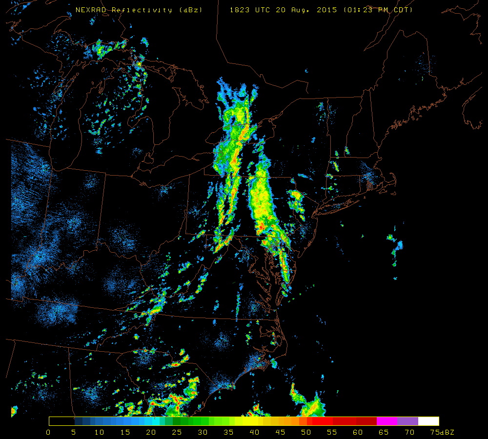
[Latest NEXRAD image of the Northeast US; courtesy University of Wisconsin]

Discussion

Waves of showers and thunderstorms associated with a slow-moving frontal system will affect the region later this afternoon, tonight and during part of Friday - and the rain will be very heavy at times. The atmosphere is full of moisture and is unstable enough to produce 2+ inches of rain in many spots along the I-95 corridor with localized flash flooding over the next 24 hours or so. This front will only crawl to the east coast and, in fact, will likely continue to cause some inclement weather (clouds, lingering showers) along coastal sections on Saturday and perhaps even into Sunday. Inland sections of the Mid-Atlantic will experience some improvement with a noticeable drop in humidity levels by the weekend.

7:00 AM | Threat for torrential rain and thunderstorms from later today into early tomorrow as slow-moving front crawls through the region

Paul Dorian

6-Day DC Forecast

Today

Mainly cloudy, excessive humidity, showers and thunderstorms likely, some of the rain will be heavy, highs in the mid-to-upper 80’s

Tonight

Showers and thunderstorms and perhaps even a period of steady heavy rainfall, lows in the upper 60’s

Friday

Early clouds give way to partial sunshine, low-to-mid 80’s

Friday Night

Partly cloudy, mild, mid 60’s

Saturday

Mainly sunny, pleasant temperatures, low-to-mid 80’s

Sunday

Mainly sunny, warm, mid 80’s

Monday

Partly sunny, quite warm, chance for showers and thunderstorms, upper 80’s

Tuesday

Partly sunny, not quite as warm, chance for showers and thunderstorms, low-to-mid 80’s

Discussion

The threat exists for torrential rain from later today into early tomorrow in the DC metro region as a very slow-moving cool frontal system inches across the region. This front will generate numerous showers and thunderstorms for the I-95 corridor and some of the rainfall will be heavy at times. In fact, many spots between now and tomorrow night will receive two or more inches of rain before improvement kicks in this weekend. Temperatures will hold in the 80’s for highs over the next couple of days due largely to copious amounts of clouds and the occasional rainfall.

7:00 AM | Showers and thunderstorms next couple of days and some of the rain will be heavy

Paul Dorian

6-Day DC Forecast

Today

Mainly cloudy, not as warm, but still very humid, scattered showers and thunderstorms from mid-day through the afternoon hours, some of the rain can be heavy, highs in the middle 80’s

Tonight

Showers and thunderstorms likely, some of the rain can be heavy at times, mild, muggy, lows in the lower 70’s

Thursday

Mainly cloudy, warm, humid, showers and thunderstorms likely, some of the rain can be heavy, mid-to-upper 80’s

Thursday Night

Showers and thunderstorms likely, some of the rain can be heavy, upper 60’s

Friday

Clouds linger early with possible showers then becoming partly sunny, warm, low-to-mid 80’s

Saturday

Partly sunny, comfortable, low-to-mid 80’s

Sunday

Partly sunny, warm, mid 80’s

Monday

Partly sunny, quite warm, chance for showers and thunderstorms, upper 80’s

Discussion

A very slow-moving cool front will crawl across the region during the next couple of days generating occasional showers and thunderstorms and some of the rainfall will be heavy at times. Given the slow movement of the front, the threat for showers and thunderstorms will linger from later today into early Friday and many spots along the I-95 corridor will likely receive two inches or more of rainfall by late Friday. High temperatures will be confined to the 80’s over the next few days as a result of the abundant amount of clouds and occasional rain.

Video

httpv://youtu.be/zUc9DDfxz3E

7:00 AM | Showers and thunderstorms return with approach of slow-moving front...some of the rain will be heavy next few days

Paul Dorian

6-Day DC Forecast

Today

Becoming partly sunny, hot, humid, chance for afternoon showers and thunderstorms, highs near 90 degrees

Tonight

Scattered showers and thunderstorms; otherwise, mainly cloudy skies, mild, muggy, lows near 70 degrees

Wednesday

Mostly cloudy, warm and humid, more showers and thunderstorms likely, some of the rain can be heavy, mid-to-upper 80’s

Wednesday Night

Mostly cloudy with scattered showers and thunderstorms, some of the rain can be heavy, mild, muggy, near 70 degrees

Thursday

Mainly cloudy, warm, humid, showers and thunderstorms likely, some of the rain can be heavy, mid-to-upper 80’s

Friday

Partly sunny, warm, still the threat for showers and thunderstorms early, low-to-mid 80’s

Saturday

Partly sunny, pleasant, cannot rule out a shower or thunderstorm, low 80’s

Sunday

Partly sunny, comfortably warm, cannot rule out a shower or thunderstorm, mid 80’s

Discussion

Today will be another hot one, but it is also likely to be the last 90 degree day of the week as abundant clouds and occasional rainfall will limit temperatures during the second half of the week. A very slow-moving cool front will inch across the region later this week and it will increase dramatically our chances for showers and thunderstorms over the next few days and some of the rainfall is likely to be heavy at times. Given the slow movement of the front, the threat for showers and thunderstorms in the Mid-Atlantic region - which begins to increase later today - will likely linger until the end of the week and perhaps even into the weekend along the east coast.

Video

httpv://youtu.be/qqM9Z5z7MVw

7:00 AM | Hot start to the week...increasing chance for showers and thunderstorms as week progresses

Paul Dorian

6-Day DC Forecast

Today

Mostly sunny, hot, humid, highs in the mid 90’s

Tonight

Partly cloudy skies, mild, lows late tonight near 70 degrees

Tuesday

Mainly sunny, hot, humid, chance for a late day shower or thunderstorm, near 90 degrees

Tuesday Night

An isolated shower or thunderstorm; otherwise, mostly cloudy, mild, near 70 degrees

Wednesday

Partly sunny, quite warm, humid, chance for showers and thunderstorms, mid-to-upper 80’s

Thursday

Mostly cloudy, warm, humid, showers and thunderstorms likely, mid-to-upper 80’s

Friday

Partly sunny, warm, still the threat for showers and thunderstorms, upper 80’s

Saturday

Partly sunny, comfortable, mid 80’s

Discussion

A flow of low-level air out of the southwest ushered in heat and humidity to the Mid-Atlantic region this weekend and those conditions will continue for the next couple of days. A very slow-moving cool front will crawl into the region in the Wednesday/Thursday time frame and these two day promise to be more active in terms of showers and thunderstorms. Given the slow movement of this frontal system, the threat for showers and thunderstorms may even continue on Friday as well.