Contact Us

Use the form on the right to contact us.

You can edit the text in this area, and change where the contact form on the right submits to, by entering edit mode using the modes on the bottom right. 


123 Street Avenue, City Town, 99999

(123) 555-6789

email@address.com


You can set your address, phone number, email and site description in the settings tab.
Link to read me page with more information.

backlit-stratus-clouds-2013-04-05.jpg

Blog

Weather forecasting and analysis, space and historic events, climate information

Filtering by Category: Historic Events

11:40 AM | Weather and the World Series

Paul Dorian

MLB.jpg

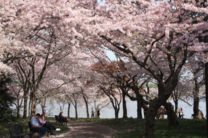
[Game winning celebration for the KC Royals at the end of Game 1; courtesy MLB, ESPN, Getty images]

Discussion

The World Series began last night in Kansas City, Missouri and it turned out to be the longest first game in Fall Classic history (14 innings, 5 hours 9 minutes) and there was ample entertainment along the way including a first-pitch inside the park home run for the Royals, a power outage that knocked the telecast off the air, and a game tying home run in the bottom of the ninth inning. The weather started off on the damp and chilly side, but, all in all, it did not play much of a factor in the marathon. This World Series is beginning slightly later than usual and should it go all 7 games, it would not end until Wednesday, November 4th. Despite some chilly weather expected in New York City this weekend for their three home games, the weather looks like it should not become a major issue this year – despite the late start. In fact, should the Series get back to Kansas City next week for games 6 and/or 7, high temperatures are liable to reach the 70’s on either day as a warm weather pattern sets up next week for much of the eastern 2/3rds of the country.

In terms of the coldest World Series games ever (and the records are sketchy pre-1970’s as Major League Baseball did not track weather records), the most memorable game occurred in Game 4 of the 1997 World Series in Cleveland, Ohio between the Indians and the Florida (now Miami) Marlins. The first-pitch temperature for that game was 38 degrees with a wind chill in the teens. Snow flurries fell throughout the game and ice patches actually formed on the infield. The first two games of that Series were played in Miami where temperatures were in the high 80’s. The second coldest game in recent history was the first game of the 1979 World Series in Baltimore, Maryland between the Orioles and Pirates with first-pitch temperatures right around 40 degrees and a steady, chilly rain falling.

Perhaps the most memorable game with respect to weather and the World Series is Game 5 of the 2008 World Series between the Phillies and the Tampa Bay Rays. That game began on October 27th with 50-degree temperatures and a steady rain falling and was suspended in the 6th inning as the rain became too heavy. The game could not be resumed the next day as a powerful nor’easter continued to pound away on the Philadelphia region with a cold, steady rain and even several inches of accumulating snow in nearby Bucks County, PA. Finally, two days after the game began, Game 5 resumed on a cold night in Philly with first-pitch temperatures at 44 degrees along with a gusty northwest wind and the Phillies went on to clinch the title.

2:30 PM | The Great New England Hurricane of 1938

Paul Dorian

Battery-Park.gif

[Photo of Battery Park (Manhattan) during 1938 storm (courtesy National Weather Service)]

Discussion

On September 21, 1938, one of the most destructive and powerful hurricanes in recorded history struck Long Island and Southern New England. The storm developed near the Cape Verde Islands on September 9, tracking across the Atlantic and up the Eastern Seaboard. The storm hit Long Island and Southern Connecticut on September 21, moving at a forward speed of 47 mph! Today marks the 77th anniversary of storm known as "The Great New England Hurricane of 1938" as well as "The Long Island Express" and the "Yankee Clipper". With no warning, the powerful category 3 hurricane (previously a category 5) slammed into Long Island and southern New England causing approximately 700 deaths and massive devastation to coastal cities and became the most destructive storm to strike the region in the 20th century. Little media attention was given to the powerful hurricane while it was out at sea as Europe was on the brink of war and the overriding story of the time. There was no advanced meteorological technology such as radar or satellite imagery to warn of the storm’s approach.

CPhDo53UkAAVw0r.jpg

[Surface weather map, 9 a.m., September 21, 1938 (courtesy National Weather Service)]

The storm began on September 9th near the Cape Verde Islands in the eastern Atlantic. About a week later, the captain of a Brazilian freighter sighted the storm near Puerto Rico and radioed a warning to the US Weather Bureau and it was expected that the storm would make landfall in south Florida where preparations frantically began. By September 19th, however, the storm suddenly changed direction and began moving north, parallel to the eastern seaboard. It had been many decades since New England had been hit by a substantial hurricane and few believed it could happen again. The storm picked up tremendous speed as it moved to the north following a track over the warm Gulf waters.

By the time the fast-moving storm approached Long Island, it was simply too late for a warning. In the middle of the afternoon on September 21st, the hurricane made landfall along the south shore of Long Island right around high tide when there was nearly a new moon (highest astronomical tide of the year). To make matters worse, this part of the country had just been through a long rainy period which saturated grounds before the arrival of this great storm. Waves as high as 40+ feet swallowed up coastal homes and homes that survived the storm surge succumbed to the damaging winds that reached 111-129 mph (lower to the west and higher to the east). By late afternoon, the hurricane raced northward at an amazing speed of nearly 50 mph crossing the Long Island Sound and reaching Connecticut ((Landsea et al. 2013, National Hurricane Center; Hurricane Research Division Re-Analysis Project). The storm surge of 14-18 feet above normal tide level inundated parts of Long Island and later the southern New England coastline. The waters in Providence harbor rapidly submerged the downtown area of Rhode Island’s capital under more than 13 feet of water and many people were swept away. The accelerating hurricane then continued northward at tremendous speed across Massachusetts generating great flooding in its path. In Milton, a town south of Boston, the Blue Hill Observatory recorded one of the highest wind gusts in history at an incredible 186 mph. Boston was hit hard and “Old Ironsides” – the historic ship USS Constitution – was torn from its moorings in Boston Navy Yard and suffered slight damage. Hundreds of other ships were not so lucky being completely demolished. The hurricane lost intensity as it passed over northern New England, but was still strong enough to cause widespread damage in Canada later that evening before finally dissipating over southeastern Canada later that night. All told, approximately 700 people were killed by the hurricane, 600 of them in Long Island and southern New England, 9000 homes and buildings were destroyed and 3000 ships were sunk or wrecked. It remains the most powerful and deadliest hurricane in recent New England history, eclipsed in landfall intensity perhaps only by the Great Colonial Hurricane of 1635 - the one storm by which all other storms are measured.

sfc_track.gif

[Track of 1938 “Long Island Express” hurricane (courtesy National Weather Service)]

In terms of weather forecasting for this storm, while the US Weather Bureau did not predict a hurricane landfall, that decision was not without controversy as a junior forecaster named Charlie Pierce believed the storm would curve into Long Island and southern New England due to blocking high pressure to the northeast and trough of low pressure which would guide the storm inland in his opinion. Mr. Pierce was overruled by the chief forecaster, Charles Mitchell. Shortly thereafter, Charles Mitchell resigned and Charlie Pierce was promoted.

3:05 PM | 115th anniversary of America's Deadliest Natural Disaster - The Galveston Hurricane of 1900

Paul Dorian

sfc_map.jpg

[Surface weather analysis of the Galveston hurricane on September 8, 1900 just before landfall]

Discussion

At the end of the 19th century the city of Galveston, Texas was a booming town with a population of 37,000 residents. The city of Galveston lies on the east end of Galveston Island which runs about thirty miles in length and anywhere from one and a half to three miles in width. Its position on the harbor of Galveston Bay along the Gulf of Mexico made it the center of trade and the biggest city in Texas in the year 1900. A quarter of a century earlier, a nearby town was destroyed by a powerful hurricane and this object lesson was heeded by many Galveston residents and talks of a seawall to protect the city were quite prevalent; however, no seawall was built and sand dunes along the shore were actually cut down to fill low areas in the city, removing what little barrier there was to the Gulf of Mexico.

By late August of 1900 the local residents couldn’t help but to have an uneasy feeling as they knew the heart of the hurricane season had arrived and there was not nearly the weather observation network that we now have with today’s satellites and radar. In fact, ship reports were the only reliable tool for observing hurricanes at sea, but these were of somewhat limited warning value as they had no way of telegraphing weather observations ashore. The first formal observation for a developing new eastern Atlantic Ocean storm occurred on August 27th when a ship recorded an area of “unsettled weather” about 1000 miles east of the Windward Islands. This storm is believed to have begun as a “Cape Verde-type” hurricane – a tropical wave moving off the western coast of Africa. By September 1st, the US Weather Bureau observers were reporting on a “storm of moderate intensity” southeast of Cuba. The storm made landfall on southwest Cuba, but some of the reports that surfaced from Cuba were simply not believed as there was a distrust of Cuban weather forecasters. By September 5th, the system emerged into the Florida Straits as a tropical storm or weak hurricane. By the afternoon of the 7th, large swells from the southeast were observed on the Gulf of Mexico from Galveston Island and clouds at all altitudes began moving in from the northeast – both observations consistent with a hurricane approaching from the east. The Galveston Weather Bureau office raised its double square flags indicating a hurricane warning was in effect. By early afternoon on Saturday, September 8th, the Bureau office was recording hurricane-force winds.

In the early part of the night of September 8th, 1900 - a terrifying night that reshaped the Gulf of Mexico forever - the wind direction shifted to the east, and then to the southeast as the eye began to pass over the island just to the west of the city. The hurricane brought winds that evening estimated to be near 145 mph at landfall making it a Category 4 on today’s rating scale – stronger than Hurricane Katrina of 2005. It also brought a storm surge of over 15 feet that inundated most of Galveston Island and the city of Galveston. By the next morning, skies had cleared and a 20 mph breeze greeted the Galveston survivors, there were 3600 homes destroyed, and it was quite obvious that there was a tremendous loss of life. The storm continued on its trek producing lots of heavy rain and strong winds along the way, first tracking into Oklahoma, then the Great Lakes, and ultimately to near Halifax, Nova Scotia. As far away as New York City there were winds estimated as high as 65 mph - some four days after the devastation occurred in Galveston.

track.gif

[Track of Galveston hurricane; courtesy Unisys]

The Galveston Hurricane of 1900 is estimated to have killed as many as 12,000 individuals, but the number most often cited in official reports is 8000 – the true number will never be known. More people were killed in this single storm than the total of those killed in all the tropical cyclones that have struck the United States since. Indeed, the Galveston Hurricane of 1900 is the deadliest natural disaster to ever strike the US. By contrast, the second deadliest storm to strike the US, the 1928 Okeechobee hurricane, caused more than 2500 deaths and the deadliest storm of recent times, Hurricane Katrina of 2005, claimed the lives of approximately 1800 people.

Galveston never regained its former status as a major commercial center as development shifted north to Houston, which was enjoying the benefits of an oil boom. A 17-foot seawall was built beginning in 1902 and perhaps an even more dramatic effort to protect the city was its raising. Dredged sand was used to raise the city of Galveston by as much as 17 feet above its previous elevation. In 1915, a storm similar in strength and track to the 1900 hurricane struck Galveston. This storm brought a 12-foot storm surge which tested the new seawall. Although 53 people died on Galveston Island during the storm in 1915, this was a great reduction from the thousands who died in 1900 during the worst natural disaster America has ever faced.

survivors.jpg

[Survivors carry the dead out of the wreckage]

9:00 AM | Even weak solar cycles can produce super solar storms...the Carrington Event of 1859

Paul Dorian

carrington_auroras.jpg

[Circled areas on plot indicate locations that experienced the northern lights during the Carrington Event]

Discussion

The sun has been relatively quiet in recent years and, in fact, the current solar cycle (24) is on pace to be the weakest in over one hundred years. Even weak solar cycles, however, can produce significant solar storms. In fact, last week marked the 156th anniversary of a super solar storm known as the “Carrington Event” and this took place during a weak solar cycle in the year 1859.

It was 156 years ago when the solar superstorm, now known as the Carrington Event, took place during solar cycle 10. The event has been named for the British astronomer, Richard Carrington, as he observed from his own private observatory the largest solar flare during this event which caused a major coronal mass ejection (CME) to travel directly toward Earth. The 33-year-old astronomer - widely acknowledged at the time to be England’s best - also recorded in detailed fashion the appearance of the sunspot regions that he saw at the time.

From August 28, 1859 to September 2, 1859 numerous sunspots and solar flares were observed on the sun and auroras were being observed in different parts of the world. Just before noon on September 1st, Richard Carrington was using his telescope to project an 11-inch wide image of the sun on a screen and he carefully drew the sunspots that he saw (below). Suddenly, two brilliant beads of blinding white light appeared over the sunspots and he realized that he was witnessing something unprecedented. He left for about one minute to find another witness and found upon their return that much had already subsided.

sunspots.gif

[Sunspots sketched by Richard Carrington on Sept. 1, 1859. Copyright: Royal Astronomical Society.]

Just before dawn the next day, skies all over Earth erupted in red, green and purple auroras - even in tropical locations like Cuba, the Bahamas and Hawaii. The massive solar flare caused a major CME that reached the Earth some 17.6 hours later. Normally such a journey takes 3 or 4 days, but an earlier CME actually cleared the way of the ambient solar plasma for the second blast to move so quickly. The auroras were so bright over the Rocky Mountains that their glow awoke gold miners who began preparing breakfast because they thought it was morning. People in the northeastern US could read a newspaper by the aurora’s light. Telegraph systems all over Europe and North America went haywire and, in some cases, telegraph operators were literally shocked as sparks were flying and telegraph paper was often set on fire. Some systems continued to work despite being disconnected from their power supplies as aurora-induced electric currents still allowed messages to be transmitted.

Now we know that solar flares happen frequently, especially during solar sunspot maximums, but in those days there were no X-ray satellites or radio telescopes and no one knew flares existed until that September morning. “It is rare that one can actually see the brightening of the solar surface which takes a lot of energy to heat up the surface of the sun” says a modern day NASA astronomer. “In the 160-year record of geomagnetic storms, the Carrington event is the biggest.” In fact, going back farther in time by examining Arctic ice (energetic particles leave nitrates in ice cores), it is estimated that this event may have been the biggest in 500 years and nearly twice as big as the runner-up.

In today’s world, electronic technologies have become embedded into everyday life and are, of course, quite vulnerable to solar activity. Power lines, long-distance telephone cables, radar, cell phones, GPS, satellites – all could be significantly affected by an event like this one. The good news is that observations of the sun are a constant in today’s world with a fleet of spacecraft in position to monitor the sun and gather data on solar flares. The bad news is that the Carrington Event occurred during a weak solar cycle (10) which actually resembles rather closely our current solar cycle (24) so we always have to stay on guard for a potential powerful solar storm - even during times of weak solar cycles.

Paul Dorian

Vencore, Inc.

12:45 PM | July 10, 1913 - the hottest temperature ever recorded in the world, but there is an interesting twist to this record set in Death Valley, California

Paul Dorian

Death_Valley_California_5578743262.jpg

[Death Valley National Park, California]

Discussion

The forecast for tomorrow’s high temperature in Death Valley, California is a rather pedestrian 100 degrees. One hundred and two years ago from tomorrow - July 10th 1913 - the weather observer at Greenland Ranch in Death Valley recorded a high temperature of 134 degrees. This is the highest air temperature ever reliably recorded on Earth, but it didn’t get that distinction until just recently. The Greenland Ranch weather station was located across the street from what is known today as the Furnace Creek Ranch and it is about 180 feet below sea level.

Death Valley National Park is the largest national park in the continental US and is located in the Mojave Desert of southeast California. It contains a vast range of elevations and landscapes and is known for being a land of extremes including its climate. In fact, the depth and shape of Death Valley contribute greatly to its extreme heat. Specifically, the extreme heat is due to a combination of several factors including the elevation below sea level, the lack of vegetation especially on the lowest part of the valley floor which allows sunlight to directly heat the desert surface, the narrow width of the valley and its north-south orientation which traps air in the valley allowing it to be recycled back down to the valley floor, radiation of heat from the rocky surfaces of the mountains that surround the valley, and the low humidity as dry air heats at a much quicker rate than moist air. Temperatures in Death Valley normally reach or exceed 100 degrees from Mid-May until early October.

During July of 1913, Death Valley endured an intense stretch of hot weather from the 5th through the 14th when the high temperature reached 125 degrees or higher each and every day. In fact, this 10 day stretch still ranks as the hottest stretch of weather ever recorded in Death Valley. The hottest days in this stretch occurred from the 9th through the 13th when the high temperature reached at least 129 degrees with the hottest being on July 10th when the record-breaking 134 degrees was measured.

death-valley.png

And now for an interesting recent twist to the story. The Death Valley record of 134 degrees was less than a decade old when it fell to a new record. On September 13, 1922, a temperature of 136 degrees was recorded at El Azizia, Libya and this was indeed cited by the World Meteorological Organization (WMO) for nine decades as the world’s highest temperature ever recorded. However, on September 12th, 2012, the WMO officially re-certified the 134 degree reading of July 10th, 1913 at Death Valley as the all-time highest air temperature ever recorded on Earth after evidence surfaced suggesting the Libya record of 136 degrees was based on a reading from a bad thermometer which was placed in the wrong place (near asphalt) and, in addition, read by an untrained observer.

This particular example of the rewriting of weather history actually cites the many difficulties of comparing high temperature records of today to those from decades ago. One important problem has to do with the fact that many official weather stations have had significant growth in development (housing, roads, etc.) in the immediate regions surrounding the stations. Materials such as asphalt and concrete that are generally connected with urban development are known to have an (warming) impact on temperature readings. This “urban heat island” effect has become an increasingly important problem in the analysis of long-term temperature trends. In the Southwest US, for example, where populations have doubled or tripled in the past 50 years near official weather stations (e.g. Las Vegas, Phoenix), the problem has become quite serious making record high temperature records of today somewhat dubious in certain locations. Even the inhospitable region of Death Valley has had some development in the area surrounding the Furnace Creek weather station with asphalt roads now leading to the nearby visitor’s center - all of which makes this long-surviving 102-year old record of 134 degrees very impressive indeed.

6:00 PM | The most important weather forecast of all-time: D-Day, June 6th, 1944

Paul Dorian

Overview

This Saturday, June 6th, marks the 71st anniversary of the D-Day invasion in Normandy, France during World War II and the weather forecast for that historic event makes for quite an interesting story in what turned out to be a pivotal moment in world history. Years of detailed planning went into the D-Day invasion on June 6, 1944, but success hinged on one element that no military commander could control — the weather. Defying his colleagues, Captain James Martin Stagg advised General Dwight “Ike” Eisenhower to postpone the invasion of Normandy by one day from June 5th to June 6th because of uncertain weather conditions in a weather forecast that was arguably the most important of all-time.

map1.jpg

Background

There were no computer forecast models, no satellites, radar was in its infancy and being used primarily for military purposes only, and yet General Dwight “Ike” Eisenhower wanted a definitive weather forecast for the planned invasion of Normandy, France with no “ifs”, “maybes” or “possibles” attached to the wording. With definitive forecast information required and thousands of lives on the line, it is an underestimate to say that the task was daunting for chief meteorologist, Group Captain James Martin Stagg, of the British Royal Air Force. Stagg ultimately persuaded General Eisenhower to change the date of the Allied invasion of Europe during World War II due to weather concerns from the 5th of June to the 6th of June in 1944. There were actually three different teams of weather forecasters involved with the Normandy invasion including the British Royal Navy, British Meteorological Office, and the US Strategic and Tactical Air Force, but Stagg was given the role as the chief meteorologist and the only meteorologist allowed direct contact with Eisenhower.

The opportunity for launching an invasion was limited to only a few days in each month to take advantage of the moon and tide. Darkness was needed when the airborne troops went in, but moonlight once they were on the ground. Spring low tide was necessary to ensure extreme low sea level so that the landing craft could spot and avoid the thousands of mined obstacles that had been deployed on the beaches. If this narrow time slot was missed, the invasion would have been delayed for two weeks. Eisenhower had tentatively selected June 5th as the date for the assault which was one of the few days in early June that met these criteria.

Saturday, June 3rd

By Saturday, June 3rd, the forecasts began to be highly unfavorable for a June 5th invasion. High pressure areas were over Greenland and the Azores, with low pressure centers moving east-northeast across the Atlantic. It seemed probable that the high winds and sea would rule out the 5th as D-day. Nevertheless, “Ike” pushed ahead for now with his plans for a June 5th invasion.

action2.jpg

Sunday, June 4th

There were two official weather briefings given by weather forecasters on June 4th. At the early weather briefing on that day, the weather prospect seemed completely hopeless for a June 5th invasion. All weather experts predicted seas heavy enough to swamp landing craft and a low ceiling, which would prevent the air forces from carrying out their part of the assault. Under these circumstances, the air commanders were unwilling to take off, and Admiral Ramsey, after being advised that the winds would reach 25 to 30 miles per hour, feared that the channel would be too rough for small craft. Only "Monty" (General Montgomery of England) wished to still carry out the schedule.

At the later briefing on June 4th, there were disagreements amongst the Allied weather forecast teams. Based on their knowledge of English Channel weather and observations, the British forecasters predicted stormy weather would indeed arrive on June 5th. The American meteorologists, relying on a differing forecasting method based on historic weather maps, instead believed that a wedge of high pressure would deflect the advancing storm front and provide clear, sunny skies over the English Channel. Captain Stagg had to make the final call and he sided with his fellow British colleagues and recommended a postponement. Captain Stagg predicted good prospects for a favorable break on the 6th of June and for heavy bombers to be able to fly during the preceding night. As a result, General Eisenhower decided to postpone the operation for 24 hours to June 6th. For the Navy, this weather forecast given at the second briefing on June 4th was the moment of decision since orders were then issued for all vessels to resume sailing to meet the new D-Day date of June 6th.

On the other side of the English Channel, German forecasters also predicted that stormy conditions would roll in as Stagg and his fellow Brits had feared. The Luftwaffe’s chief meteorologist, however, went further in reporting that rough seas and gale-force winds were unlikely to weaken until mid-June. Armed with that forecast, Nazi commanders thought it impossible that an Allied invasion was imminent, and many left their coastal defenses to participate in nearby war games. German Field Marshal Erwin Rommel even returned home to personally present a pair of Parisian shoes to his wife as a birthday present.

Monday, June 5th

The 5th of June was indeed a miserable day and soldiers were cooped up in small beaching craft under lashing rain, and a day of intense anxiety for the top commanders watching from shore. The surface weather chart for 4 June 1944 (not shown) featured an intense low pressure system centered to the west of England and a cold front extending southeast from the low pressure center to Ireland. The foul weather that set in on June 4th threw all German commanders off their guard since, lacking weather observation stations west of the European continent; they were unable to predict the favorable weather that would follow the frontal system. The German weather station in Greenland had been evacuated at the beginning of June, and no weather reporting U-boats were in a position to detect the small area of high pressure. Hitler had long understood that the key to anticipating the timing of the invasion would be good weather forecasting. General Rommel, who was in charge with the defense of the invasion beaches, was certain that there would be no invasion between June 5th and 8th because the tides were "not right" and the German weather forecasters predicted no letup in the stormy weather until mid-June. Rommel also thought that the Allies would not attempt an invasion without a guarantee of about six days of fine weather. He was actually at home in Germany on the morning of D-Day when news of the landing caught up with him and only made it to the front at the end of the first day.

action1.jpg

D-Day, Tuesday, June 6th

On June 6th, the weather was more tolerable, but certainly not ideal. A gusty wind blowing from the west at 15 to 20 knots produced a moderately choppy sea with waves of from 5 to 6 feet in height. This was a heavy sea for the small craft, which had some difficulty in making way. Even the assault area was rough for the shallow-draft vessels, although there the wind did not exceed 15 knots, and the waves averaged 3 feet. Visibility was 8 miles with a cloud ceiling at 10,000 to 12,000 feet. Scattered clouds from 3000 to 7000 feet covered almost half the sky over the channel, becoming denser farther inland. Maritime polar air had moved over the channel behind the cold front as the low of 4 June that was west of England moved eastward; the deep low that was off Labrador on 4 June moved north-northeast to just off the southeast coast of Greenland (surface map for 6 June 1944 below). This was the key to the clearing weather: if the Labrador low had tracked eastward, foul weather would have prevailed. The midlevel overcast was most serious for air operations. Heavy bombers assigned to hit the coastal fortifications at Omaha Beach had to bomb by instruments through the overcast. With concurrence of General Eisenhower, the Eighth Air Force ordered a delay of several seconds in its release of bombs, in order to insure that they were not dropped among the assault craft. The result was that the 13,000 bombs dropped by 329 B-24 bombers did not hit the enemy beach and coast defenses at all, but were scattered as far as 3 miles inland. The weather also contributed to navigational difficulties. Mist mixed with the smoke and dust raised by the naval bombardment obscured landmarks on the coast; additionally, a lateral current of from 2 to 3 knots tended to carry craft east of their touchdown points by 1500 to 2000 yards and this caused some confusion. Their difficulties were compounded by the heavier enemy opposition, which isolated boat sections only a few hundred yards apart and at first made reassembly and reorganization or improvised missions almost impossible. Unloading at Utah beach proceeded in an orderly fashion, the chief distractions being an intermittent shelling of the beaches and air raids in the early morning hours.

Post D-Day

By D-Day plus 12 days, the flow of men and supplies over the beaches was running smoothly: 314,514 troops, 41,000 vehicles, and 116,000 tons of supplies had been landed on the American beaches, with almost identical figures for the British beaches. Had General Eisenhower postponed the invasion, the only option would have been to go two weeks later, and this would have encountered the “worst channel storm in 40 years” as Churchill later described it, which lasted four days between 19 and 22 June. In fact, Eisenhower sent a letter to Captain Stagg saying in reference to the major storm that occurred in the potential second time slot for the invasion, “I thank the Gods of war we went when we did.” For the rest of his life, in moments of stress, Group Captain Stagg would remember some words spoken to him by General Morgan, Eisenhower's Chief of Staff, in the tension-filled days leading up to the postponement: "Good luck Stagg: may all your depressions be nice little ones, but remember, we'll string you up from the nearest lamp post if you don't read the omens right."

Years later, during their ride to the Capitol for his inauguration, President-elect John F. Kennedy asked President Eisenhower why the Normandy invasion had been so successful.

Ike's answer: "Because we had better meteorologists than the Germans!"

sfcmap.gif

[Surface map 0700 GMT 06 JUNE 1944]

Paul Dorian

Vencore, Inc.

8:40 AM | Hindenburg disaster...weather played a critical role 78 years ago today

Paul Dorian

hindenburg.jpg

[As the hydrogen gas burned and escaped from the rear of the Hindenburg, the tail dropped to the ground, sending a burst of flame punching through the nose. Ground crew below scatters to flee the inferno; courtesy AP]

Discussion

While weather played an important role in the Titanic disaster just over one hundred years ago, it was an even more direct cause of the Hindenburg disaster 78 years ago today – at least that is the prevailing belief. On May 6th, 1937, while the Hindenburg was attempting to land at the Lakehurst Naval Air Station in New Jersey, a flame appeared on the outer cover of the rear of the ship. Within 34 seconds, the entire airship was consumed by fire and the golden age of airship travel was over.

The effect of the weather on this tragedy actually began on the trip across the Atlantic Ocean. On most trips across the ocean, the Hindenburg maintained an altitude of about 650 feet and cruised at nearly 80 mph; however, on this particular trip the airship encountered strong head winds that slowed it down, pushing back the expected arrival time in New Jersey from around 6am to about 4pm on May 6th, 1937. This change in expected arrival time was critical as late afternoon and early evening hours are much more likely to feature thunderstorm activity compared to the early morning hours. Indeed, on that particular afternoon, a thunderstorm was brewing over Lakehurst, NJ and winds were kicking up to nearly 30 mph. As a result, the Hindenburg circled around for quite some time while waiting for the weather conditions to improve. By 6pm, the rain was still falling quite heavily from thunderstorm activity throughout much of New Jersey and lightning storms were clearly recorded in the weather observations for the day. Finally, shortly after 7pm, the decision was made by the commander of the airship to land as “conditions definitely improved”.

Not long after that decision was made, the Hindenburg appeared over Lakehurst, NJ and it began to circle the airfield in preparation for the landing. At 7:21pm, the Hindenburg was still about 1000 feet away from the mooring mast and about 300 feet in the air. At 7:25pm, witnesses reported a blue glow on top of the Hindenburg followed by a small flame from the top of the tail section and within seconds there was an explosion and fire engulfed the tail and spread quickly forward. The mid-section of the ship was completely in flames even before the tail of the Hindenburg hit the ground. It took only 34 seconds for the entire airship to be consumed by flames, 36 people lost their lives and, amazingly, there were 61 survivors.

Many theories have been talked about and investigated over the years regarding the disaster including sabotage, mechanical failure or even the possibility that it was shot from the sky. The most widely accepted theory involves the highly flammable hydrogen on the Hindenburg. Most people believed at the time that something caused the hydrogen to spark, thus causing the explosion and fire. In the beginning of the initial investigation, the idea arose that the drop lines carried static electricity back up to the airship which caused the explosion. However, the chief of the ground crew denied this claim by the fact that the mooring lines were not conductors of static electricity. More credible was the idea that the blue arc seen at the tail of the airship just before it burst into flames was actually lightning and it caused the detonation of the hydrogen. This theory was substantiated by the presence of the lightning storms reported in the area. The hydrogen explosion theory became accepted as the reason for the explosion and led to the end of commercial lighter-than-air flight and the stalling of hydrogen as a reliable fuel.

9:45 AM | Cherry blossoms in DC should peak around April 9th or so

Paul Dorian

cherry.jpg

[Cherry blossoms near the FDR Memorial in DC]

Discussion

Overview

February was significantly colder-than-normal in the DC metro region and March is running slightly below normal for the half of the month. Despite a couple of mild days to start this new week, a colder-than-normal pattern will return on Wednesday throughout the I-95 corridor and it is likely to continue right through March and into the first week or so of April. Given the winter conditions so far in the DC metro region and the expectation of primarily colder-than-normal conditions for the next few weeks, I believe it is likely that the cherry blossoms will reach a peak later than normal this year – perhaps right around April 9th or 10th – give or take a couple of days. Peak is defined here as the day when 70% of the cherry blossoms are open and typically the bloom period is several days depending on weather conditions.

Temperatures and the peak blossom date

Historically, bloom dates have shown a strong relationship with March temperatures. When temperatures are warmer than normal in March, the blossoms tend to peak early. Conversely, when March is cold, the blossoms peak late. Bloom dates have almost always been later than average when March temperatures have been at least two degrees below average and that is very likely to be the case this year in DC. Once April begins, the buds should be working through their stages of development. The weather will play a key role into how fast they mature. Warm, sunny days and mild nights will accelerate the process whereas chilly, cloudy days and cold nights will slow it down.

Blossom peak records have been maintained by the National Park Service since 1921. The average cherry blossom peak bloom date in the DC metro region from 1992 through 2013 is March 31st. The earliest bloom date on record was March 15th (1990) and the latest was April 18th (1958) according to the National Park Service. The last time the blossoms peaked early was in 2012 when it took place around March 20th.

Some of the history behind the cherry trees

When the cherry trees first arrived in Washington, D.C., on January 6, 1910, they were unfortunately bearing more than just goodwill. The Department of Agriculture discovered the trees were infested with insects and parasitic worms. On January 28, 1910, President William Taft regretfully gave his assent to destroy the trees, and most were incinerated in heaps resembling giant funeral pyres.

When the second shipment of 3,020 cherry trees, composed of a dozen varieties gifted by Tokyo, reached the capital in March 1912, they were in perfect condition. On March 27, 1912, in a simple ceremony with little fanfare and no photographers, the first lady and the Japanese ambassador’s wife dug their spades into the ground to begin planting the first two trees, which still stand today along the northwest wall of the Tidal Basin. Planting continued for the rest of the decade, and the flowering trees quickly became such a beloved Washington institution that the selection of the Tidal Basin as the location for the new Jefferson Memorial led to howls of public protests from those fearing the mass removal of the trees. Flamboyant newspaper editor Eleanor “Cissy” Patterson, who took daily walks with her poodles under the canopy of the cherry trees, led the grassroots opposition, pledging in the Washington Herald to “defy workmen to so much as break a twig.” The Japanese cherry blossoms have now endured for a century in the nation’s capital, and there are more than 3,750 trees.

9:50 AM | *The amazing blizzard of March 1958*

Paul Dorian

Discussion

Overview

March is known to feature some crazy and surprising weather and the 1958 blizzard that occurred in the Mid-Atlantic region between March 18th and 23rd was indeed rather unexpected. In general, forecasts on the morning of March 18th had no mention of snow. This was in an era before computer forecast models were being utilized by weather forecasters and even before satellite imagery existed which could aid in the forecast. By afternoon on that particular day, the light rain had changed into huge, wet snowflakes and - for the next few days - history was being made.

Details

This was a relatively warm storm and it was quite a struggle for the precipitation to fall in the form of snow. However, as low pressure intensified off of the Mid-Atlantic coastline, heavy, wet snow began to pile up. Under the weight of the heavy, wet snow, it didn’t take long for trees to start snapping in the Mid-Atlantic region and power outages spread as electric power lines started coming down. In addition, many houses suffered severe damage to roofs, porches and sheds as incredible amounts of heavy wet snow piled up.

sfc_map.jpg

[Surface map on March 20th, 1958]

The most striking characteristic of this storm was its slow-movement resulting in substantial accumulations over a several day period. Also, as is often the case in March, the snow accumulations during this event became extremely dependent upon elevation whereby significant differences occurred at differing elevations. A couple degrees of difference on the thermometer between lower and higher elevation locations made huge differences in snowfall totals. One of the most amazing results occurred in Morgantown, PA at an elevation of 750 feet in which an astonishing 50 inches of snow accumulated during the March blizzard - still the highest ever for a single snowstorm in southeastern PA. In fact, snow piled up on ridge tops all the way from southeastern to northeastern PA with an incredible five feet of snow (60 inches) covering the ground by March 23rd in the small Poconos village of Gouldsboro – still the greatest amount ever in the state of Pennsylvania for a single snowstorm. Other notable snowfall measurements included 35 inches in Stroudsburg, PA, 33 inches in Mount Airy, MD, and 20 inches in Allentown, PA.

nesis.jpg

[Snowfall totals for the period of March 18-21, 1958; courtesy NOAA]

In lower elevation location such as in the city of Philadelphia “only” 11.4 inches fell as slightly milder temperatures and the lack of orographic enhancement (i.e., precipitation being “squeezed out” of the atmosphere due to rising air on windward-facing mountains). Other urban centers were hit as well with this late season snowstorm including Washington, DC at 4.8 inches, Central Park, NY at 11.7 inches and Boston, MA at 6.7 inches. This storm was not the only snowstorm in that great winter of 1957-1958 as just four weeks earlier another major event occurred in much of the same region.

Similarities between the winter of 1957-1958 and 2014-2015

There are many similarities in global patterns between the winters of 1957-1958 and this winter with perhaps the most important being relative to the sea surface temperature (SST) anomaly pattern in the all-important Pacific Basin. The comparison map below shows the SST anomalies in February 1958 (left) and February 2015 (right) with many striking similarities. Specifically, very warm water existed in both cases off the west coast of Canada and the US. Also, colder-than-normal water existed in both years across the north-central Pacific Ocean. Finally, in both cases, the central part of the tropical Pacific Ocean featured warmer-than-normal waters (i.e., a "centrally-based" El Nino).

Picture1.png

[Sea surface temperature anomalies in the Pacific Basin during February 1958 (left) and February 2015 (right)]

All indications suggest that a winter-like pattern will resume here in the Northeast US following our current “spring break” and this transition back to colder-than-normal could begin as early as next week (http://vencoreweather.com/2015/03/10/930-am-winter-like-pattern-to-resume-after-spring-break/). While it is a long shot to get a blizzard in this region this late in the season (or frankly at any time of year), the amazing storm of 1958 proves that it indeed can happen.

7:00 AM | Weather and the Battle of Trenton December 25-26, 1776

Paul Dorian

GW

Discussion

Morale was low, hope for winning the war was diminishing, and the cause for independence was fading in December of 1776. The Continental Army led by George Washington was thinning in numbers after many battles lost to the British. December began with lots of rain and muddy travel conditions for the men which did not help with their spirits. After retreating through New Jersey, they set up camp in Valley Forge, Pennsylvania where the army was met with very cold weather that led to plenty of ice on the Delaware River. All in all, things were not looking good for Washington's army.

However, George Washington devised a plan that would change the course of the war and the history of our nation. With only a week before his soldiers' enlistments expired, Washington had to do something fast. He decided he would attack Trenton, New Jersey, which the Hessians (German soldiers fighting with the British) controlled. He planned to cross the Delaware River on Christmas Day and invade Trenton before sunrise on December 26th. Washington thought this action could catch the Hessians off guard and create a better possibility of victory, thereby boosting the morale of his army.

So the day came, Christmas 1776. The weather was actually quite tranquil for most of the day. The morning started off with a mixture of sun and clouds, very cold temperatures in the upper teens, and light northerly winds. By the afternoon, clouds started to increase with temperatures now peaking in the upper 20s. These clouds were associated with a powerful nor’easter that was rapidly strengthening off the coast. This storm brought freezing rain to the Delaware Valley that then changed to sleet and snow. The crossing of the river began at 5pm on the 25th with temperatures in the upper 20s. As the 2,400 soldiers, 18 cannons, and 75-100 horses crossed the Delaware, they had to deal with the icy river conditions. During the crossing, one of the soldiers described the weather conditions as a “violent storm of rain, hail, and snow [the nor’easter] coupled with the ice flows and high winds, slowed operations.” Meanwhile, George Washington patiently watched his soldiers implementing his dramatic plan in these extreme conditions. One of his officers wrote, “He [Washington] stands on the bank of the stream, wrapped in his cloak, superintending the landing of his troops. He is calm and collected, but very determined. The storm is changing to sleet and cuts like a knife.” All the men finished crossing the river at 3am on the 26th, 3 hours behind schedule due to the weather and sheets of ice on the river. The plans to attack under cover of darkness were ruined, but Washington and his men marched to Trenton anyway, undeterred by the conditions.

Temperatures were now in the low 20s with wind driven snow and sleet coming down as the march continued to Trenton. Many soldiers were suffering and one even froze to death during the 9 mile trek. At 8 AM, hidden by heavy snow, the surprise attack on the Hessians began. Although the sleet and snow provided cover, it also made many of the muskets misfire, so cannons and bayonets were used by Washington’s forces. Washington’s plan had worked and the American army captured 900 Hessians with only a few revolutionary troops wounded. Trenton had been taken and the fight for Independence would survive.

In the end, Washington and his army endured the extreme weather conditions and the weather conditions helped with the surprise attack since the Hessians did not expect an assault in such weather. This is now thought of as the turning point in the American Revolution and another example of how weather influenced history.