7:00 AM | *Painfully cold today with strong NW winds*
Paul Dorian
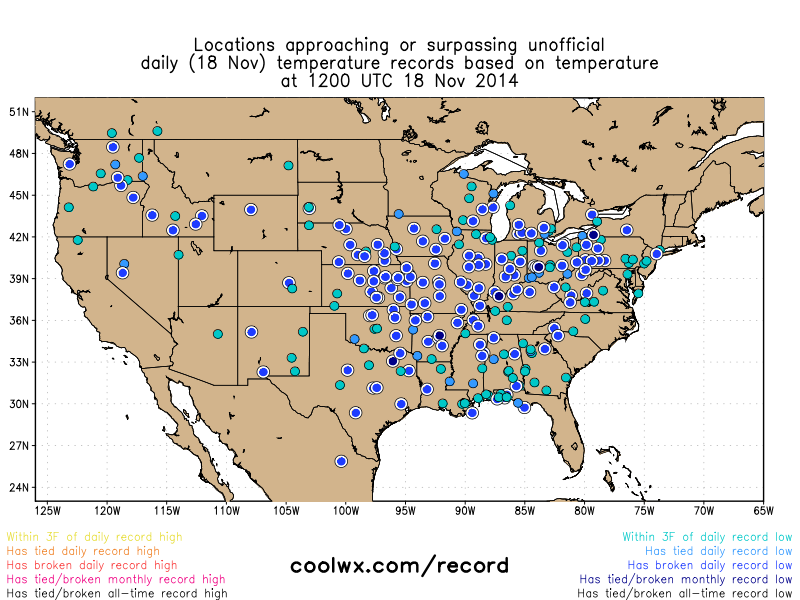 [Record or near record lows this morning virtually from coast-to-coast; map courtesy coolwx.com]
6-Day Forecast
Today
Mostly sunny, windy, painfully cold for mid-November, highs this afternoon will struggle to pass the freezing mark and wind chills will be noticeably lower at times
Tonight
Mostly clear, very cold for this time of year, lows in the lower 20’s in town, teens in the suburbs
Wednesday
Mostly sunny, still very cold, but not as windy, low 30’s
Wednesday Night
Mostly cloudy, quite cold, near 30 degrees
Thursday
Mostly sunny, breezy, not as cold, low 40’s
Friday
Partly sunny, breezy, colder, upper 30’s
Saturday
Mostly sunny, cold, near 40
Sunday
Mostly cloudy, milder, chance for PM rain, low-to-mid 50's
Discussion
Today will flat out be one of the coldest November days ever experienced in the Mid-Atlantic region and across much of the nation. This amazing Arctic outbreak is causing record or near record low temperatures this morning (blue circles) virtually from coast-to-coast with some cities experiencing their coldest temperature ever in the month of November (black circles) [above map courtesy coolwx.com]. Another outbreak of Arctic air has indeed arrived in the Mid-Atlantic region following yesterday’s storm system and evening cold frontal passage. Temperatures this afternoon will struggle to pass the freezing mark and then should plunge into the teens during the overnight hours in suburban locations, near 20 in town, – way below normal for mid-November. In addition, strong NW winds will make it feel even colder at times today with wind gusts up to 30 mph or so. The very cold conditions will continue tomorrow, but it won’t be as windy as today and then there will be a bit of moderation in temperatures on Thursday only to be followed by reinforcing cold air to end the week. Looking ahead, noticeable milder conditions are likely late this weekend and early next week, but the warmer weather will be accompanied by some rainfall.
Video
httpv://youtu.be/h6avANezMcU