12:30 PM | *An update on the accumulating snow for Thanksgiving Eve*
Paul Dorian
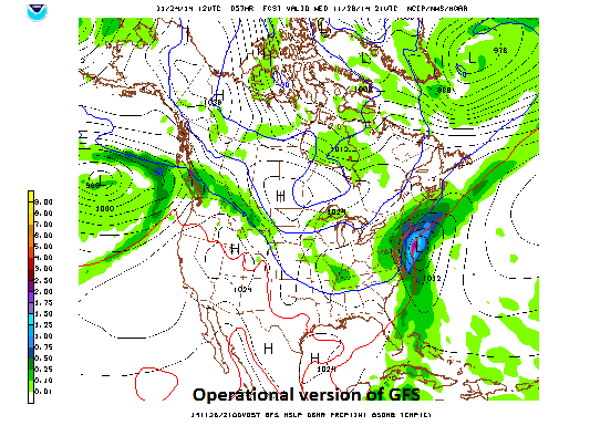 [12Z GFS forecast map for Wednesday afternoon]
Discussion
Overview The first significant snowfall of the season is on the way for many parts of the Mid-Atlantic region. Low pressure will develop over the eastern Gulf of Mexico on Tuesday night and intensify as it tracks northeastward along the east coast on Wednesday. The low is expected to pass just east of New Jersey on Wednesday evening before reaching the New England coastal waters late Wednesday night. This coastal storm will have a big impact on the interior Mid-Atlantic region on Wednesday and Wednesday night resulting in rather typical fashion of generating more snow to the north and west and less snow to the south and east. Odds are against much accumulation of snow at or near the immediate coastline given the fact that the air mass will be only marginally cold for snow and there will be no blocking cold high pressure system to the north of here.
As far as travel is concerned, precipitation from this coastal storm will be an all-day affair in the region from DC-to-NYC, but the earlier in the day one can drive the least likely snow will become a problem. Roads will take awhile to become slippery given the warmth of today and the expected relative warmth of tomorrow. The worst driving conditions should occur from late Wednesday afternoon through Wednesday evening when the sun loses its effectiveness on the roads (yes, it has an effect even on overcast days). Of course, the best advice of all for those planning to travel would be to drive on Tuesday if at all possible.
Details Precipitation should overspread the region from the southwest early Wednesday morning. Precipitation should be mainly rain during the daylight hours from I-95 to points south and east, and mainly snow well to the northwest (Berks County, Lehigh Valley, Poconos). As colder air gets drawn into the system, the rain-snow line will drop southeastward during the day and the precipitation should change to snow in the immediate I-95 corridor during the mid-day and aftrnoon hours and continue as snow Wednesday night. The last area to change over to snow will be down at the Jersey Shore and they can expect the least amount of snow. Northerly winds are forecast to increase to 10 to 20 mph on Wednesday with gusts to 25 or 30 mph possible. The snow will be of the heavy, wet variety.
Preliminary snowfall estimates 3-6 inches of snow in the far northern and western suburbs (e.g., northern Chester County, northern Bucks, northern Montgomery Counties), 1-3 inches of snow in the city of Philadelphia and its immediate suburbs (e.g., Delaware County), <1 inch at the New Jersey coastline
Stay tuned, still some time to go before this event.