7:00 AM | **Repeat performance for Friday and Saturday...yet another "clipper" system with snow showers and gusty winds in the Northeast US on Friday to be followed by more bitter cold air for Saturday**
Paul Dorian
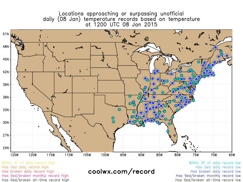 [Dozens of record or near record lows this morning (blue circles); map courtesy coolwx.com]
6-Day Forecast
Today
Mainly sunny, not as windy as yesterday, brutal cold, highs in the upper teens
Tonight
Increasing clouds, bitter cold, snow showers possible late, lows not far from 10 degrees
Friday
Snow showers early that can produce a quick coating and some slick spots; otherwise, becoming partly sunny and windy, still quite cold, but not as severe, upper 20’s
Friday Night
Mostly clear, brutal cold, near 10 degrees
Saturday
Mainly sunny, breezy, bitter cold, upper teens
Sunday
Partly sunny, still quite cold, but not as severe, near freezing for highs
Monday
Mostly cloudy, cold, chance for snow, ice and/or rain, low 30’s
Tuesday
Mostly cloudy, still quite cold, chance for snow, ice and/or rain low-to-mid 30’s
Discussion
Single digits are widespread this morning in the Northeast US and temperatures will struggle around here today to reach the upper teens despite plenty of sunshine. This air mass is comparable to some of winter’s worst from last winter with dozens of record or near record lows this morning (blue circles on map; courtesy coolwx.com). A repeat performance is in store for the next couple of days with yet another “clipper” system bringing snow showers into the Northeast US on Friday along with gusty winds and then bitter cold air will follow for the beginning of the weekend. Temperatures ease somewhat on Sunday and then moisture pulling out of the southern states could affect us with some snow, ice or rain during the early part of next week.