10:25 AM | **California has a brief break before getting pounded again...clock is ticking on a dam crisis**
Paul Dorian
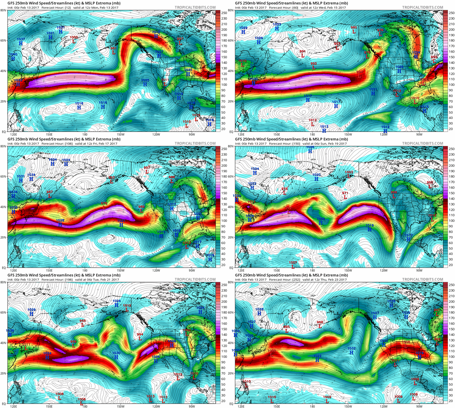
Computer forecast models indicate a powerful jet stream will continuously pound California over the next ten days and bring copious amounts of moisture from off of the Pacific Ocean into the state. This 10-day loop of predicted upper-level winds at 250 mb are in 6-hour increments from today until Thursday, February 23rd; maps courtesy tropicaltidbits.com, NOAA/EMC (GFS)
Overview (Monday, February 13th)
There have been many occasions in the past in which floods have followed droughts in California and this recent time period is yet another example. In California, incredible amounts of rain have piled up in recent weeks across low-lying areas of the state, mountains of snow have accumulated in the higher elevations of the Sierra Nevada Mountains - and more is on the way. After a couple days with a break in the action, another storm is likely to arrive in northern California by later Wednesday and continue into early Thursday. After that, a second and very intense storm looks like it will slam the entire state by the end of the work week with southern California likely being especially hard hit with not just heavy rain, but also high wind, possible power outages and flash flooding.
The next storm arrives in northern California later Wednesday and lasts into Thursday; map courtesy tropicatidbits.com, NOAA/EMC
California blitz to continue
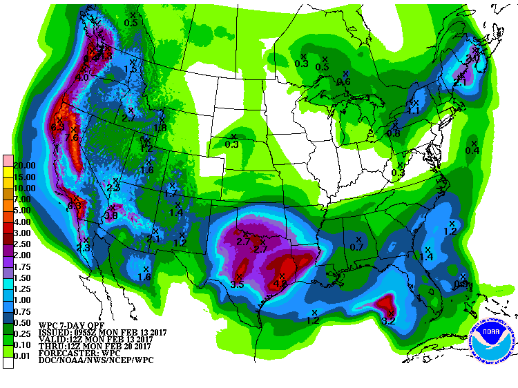
After a lengthy drought, California has been battered by potentially record-setting rain, with the Northern California region getting 228 per cent more than its normal rainfall for this time of year. The average annual rainfall of about 50 inches had already been overtaken with 68 inches in 2017 alone and another 6+ inches is possible over the next week-to-ten days. The latest computer model forecast of upper-level winds for the next ten days (Monday, 2/13 to Thursday, 2/23) does not hold out much hope for any significant drying in California. Powerful winds in the upper atmosphere (at 250 mb) will continuously pound California and bring copious amounts of moisture from the Pacific Ocean into the state. The total precipitation forecast map by NOAA for the next 7 days indicates more significant rainfall (and snowfall) is likely throughout the state.
A second storm is likely to arrive in California by the upcoming weekend and this system is likely to impact the entire state; map courtesy tropicatidbits.com, NOAA/EMC
The first storm looks like it will arrive later Wednesday and continue into Thursday and be concentrated in the northern part of the state. Just a couple days later, a second storm will push in from the Pacific Ocean, and this storm looks like it’ll bring copious amounts of precipitation throughout the state with southern California likely to be especially hard hit. In fact, there is the potential that this late week storm ends up being one of the worst in many years for southern California with several inches of rain likely from early Friday into Saturday along with strong winds, possible power outages and flash flooding.
7-day total precipitation amounts as predicted by NOAA forecasters with high amounts in California
Oroville Dam Crisis
Lake Oroville is one of California’s largest man-made lakes with 3.5 million acre-feet of water and 167 miles of shoreline, and the 770-foot-tall Oroville Dam is the nation’s tallest, about 44 feet higher than Hoover Dam on the Colorado River. Oroville Dam is located in the foothills of the western Sierra Nevada mountain range. The lake is the linchpin of California’s government-run water delivery system, sending water from the Sierra Nevada for agriculture in the Central Valley and for residents and businesses in Southern California.
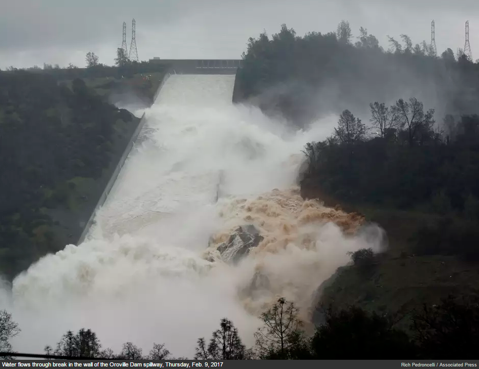
Oroville Dam as of Thursday, February 9th following heavy rainfall; photo courtesy Associated Press
On Sunday, state engineers discovered significant erosion had occurred back towards the face of the emergency spillway at Oroville Dam after huge water outflows, meaning the structural integrity of the dam's auxiliary spillway was at risk. The emergency spillway is an unlined channel that is essentially a natural hillside with rocks, brush and other debris. California officials worked frantically on Sunday to evacuate thousands of residents downstream of the Oroville Dam after the hole was discovered on an emergency spillway. The emergency spillway was activated Saturday for the first time ever in the dam's 48-year history after the swollen dam reached above its elevation capacity of 901 feet following a deluge of rain in the Northern California region.
The clock is ticking on the Oroville Dam crisis on more than one level. In the short-term, action must be taken quickly as more rain is likely to arrive later Wednesday and then another storm is destined to follow by the weekend and yet another storm is possible early next week. Just between Wednesday and Friday of last week, the mountains surrounding the Oroville Dam received between 10 and 20 inches of rain according to the National Weather Service. In addition to the near-term concern, pressure is on state officials over the longer-term to resolve the spillway crisis at Oroville since the heavy snowfall in the Sierras will be melting in the spring and bring more water to area reservoirs.
Meteorologist Paul Dorian
Vencore, Inc.
vencoreweather.com


