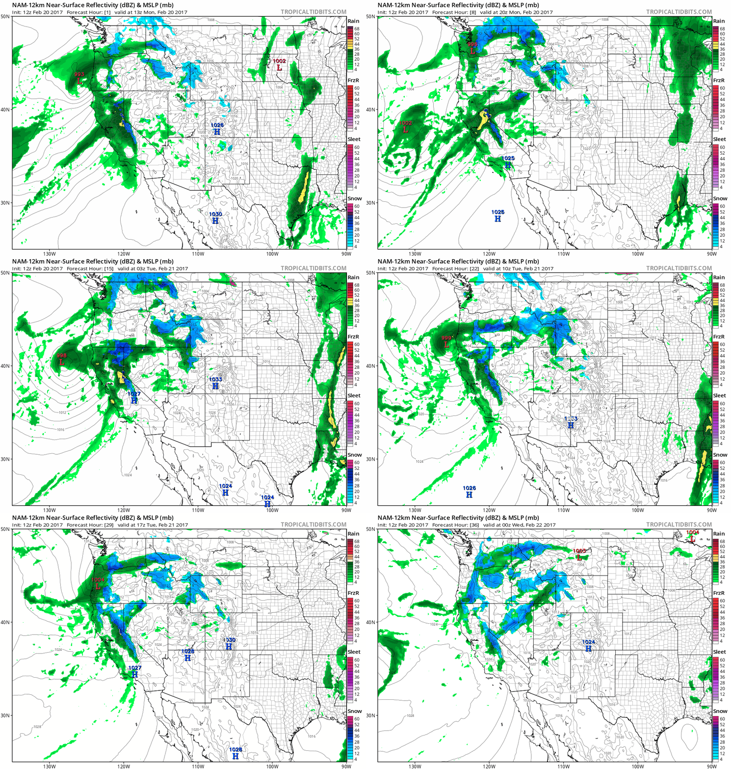
1:55 PM | *Northern California getting pounded today…some incredible rain and snow amounts piling up*
Paul Dorian
12Z high-resolution NAM surface reflectivity forecast loop for the next 36 hours (in hourly increments) with rain in green and snow in blue; courtesy tropicaltidbits.com, NOAA/EMC
Overview
Southern California got slammed on Friday and early Saturday from one intense storm and yet another is now pounding away at northern California. A widespread 3-6 inch rainfall is expected in the San Francisco Bay and Sacramento Valley regions by early tomorrow from this latest in a series of storm systems. Even higher amounts of rain are possible in the higher elevations of the Santa Cruz Mountains over the next 24 hours or so. To go along with the heavy rain, there will be strong winds today and heavy mountain snows. As this seemingly daily onslaught continues in California, some amazing numbers are piling up with respect to rain and snowfall amounts.
Mammoth Mountain monthly record snowfall amounts with January and February of this year circled
Some amazing numbers
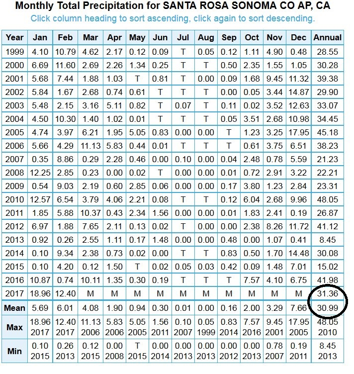
This latest storm system will likely bring another 2 to 4 feet of snow to the highest peaks of the Sierra Nevada over the next 24-36 hours. While some of these mountain peaks are known for tremendous snowfall amounts, what has been taking place at Mammoth Mountain is quite spectacular. Mammoth is the highest ski resort in California and is notable for the unusually large amount of snowfall it receives compared to other Eastern Sierra peaks—about 400" annually- but the snowfall there during January and February has been off the charts. In fact, the combined January and February snowfall amount of 368 inches has shattered the previous record for Mammoth Mountain (296 inches) – and that is before the current storm totals are included. Rainfall amounts have been quite amazing in some many spots as well across California. For example, Santa Rosa has already received more rainfall in 2017 (31.3”) than it gets in an average year (31.0”).
2017 rainfall totals at Santa Rosa already exceed the yearly average
Oroville Dam
California officials are confident Lake Oroville will be able to withstand the rainfall expected early this week. The Department of Water Resources increased outflow from the Oroville Dam flood control spillway on Sunday, from 55,000 cfs to 60,000 cfs, in anticipation of the expected increase in inflows. Despite the current inclement weather, work continues around-the-clock on the area below the spillway with rock and cement continuing to be placed into areas affected by erosion. Looking past this current storm, there are no major storms expected over the next few days, but another major storm is possible this weekend.
Meteorologist Paul Dorian
Vencore, Inc.
vencoreweather.com


