12:15 PM | *Threat exists in DC, Philly for severe thunderstorm activity late today/tonight*
Paul Dorian
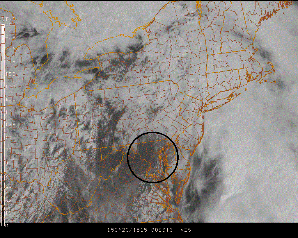 [GOES visible satellite image around noon; courtesy Penn State eWall, NOAA]
Discussion
A warm front pushed through the region this morning and sunshine has broken out across the DC metro region and is likely to appear in southeastern Pennsylvania during the afternoon. As a result, temperatures will jump to quite warm levels and this will help to destabilize the lower atmosphere ahead of the arrival of a strong cold frontal system which is now centered over the eastern Ohio Valley. The current visible satellite image shows the clearing skies across the DC metro region as of noon (circled area) and that area is expanding to the north and east. Any severe thunderstorm late today or tonight in the DC, Philly metro regions could generate damaging wind gusts, hail and possible isolated tornadoes. The latest high-resolution NAM computer forecast simulated radar map (below) for 11PM features a relatively solid line of thunderstorms near DC and just to its east as well as one line approaching southeastern Pennsylvania. The most likely time frame for any severe thunderstorm activity in the DC and Philly metro regions is between 6pm and midnight. The New York City metro region is likely to escape from any potential severe thunderstorm activity due to stubborn low cloud cover and cooler air at surface level in that area.
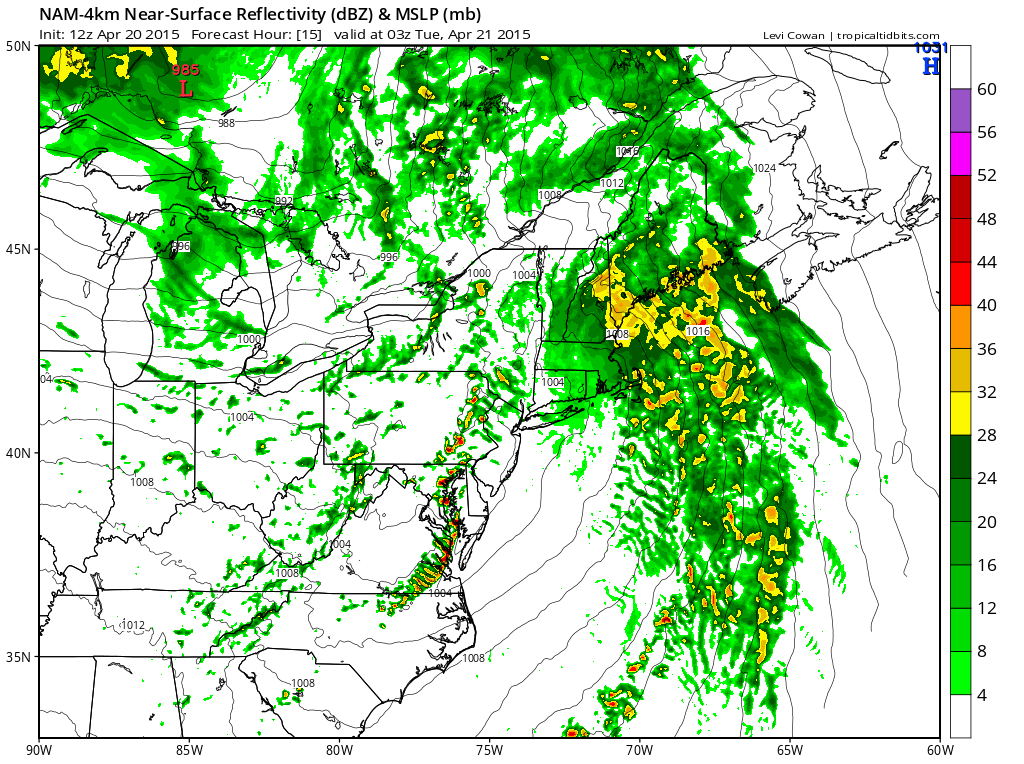 [12Z NAM simulated radar map for 11PM; map courtesy tropicaltidbits.com, NOAA]