10:40 AM | Big changes coming to the Mid-Atlantic
Paul Dorian
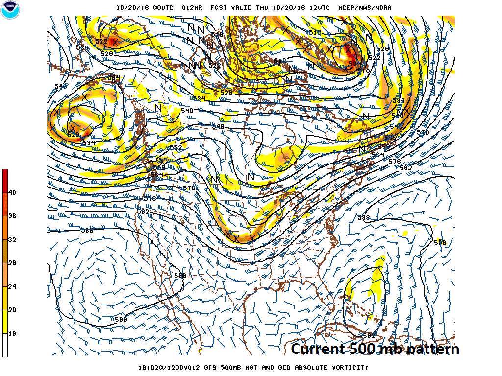
Big upper-level trough in the Northern Plains this morning; map courtesy NOAA
Overview
Philadelphia officially broke a record yesterday as the airport reached 86 degrees which easily bested the old record of 80 degrees set back in 1947. In fact, there has been much record warmth during the past few days in the eastern states, but big changes are coming by the weekend. A strong cold front whips through the region tomorrow night and its passage will usher in a much cooler air mass for the weekend and it’ll generally stay below-normal into the middle part of next week.
Big upper-level trough over the Northeast US come early Saturday; map courtesy NOAA
Details
Winds this morning in the upper part of the atmosphere continue to push relatively mild air into the Mid-Atlantic region from the south-central US, but by Saturday morning the upper-level trough now sitting over the Northern Plains amplifies over the Northeast US. A strong cold front will press eastward on Friday and generate some rain in the I-95 corridor as the transition begins, but the heaviest rainfall during this event is likely to stay northwest of the immediate I-95 corridor. By late tomorrow night, the winds will pick up noticeably and temperatures will drop sharply into the 40’s for lows in the DC-to-Philly-to-NYC corridor. In fact, this air mass is so chilly that snowflakes could fall in some of the higher elevation locations across central and western PA late Friday night/early Saturday. Temperatures in the big cities this weekend should generally be confined to the 50’s by day for highs and this cool shot should last into the middle part of next week as a some reinforcing cool air will come down from the northwest of here for Tuesday and Wednesday. Overnight lows in the 30’s are possible during this stretch of below normal weather in suburban locations to the north and west of the big cities.
Meteorologist Paul Dorian
Vencore, Inc.


