
10:30 AM | *Tropical system still has its eyes set on Florida/Gulf of Mexico, but remains disorganized*
Paul Dorian
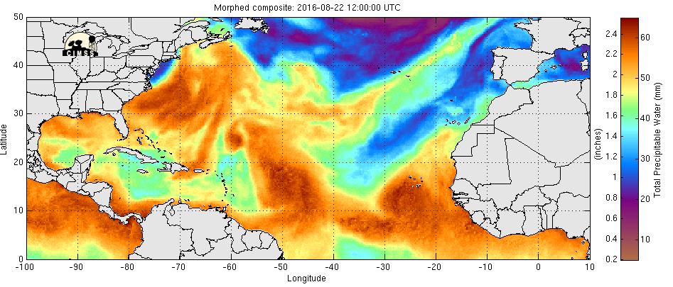
72 hour loop of "total precipitable water" where moist air is represented by orange, yellow, dry air by blue, green; courtesy University of Wisconsin/CIMSS
Overview
The tropical system still officially known as 99L is currently located near the island of Hispaniola and it is still disorganized. The main areas of showers and thunderstorms are on the southern side of Hispaniola, but there is reason to believe the low-level circulation center is just to the north of the island (i.e., a disjointed system). There is mountainous terrain on Hispaniola and this will inhibit intensification of tropical system 99L in the short term; however, once passed this current obstacle, there are reasons to believe some intensification will take place. In fact, it is possible that a tropical storm (would be named Hermine) reaches Florida by late Sunday - perhaps as far south as the Florida Keys. After that, it could spill out into the Gulf of Mexico where additional development can take place - perhaps even to major hurricane status.
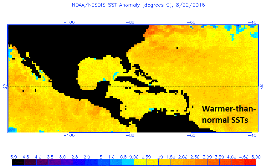
Sea surface temperatures are warmer-than-normal in most of the western Atlantic, Caribbean Sea, and Gulf of Mexico; courtesy NOAA
Favorable conditions for some intensification once passed Hispaniola
Several factors suggest intensification of 99L can take place after it passes by the obstacle of Hispaniola Island - as long as it holds together. First, there is very moist air not only in the vicinity of its current location, but also in its likely path over the next few days. The latest loop of “total precipitable water” shows areas of moist air (i.e., high total precipitable water content) and this will be a favorable factor for development in the next couple of days. Second, sea surface temperatures are warmer-than-normal throughout much of the Caribbean Sea, Gulf of Mexico and western Atlantic Ocean and this is also a favorable factor for future intensification. In addition to these two factors, there are signs of decreasing wind shear in the vicinity of this tropical system over the next few days and this is also favorable for some future intensification.
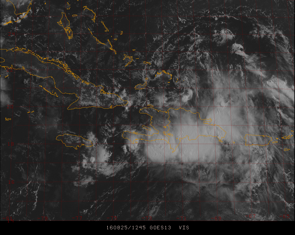
Recent GOES visible satellite image with showers/thunderstorms over Hispaniola; low-level circulation center may be north of the island; courtesy Penn State eWall, NOAA
Computer forecast models
NOAA’s main high-resolution hurricane forecast model known as the Hurricane Weather Research and Forecasting (HWRF) model puts the tropical system at the southern tip of Florida by Sunday afternoon and then over the Gulf of Mexico in a stronger state by early Tuesday morning. Given the abundance of moist air, widespread warmer-than-normal sea surface temperatures, current steering winds, and expected overall weather pattern with high pressure over the Northeast US, this track and intensity forecast is plausible, but a lot depends on how 99L survives its encounter with Hispaniola. Last night's Euro computer model forecast is in general agreement with the 00Z HWRF model run.

NOAA's HWRF model forecast for Sunday afternoon (left) and Tuesday morning (right); courtesy tropicaltidbits.com, NOAA
Final notes
Amazingly, the state of Florida has not had a hurricane of any intensity since Wilma came ashore in southwestern Florida during late October of 2005. Hurricane Wilma was also the last major hurricane (i.e., category 3, 4 or 5) to strike US soil in what has turned out to be another amazing streak. We should know by the middle of next week if one or both of these streaks comes to an end.
Stay tuned.
Meteorologist Paul Dorian
Vencore, Inc.