3:25 PM | *Icing problems on Saturday for the DC metro region*
Paul Dorian

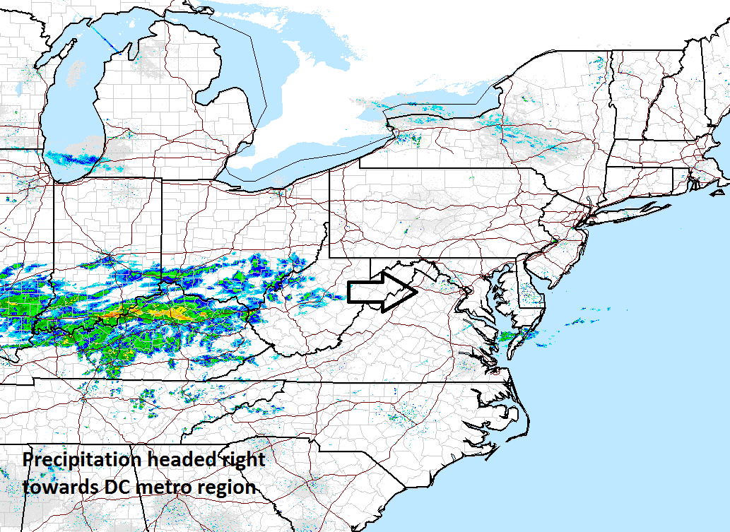
Latest radar map with echos moving quickly towards the DC metro region; courtesy NOAA
Temperatures have held near 50 degrees this afternoon following the passage of a cold frontal system and will drop noticeably after dark. High pressure is building southward and pushing drier and colder air into the low-levels of the atmosphere. Meanwhile, low pressure in the Tennessee Valley is drawing warmer into the upper parts of the atmosphere. Moisture is advancing rapidly in a west-to-east fashion across the Ohio Valley and should arrive in the DC metro region after midnight. As temperatures drop to near freezing, the precipitation is likely to arrive as a brief period of snow and then sleet and freezing rain. On Saturday, as temperatures hover near the freezing mark, freezing rain is liable to be the main precipitation type although sleet can mix in at times and a light glaze of ice is likely to form on untreated road surfaces trees and bushes. Travel conditions could get slippery on any untreated road surface. The precipitation should lighten up tomorrow night, but there can still be some residual freezing rain possibly mixed with sleet and temperatures will hold near freezing.
Well to the west of here, a major ice storm is unfolding from the Texas Panhandle to Ohio. The thickness of the ice will become substantial enough to weigh down trees and power lines in portions Texas, Oklahoma, Kansas, Missouri and Illinois with the worst hit region likely to be from Kansas into Missouri.
Meteorologist Paul Dorian
Vencore, Inc.
vencoreweather.com