
12:30 PM | *Nate likely to strike LA/MS border region on Saturday night as a hurricane…significant rain likely in much of eastern US from remains of Nate*
Paul Dorian
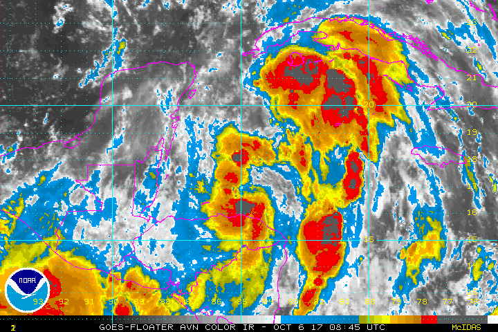
The latest colorized IR satellite imagery loop with Tropical Storm Nate getting better organized as it closes in on the eastern tip of the Yucatan Peninsula; images courtesy NOAA
Overview
Tropical Storm Nate is likely to strengthen over the Gulf of Mexico on Saturday and head towards the Louisiana/Mississippi southern border region. It is likely to make landfall in that part of the northern Gulf coast on Saturday night as a category 1 or 2 status hurricane. After landfall, Nate is likely to turn to the northeast and take an inland track through the eastern states on Sunday night and Monday. This expected path is likely to result in significant rainfall for much of the interior eastern US including the Mid-Atlantic region where it has been very dry in recent weeks.

12Z GFS forecast map for Saturday evening; courtesy tropicaltidbits.com
Discussion
Tropical Storm Nate is now moving rather quickly to the north-northwest and will skirt the eastern tip of the Yucatan Peninsula over the next 12 hours or so on its way to the central Gulf of Mexico. Nate is currently between an upper-level low over Central America and a strong ridge of high pressure building over the western Atlantic. The combination of these two systems is steering the storm to the north-northwest at a rather quick clip. Tropical Storm Nate is likely to head out over the warm waters of the central Gulf of Mexico on Saturday and should intensify to hurricane status of category 1 or perhaps even category 2.

12Z GFS forecast map for Monday evening with the remains of nate situated over SE PA; courtesy tropicaltidbits.com
Intensification over the next 12 hours or so will be somewhat inhibited for a couple of reasons. First, Nate will have an interaction with land later today and tonight as its center heads near or over the eastern tip of the Yucatan Peninsula. Second, there are two other tropical waves in the same general vicinity of Nate and they are, in effect, in competition with each other for atmospheric energy. By tomorrow, more rapid intensification is likely as these two other competing tropical waves will vanish from the scene and Nate will be “all alone” as it moves over the warmer-than-normal waters of the Gulf of Mexico with little competition from elsewhere.
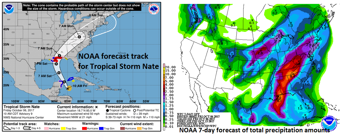
NOAA's latest forecast track (left) for Tropical Storm Nate (with uncertainty "cone"); NOAA's latest forecast of 7-day precipitation amounts (right)
Landfall is likely by later Saturday night in the LA/MS southern border region and then Nate will likely change course and turn to the northeast taking an inland route through the Tennessee Valley and into the Mid-Atlantic region from late Sunday into Monday. Tropical moisture associated with the remains of Nate will likely result in significant rainfall all the way from the Deep South to the Mid-Atlantic region – especially at interior locations - in the period from late Sunday into Monday. Much of the eastern US including the Mid-Atlantic region has been quite dry in recent weeks and the rains from Nate will actually be welcome news in many locations.
Meteorologist Paul Dorian
Vencore, Inc.
vencoreweather.com
Extended video discussion on Nate: