
2:45 PM | *Jose could strengthen to category 3 (major) status and will likely come “too close for comfort” to the NE US coastline...other tropical threats as well*
Paul Dorian

The latest satellite image shows Tropical Storm Jose over the Atlantic Ocean with a "healthy-looking" symmetry...it is likely to regain hurricane status shortly. Image courtesy NOAA/NASA
Jose is currently classified as a tropical storm with max sustained winds at 70 mph and a central pressure of 989 millibars. Jose is currently moving to the northwest at 9 mph and is likely to continue in this direction over the next couple of days. The latest satellite image of Jose is rather impressive with a “healthy-looking” symmetry to the storm and the possible beginnings of an eye formation. Hurricane status is likely to be regained shortly based on the latest observations and by the middle of next week, Jose could be a real concern for the northeast US; especially, across southern New England.
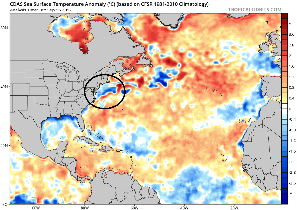
The latest sea surface temperature anomaly chart shows warmer-than-normal conditions (orange) in the current general vicinity of Tropical Storm Jose which should aid in near-term intensification. Farther to the north, the circled region shows some colder-than-normal (blue) water off the Mid-Atlantic coast and this could ultimately become a weakening factor for Jose should it come to the coastline. Map courtesy tropicaltidbits.com, NOAA
Jose will be moving into a more favorable environment for intensification (warmer sea surface temperatures) over the next few days and it could very well not only reach hurricane status, but perhaps "major" status as a category 3 storm. All indications suggest Jose will ride northward and parallel to the coast during the early and middle parts of next week – only a couple hundred miles off the east coast and "too close for comfort". There is still a possibility that Jose ends up taking a strange path in its future with a brief departure towards the open Atlantic, but then a loop back towards the NE US coastline as strong high pressure ridging builds across the northern Atlantic. One of the factors that could eventually play a role in Jose’s fate is the chilly water off the Mid-Atlantic coastline. If Jose were to shift just a bit to the west of its current track projection (and certainly still within the realm of possibility), it may have to deal with this chilly water which would tend to weaken the tropical system if it approached the coastline.

The latest visible satellite image of the eastern Atlantic showing "wave-after-wave". This activity promises quite an active latter part of September for the US. Image courtesy Penn State ewall, NOAA
Elsewhere, the tropics are certainly quite active above and beyond Jose. There are currently two separate systems in the eastern Atlantic and there is growing concern that there will be one or more impacts in the US as we head through the second half of September.
Meteorologist Paul Dorian
Vencore, Inc.
vencoreweather.com