1:40 PM | *Tropics likely to feature “home-grown” systems next few weeks*
Paul Dorian

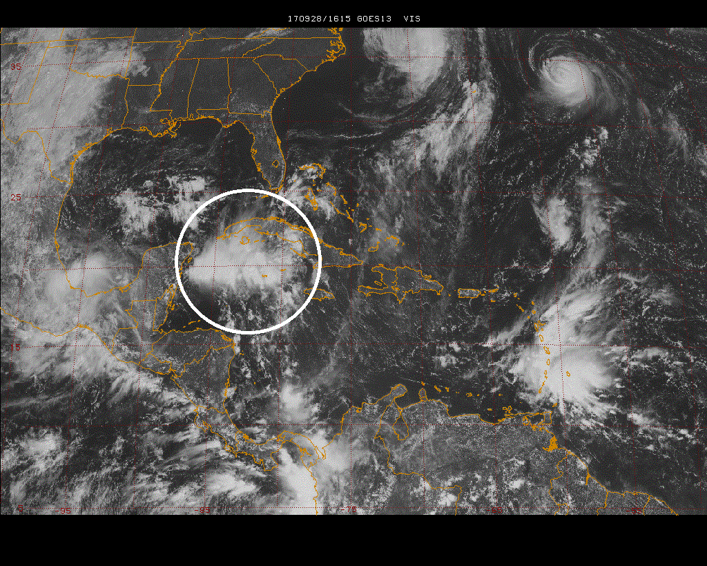
The latest visible satellite image features an area of showers and thunderstorms just to the south of Cuba and this tropical wave will impact Florida next few days; image courtesy NOAA/GOES, Penn State eWall
Overview
Typically, “African-wave” tropical systems wane during the latter stages of the Atlantic Basin tropical season and there are often more in the way of “home-grown” systems that form in more nearby locations to the US such as the Gulf of Mexico, Caribbean Sea or western Atlantic region near the Southeast US coastline. In fact, there are strong signs that one tropical system may form near the eastern side of Florida over the next few days and then the medium-term (7-14 days out) is likely to feature a tropical system over the western Caribbean Sea/southern Gulf of Mexico which could eventually also have an impact on parts of the Southeast US.

00Z Euro model forecast of 500 mb height anomalies in days 1-5 featuring strong ridging (orange) across the Great Lakes/Northeast US/southeastern Canada; map courtesy NOAA/EMC, tropicaltidbits.com
Discussion
High pressure this time of year that sits over the Northeast US and southeastern Canada is often a forerunner of tropical tropics for the US. Computer forecast models support the idea for strong upper-level high pressure ridging to persist over the next ten days or so in these particular regions - and that could pose problems for the Southeast US.

00Z Euro model forecast of 500 mb height anomalies in days 6-10 featuring strong ridging (orange) across the Great Lakes/Northeast US/southeastern Canada; map courtesy NOAA/EMC, tropicaltidbits.com
In the near term, an area of showers and thunderstorms now situated just to the south of Cuba is likely to expand and intensify over the next few days as low pressure forms near or over the east coast of Florida. This low pressure system could develop into a named tropical storm at some point, but whether it does or not, the likelihood is for some heavy rainfall in places like the Florida Keys, Bahama Islands and much of mainland Florida. As strong high pressure builds to the north, this low pressure system could actually run into an “atmospheric brick wall” late in the weekend and be forced westward across northern Florida by the early part of next week.
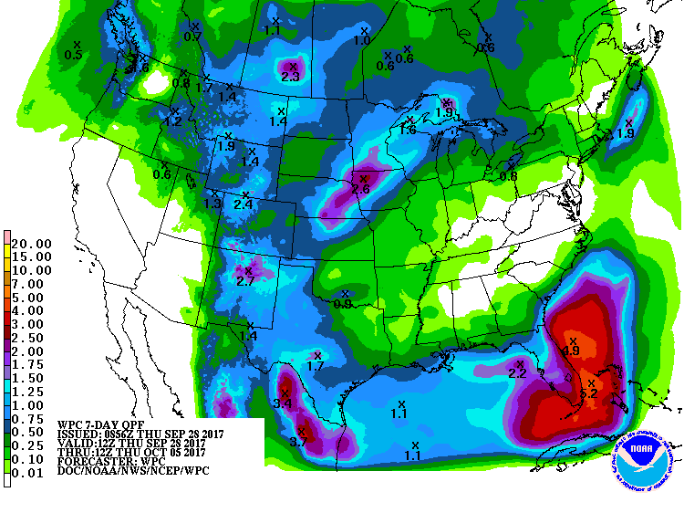
NOAA's forecast of total precipitation amounts over the next 7 days with a few-to-several inches expected in parts of Florida
In the medium term (i.e., ~1 to 2 weeks out), signs point to the formation of a “home-grown” type system over the western Caribbean Sea or southern Gulf of Mexico. From this point, this potential scenario could feature a tropical system pushing northward towards Florida and the rest of the Southeast US by the middle part of October. Around here in the Mid-Atlantic, we'll experience pleasantly cool conditions for the next several days, but persistent high pressure ridging will virtually guarantee another warm spell as we progress through October with above-normal temperatures.
Meteorologist Paul Dorian
Vencore, Inc.
vencoreweather.com