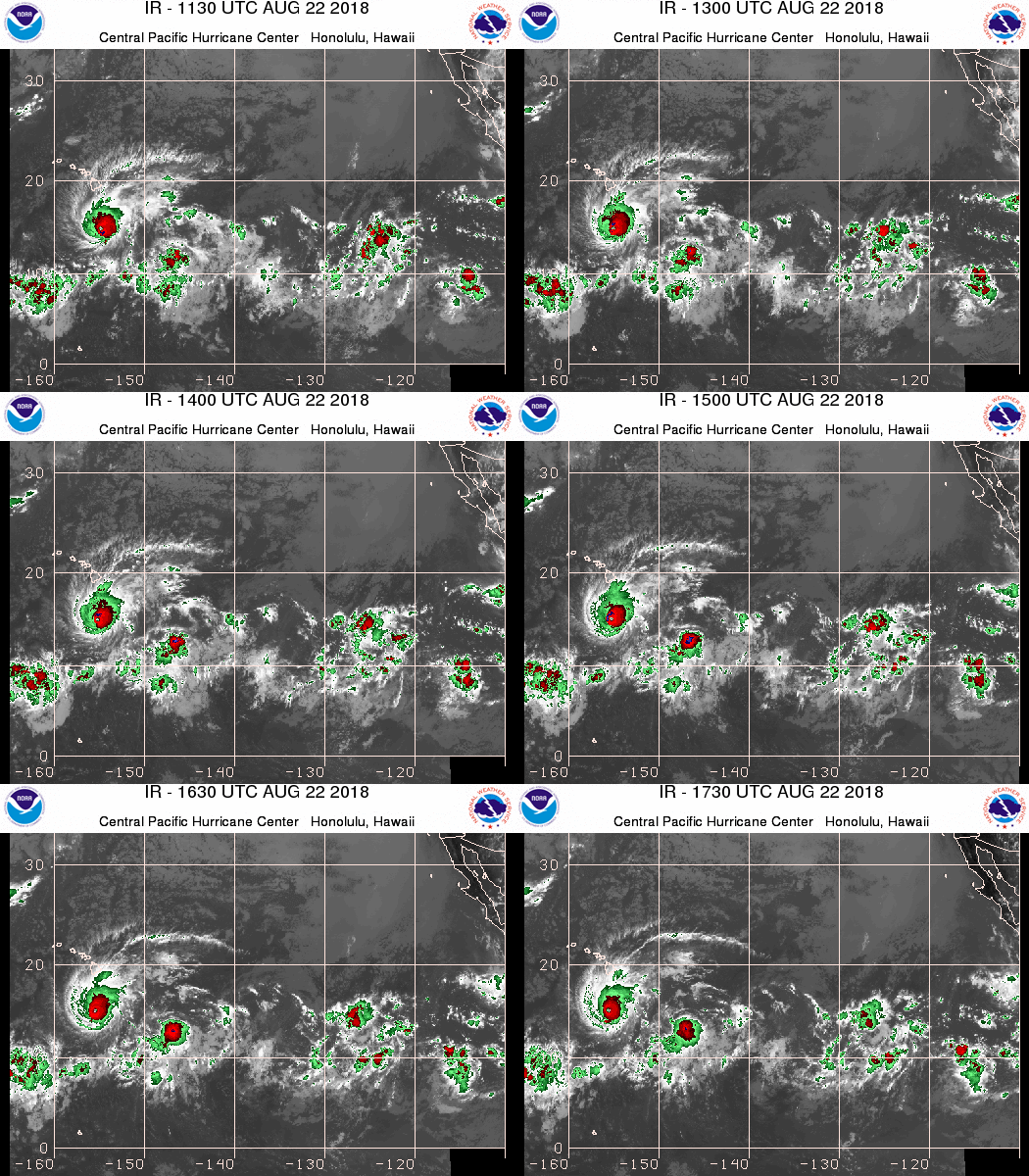
2:30 PM | *Major Hurricane Lane headed towards the Hawaiian Islands, but landfall not likely…now a high end category 4 storm…increasing wind shear should gradually weaken Hurricane Lane next few days*
Paul Dorian
Hurricane Lane (left) closes in on the Hawaiian Islands; courtesy NOAA
Overview
In general, the Pacific Ocean has had more tropical activity this season compared to the Atlantic Basin and that trend should continue in the near term. Sea surface temperatures are playing a role in this trend and they are currently warmer-than-normal in the vicinity of Hawaii with a major hurricane headed in that direction. Fortunately, Hurricane Lane is likely to not make a direct hit on the islands and it should undergo steady weakening in coming days due to increasing amounts of wind shear. Nonetheless, Hurricane Lane will be a formidable storm for the state of Hawaii with potential significant impact in terms of rainfall; especially, on the Big Island. This is very likely not going to be the last tropical threat for Hawaii this season as warmer-than-normal sea surface temperatures and a developing El Nino in the central Pacific Ocean will likely aid in the formation of additional systems in coming days.
If - as I expect - Hurricane Lane weakens in coming days, it won't be because of water temperatures as they are sufficiently warm for maintaining storm intensity, but rather it will likely take place due to increasing wind shear. Courtesy NOAA, tropicaltidbits.com
Details
Hurricane Lane is currently moving WNW at 9 mph with 155 mph maximum sustained winds. Its central pressure is 935 millibars (27.61 inches) and it is currently in an environment of low wind shear and warm waters. The overall wind shear, however, is likely to strengthen in coming days as Hurricane Lane gets closer to the Hawaiian Islands and it should gradually weaken as a result. In fact, the current infrared satellite imagery loop (above) already shows some signs of wind shear with high-level clouds seen "blowing off" quite noticeably to the northeast in the upper, right quadrant of the system. As Hurricane Lane gets under the influence of an upper-level ridge of high pressure, its path may become more northwesterly in the next day or so taking it closer to the Big Island, but then a westerly shift should keep it from making a direct hit.
Even without a direct hit, tropical-storm force winds are likely in much of the state and excessive rainfall amounts of two to three feet are possible on some of the east-facing slopes of the Big Island. Hurricane force wind gusts are less likely given the expected steady weakening due to increasing amounts of wind shear and the anticipated storm path away from land, but this threat still needs to be closely monitored.
A dramatic turn to the north-northeast gave residents of Kauai little preparation time for the arrival of category 4 Hurricane Iniki in September 1992; map courtesy Wikipedia
Hurricane Iniki 1992
Hurricanes rarely make direct hits on the Hawaiian Islands and the last one to do so was Iniki in 1992 which became the most powerful storm to strike the islands in recorded history (and it interrupted the filming of the original Jurassic Park movie). Kauai bore the brunt of Iniki in 1992 as it made landfall there on September 11th as a category 4 storm after making a sudden and dramatic sharp turn to the north-northeast. This sudden shift in Iniki’s path left residents with less than 24 hours to prepare before it hit and the entire island lost power and telephone service. It would take years after landfall for the island to recover from the damage of Hurricane Iniki in 1992. Prior to Iniki, the last hurricane to make a direct hit on Hawaii was "Dot" in 1959.
Meteorologist Paul Dorian
Perspecta, Inc.
perspectaweather.com


