9:30 AM | *Eastern Pacific Hurricane Rosa to soak the Southwest US early next week and its moisture field could actually end up in southeastern Canada*
Paul Dorian

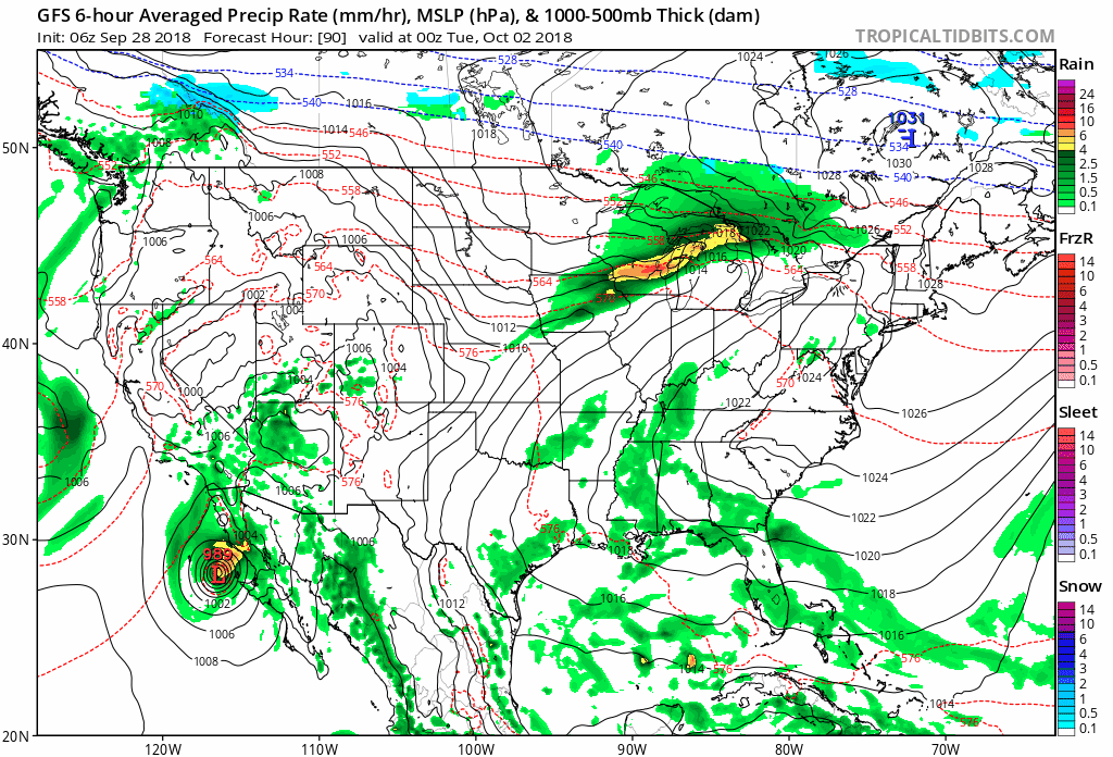
06Z GFS surface forecast maps from next Monday evening (90 hours) to Thursday morning (150 hours). The moisture field of Rosa moves into the Southwest US early next week and ultimately pushes into southeastern Canada by late next week. Maps courtesy NOAA/EMC, tropicaltidbits.com
Overview
Hurricane Rosa is now rated as a major (category 4) storm in the eastern Pacific Ocean with maximum sustained winds at 145 mph and it will take a track in coming days right towards the southwestern US. While it’s winds will diminish significantly over the next few days as it very likely weakens to tropical storm status before reaching the Southwest US, its moisture field will remain largely intact and flooding rains could be the result in places like Arizona, southern California and Utah. Once Rosa arrives in the Southwest US, upper-level winds could very well carry its moisture field all the way across the US and into southeastern Canada by late next week.

The latest projected path for Hurricane Rosa by the NOAA National Hurricane Center takes it right into the Southwest US by early next week albeit in a much weakened state (i.e., tropical storm status) compared to its current “major” hurricane status. Courtesy NOAA/NHC
Details
Hurricane Rosa has strengthened into a major category 4 storm and will likely head into the Southwest US early next week and produce heavy rainfall there that may result in some serious flash flooding. Some areas in the Southwest US including Arizona, southern California, and Utah could receive several inches of rain from what will likely be tropical storm Rosa by the time the system reaches southern Arizona or extreme southern California. In addition to the heavy rainfall, there can very well be some severe weather associated with Rosa early next week in the Southwest US with severe thunderstorms and possibly a few tornadoes.
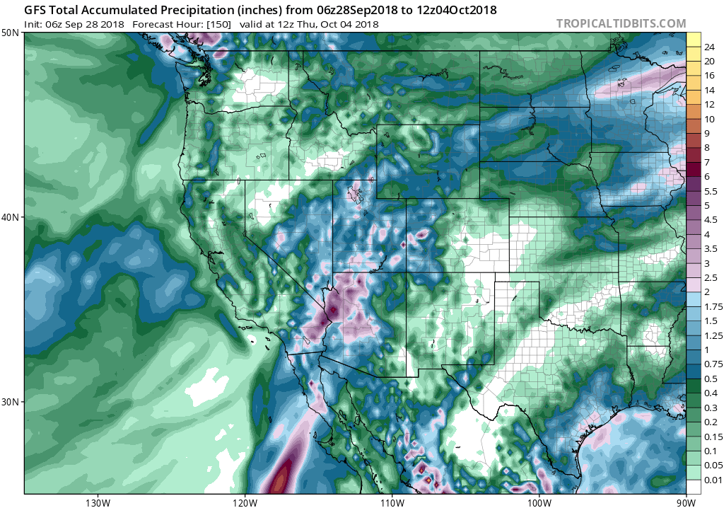
06Z GFS forecast map of total precipitation amounts between now and next Thursday with several inches of rain indicated in the Southwest US associated with what is now “major” Hurricane Rosa; map courtesy NOAA/WPC, tropicaltidbits.com
Once Rosa arrives in the Southwest US, high-level winds will pick up its moisture field and push it towards the Rockies and then into the Northern Plains. In fact, there are signs that the leftover moisture of Rosa will eventually interact with a frontal system and perhaps push all the way into southeastern Canada by around Thursday or so of next week.

The latest IR image of Hurricane Rosa features a well-defined eye and an overall very symmetrical look to the system; courtesy NOAA, University of Wisconsin/CIMMS