
2:45 PM | *Early season bitter cold and accumulating snow from the Rockies to the Northern Plains…western Atlantic lows to merge into one powerful storm*
Paul Dorian
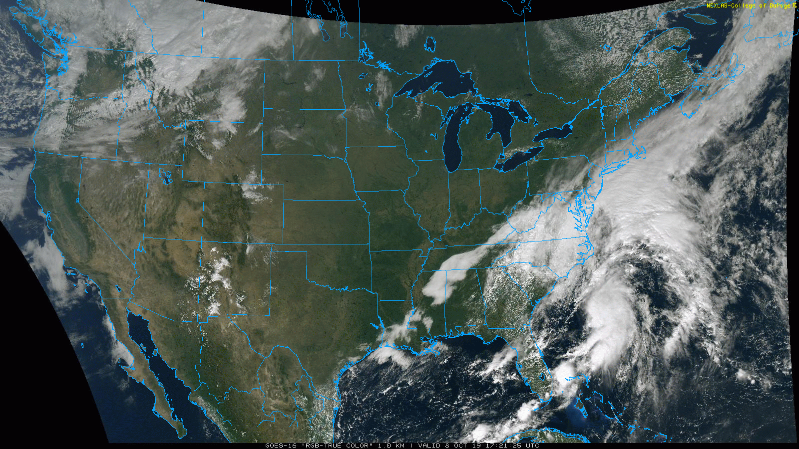
A lot of activity over the western Atlantic…two separate systems may merge into one powerful storm over the next few days; courtesy NOAA, College of DuPage
Overview
A very active weather pattern across North America will bring a tremendous early season shot of cold air and accumulating snow to the region from the Rockies to the Northern Plains over the next few days and two systems off the east coast will merge into one powerful storm just off the Mid-Atlantic/NE US coastlines. As much as two feet of snow is possible in coming days to the Northern and significant rain and wind is possible from the Atlantic low(s) in southern New England.

A bitter cold blast for early October is headed to the region from the Rockies to Northern Plains and there will be accumulating snow as well in coming days; courtesy NOAA, tropicaltidbits.com
Rockies-to-Northern Plains cold and snow
There was an early season cold blast and major snowstorm in Montana at the end of September and another Arctic blast is poised to pounce on the region from the Rockies to the Northern Plains later in the week. Dramatic temperature drops are likely to follow the passage of an Arctic front over the next couple of days with, for example, Boulder, Colorado potentially plunging from the mid 70’s on Wednesday afternoon to the lower teens on Thursday and they’ll likely receive accumulating snow as well. The cold blast and accumulating snow will ultimately extend from the Rockies to the Northern Plains and parts of eastern North Dakota and northwestern Minnesota could end up with two feet of snow by week’s end. The brunt of this unusual early season cold shot will then head towards the western Great Lakes by the upcoming weekend.
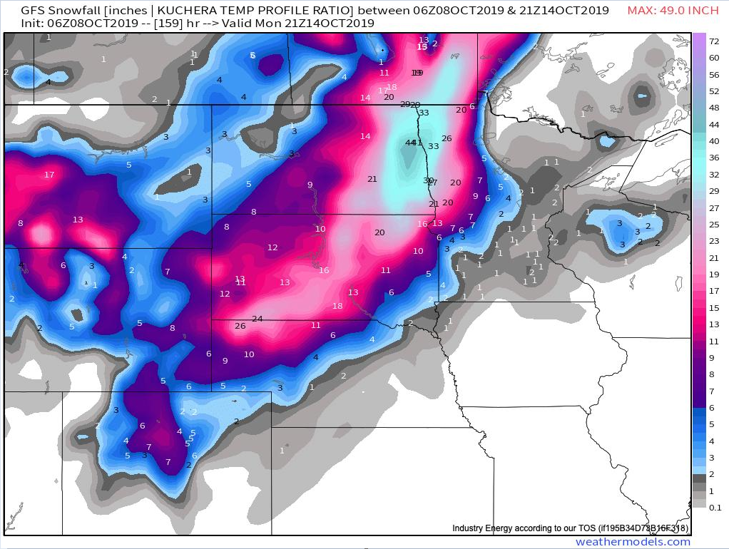
Some incredible snowfall amounts depicted by the 06Z GFS computer forecast model for this upcoming early season snowstorm with the “bullseye” region eastern North Dakota/northwestern Minnesota; courtesy NOAA, weathermodels.com
Western Atlantic low(s)
Not to be outdone by the news making threat of snow and cold in the western and central US, there is a lot of action going on over the western Atlantic Ocean. The cold front that passed through the Mid-Atlantic region in the overnight hours has stalled out over the western Atlantic and low pressure is forming along its boundary zone. This system will intensify over the next couple of days and as it meanders over the still quite warm waters of the western Atlantic Ocean.

Low pressure has formed along a stalled out frontal boundary zone (yellow in boxed region) and a tropical-looking disturbance has formed off the South Carolina coastline (orange in boxed region). These systems may merge into a powerful storm over the northwestern Atlantic in coming days. Courtesy NOAA/NHC
To complicate matters, another low pressure system has formed a few hundred miles off the South Carolina coastline and is already producing winds near tropical storm strength. In fact, there appears to be some organization in recent hours associated with thunderstorm activity near the low pressure center and it wouldn’t take much intensification to call this a tropical depression or even a named tropical storm. Ultimately, this system is likely to merge with the “frontal boundary zone” low pressure system just to its north and form one powerful storm.
There is a chance that clouds and rain back all the way into the Mid-Atlantic I-95 corridor region over the next couple of days as a result of this developing storm system. An especially vulnerable area may be southern New England in coming days where the chance exists for substantial rainfall of up to several inches and potentially strong wind gusts of 50-60 mph during the late Wednesday night into Thursday time period from this unfolding powerful and slow moving storm. The merged low pressure system may just wait until the early part of the weekend to be pushed farther out-to-sea by an eastward moving N-S oriented cold front.
Meteorologist Paul Dorian
Perspecta, Inc.
perspectaweather.com