
3:00 PM | *With today’s warm up comes the chance for a strong evening thunderstorm*
Paul Dorian
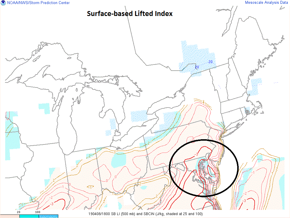
A stability parameter known as the surface-based lifted index shows some marginal instability at mid-afternoon in the DC-to-Philly corridor; courtesy NOAA
It is perhaps not too surprising that today’s warm up is leading to some instability in the atmosphere and the result could be an evening thunderstorm anywhere along the DC-to-Philly corridor. Some of the storms can even reach strong levels with the greatest likelihood for that just to the southeast of DC and across the Delmarva Peninsula. At 2PM temperatures ranged from 80 degrees at Dulles to 77 degrees in Philly and the wind is pretty gusty at times out of the southwest. A mesoscale analysis of the surface lifted index in Mid-Atlantic indeed shows some instability in the DC-to-Philly corridor and latest radar echoes are increasing in intensity and coverage across West Virginia and southern Pennsylvania.

Radar echoes are increasing in intensity and coverage at mid-afternoon well to the west of the I-95 corridor; courtesy NOAA/College of DuPage
High-resolution forecast models indicate the likely time period for the potential thunderstorm activity will be roughly 6-10pm. The one inhibiting factor for the development of strong thunderstorms is the low-level moisture field as dew points are relatively low in the 50’s across most I-95 locations. However, there is the chance that these lift into the 60’s over the next couple of hours which would increase the chance for storms to make it into the DC-to-Philly corridor.
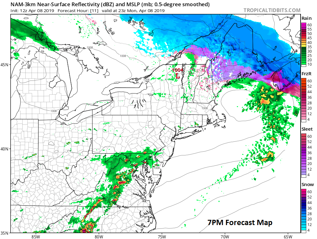
High-resolution forecast model surface map for 7pm this evening with scattered storms in the DC-to-Philly corridor; courtesy NOAA/EMC
Meteorologist Paul Dorian
Perspecta, Inc.
perspectaweather.com