
12:00 PM (Wed) | *Eta now pounding western Florida…has reached its peak intensity as a category 1 hurricane…probable landfall by early tomorrow near or north of Tampa as a weakening tropical storm*
Paul Dorian
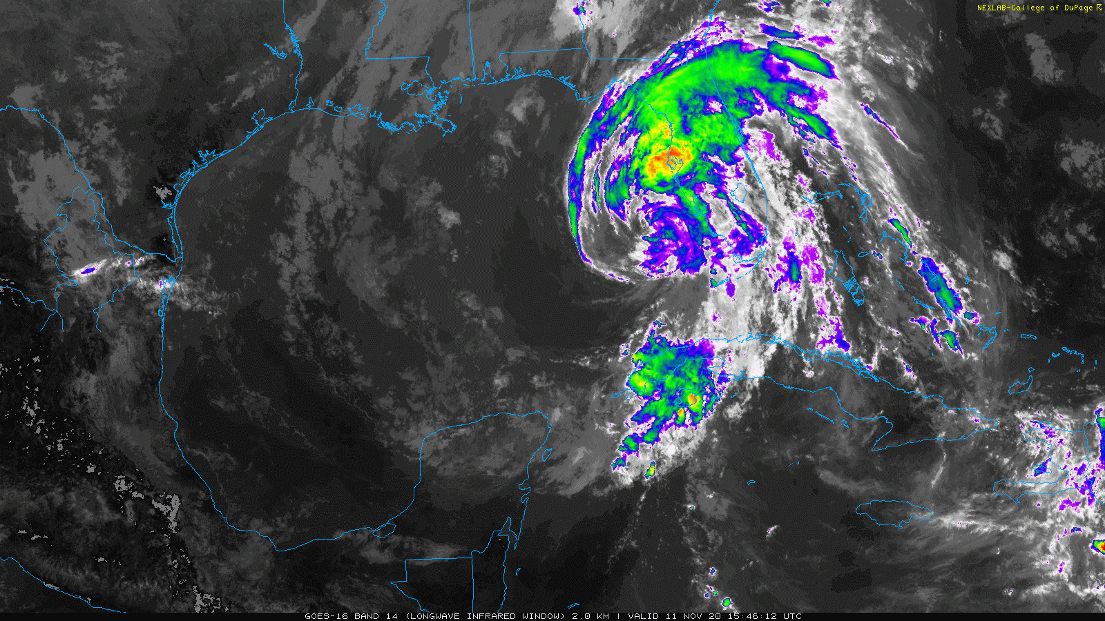
Eta is in a weakening phase as it encounters some dry air and increasing vertical wind shear. Images (long wave IR) courtesy College of DuPage, NOAA
Overview
Eta reached hurricane status this morning as a category 1 storm with maximum sustained winds of 75 mph, but that is likely its peak intensity as it should weaken during the next several hours while encountering increasing vertical wind shear and some dry air. Nonetheless, much of western Florida - including the Tampa area - will experience heavy rain squalls today and tonight with localized flash flooding, damaging wind gusts and possible tornadoes. As a weakening system on Thursday, the remains of Eta will cross the northern part of the Florida Peninsula and it should exit into the southwestern Atlantic Ocean around nightfall.
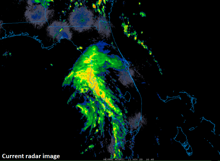
Heavy rain squalls are affecting much of western Florida today as Eta closes in on the west coast. Image courtesy College of DuPage, NOAA (NEXRAD)
Details
At 10AM, Eta had movement of 10 mph to the NNE and maximum sustained winds of 75 mph which maintains its recently achieved status as a category 1 hurricane. It is likely to begin a weakening phase shortly; however, as it encounters increasing vertical wind shear. In addition, satellite imagery loops suggest there is some dry air getting entrained into the circulation center and this will also contribute to a weakening of Eta this afternoon and evening and before expected landfall near or north of Tampa late tonight or early tomorrow.
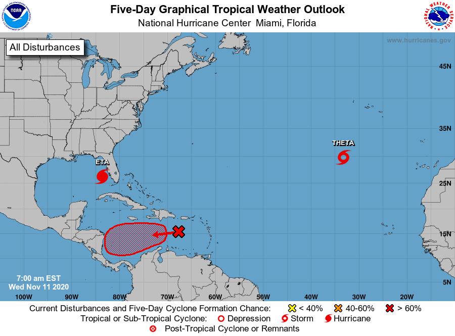
The Atlantic Basin remains active despite closing in on the middle of November with Eta, Theta and a new wave over the eastern Caribbean Sea. Map courtesy NOAA/NHC
The weakening remains of Eta will cross the northern half of the Florida Peninsula on Thursday and this track will allow for some heavy rain squalls and gusty winds to reach into central and eastern Florida both tonight and on Thursday before the system exits off the coast late tomorrow or early tomorrow night into the southwestern part of the Atlantic Ocean.
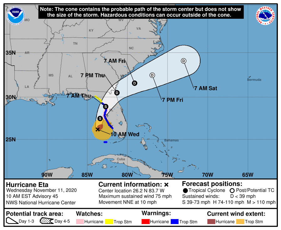
The expected track of Eta will bring it to a landfall near or north of Tampa and then across the northern part of the Florida Peninsula on Thursday. Map courtesy NOAA/NHC
Eta has been a big problem to monitor for many days now as it intensified last over the Caribbean Sea and then traveled westward into Central America. It produced tremendous rainfall amounts across Nicaragua and Honduras last week before re-emerging over the western Caribbean this weekend. Once back out over the still warm waters of the Caribbean, Eta intensified and turned northeast to a landfall in the central part of Cuba. After that, Eta moved into the Florida Straits and delivered a blow to the Florida Keys and then drifted westward over the Gulf of Mexico for a few days before a turn back to the north and east and right towards the west coast of Florida.
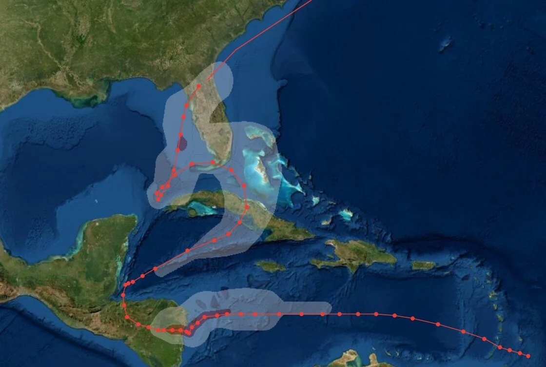
Eta has been alive and kicking for a long time now and has taken quite an interesting path to Florida.
Meanwhile, the rest of the Atlantic Basin remains active in this extremely active 2020 tropical season. “Theta” is a newly named tropical storm over the eastern Atlantic and it will move to the east in coming days towards Europe (Portugal). Tropical Storm “Theta” became the 29th named storm of the 2020 Atlantic Basin tropical season which broke the record set in 2005 for the highest number of named storms. Elsewhere, a new tropical wave has formed over the eastern Caribbean and it has a better than even chance of becoming yet another named system as it likely heads on a western track and, once again, towards Central America.
Meteorologist Paul Dorian
Perspecta, Inc.
perspectaweather.com
Follow us on Facebook, Twitter, YouTube
Video discussion: