2:15 PM | ***Very active weather pattern across the nation includes a severe weather outbreak today in the Lower MS Valley/TN Valley and relentless pounding for California with Pacific Ocean storms***
Paul Dorian

Numerous ocean storms will slam into California during at least the next 7-to-10 days with excessive rainfall, incredible snowfall amounts, and the potential of damaging wind gusts. Maps courtesy NOAA, tropicaltidbits.com
Overview
A very active weather pattern continues across the nation as we begin the new year and it includes a severe weather outbreak today across the Lower Mississippi Valley/Tennessee Valley. In addition, the relentless pounding in California by ocean storm-after-storm will continue for at least the next week-to-ten days with excessive rainfall, damaging winds and incredible snowfall amounts in higher-elevation Sierra Nevada Mountains.

NOAA’s “Weather Warning” map has two areas of focus with tornado watches/warnings in the southern states and “flood/wind/snow watches/warnings across the Golden State.
Details
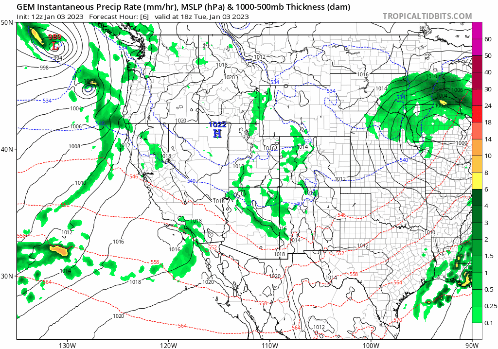
An active weather pattern continues across the nation with two main areas of focus as we begin the new year. First, a severe weather outbreak is underway today in the region from the Lower Mississippi Valley to the Tennessee Valley and this threat includes the possibility of isolated tornadoes. An unusually warm and humid air mass has pushed northward today from the Gulf of Mexico into the southern US and at the same time quite cold air is dropping southeast across the central Plains.

A severe weather outbreak today includes the threat of tornadoes from the Lower Mississippi Valley to the Tennessee Valley. Maps courtesy NOAA, College of DuPage
As a result, severe weather is breaking out this afternoon with a line of strong-to-severe thunderstorms extending from the Lower Mississippi Valley to Tennessee Valley. In fact, numerous tornado watches have been issued in the region from Louisiana to Tennessee and even a few warnings have developed in the past hour or two. Meanwhile, accumulating snow is likely in the cold sector of this storm across Nebraska and South Dakota to Minnesota and Wisconsin. Some of these areas can receive 6-12 inches of snow over the next 12-24 hours or so.

Excessive total rainfall amounts during the next 9 days are displayed here from the 12Z run of the Canadian model. Map courtesy Canadian Met Centre, tropicaltidbits.com
Elsewhere, the state of California has been pounded by numerous Pacific Ocean storms in recent days and multiple storms are in the offing during at least the next week-to-ten days. These storms are bringing excessive rainfall amounts to low-lying coastal sections and incredible snowfall amounts to the higher-elevation Sierra Nevada Mountains of eastern California. The next several days could feature rainfall totals of more than a foot in some low-lying elevations and massive snowfall amounts of 25 to 30 feet or more in the Sierra Nevada Mountains.

Incredible total snowfall amounts during the next 9 days are displayed here from the 12Z run of the Canadian model with the arrow pointing to a spot in the Sierra Nevada predicted to receive 100 inches in this time period. Map courtesy Canadian Met Centre, tropicaltidbits.com
The next major storm arrives on Wednesday and this one can include not only the excessive rainfall and significant snowfall, but also damaging winds which can bring down tree limbs and be the catalyst for power outages in many parts of the state. This stormy pattern looks like it’ll continue into at least the middle of the month with tons of moisture flowing into the Golden State from the Pacific Ocean.
Meteorologist Paul Dorian
Arcfield
arcfieldweather.com
Follow us on Facebook, Twitter, YouTube
Video discussion: