**Tropical moisture from the remnants of an eastern Pacific hurricane to combine with an upper-level low to produce a heavy rain event for much of Southwest and Central US**
Paul Dorian
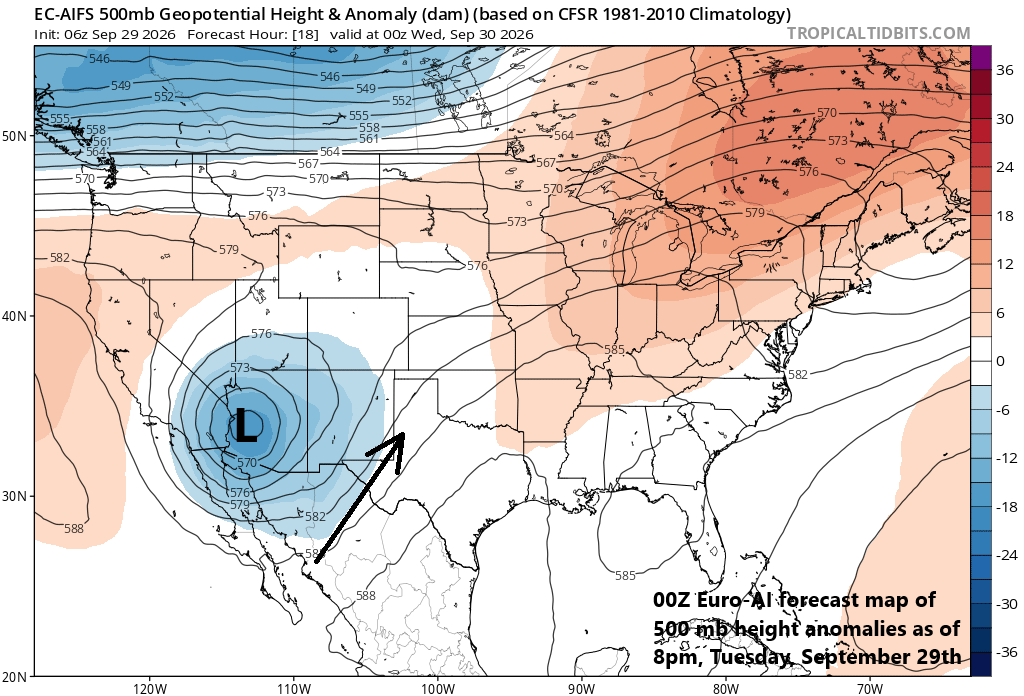
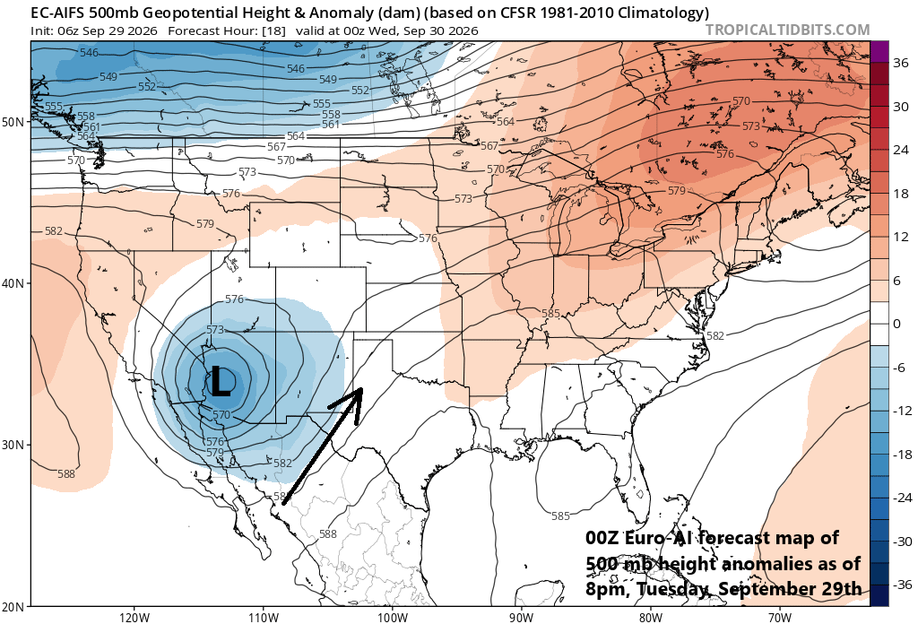
A key player in the upcoming heavy rain event will be a deep upper-level trough of low pressure now over western Arizona. This system will act to funnel tropical moisture from Mexico into the SW and Central US leading to potential flash flooding conditions over a wide part of the nation. Map courtesy ECMWF, tropicaltidbits.com
Overview
Ingredients are pulling together for a major rain event across much of the Southwest and Central US during the next few days including an upper-level low combining with vast amounts of tropical moisture associated with the remnants of an eastern Pacific hurricane named “Polo”. Severe thunderstorms can become part of the overall weather pattern as well during the next few days; especially, across portions of Texas and Oklahoma. While much of the Southwest and Central US are drought-stricken and welcome some rainfall, this may be too much over a short period of time potentially leading to flooding issues.
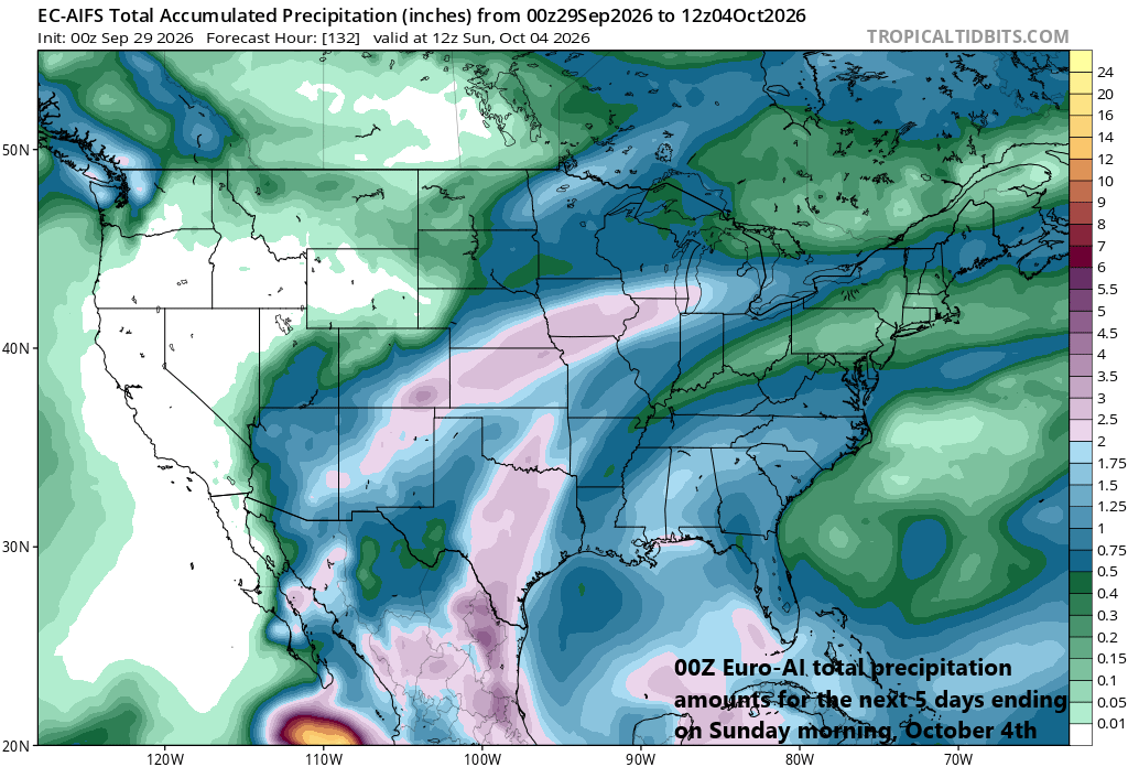
Some spots can receive as much as 4 or 5 inches of rain during the next 5 days in locations extending from the SW US to the central Plains. Map courtesy ECMWF, tropicaltidbits.com
Details
“Polo” remains a (minimal) hurricane early on Tuesday with maximum sustained winds of 75 mph, but it will weaken to tropical storm status in just a few hours’ time as it crosses Baja California into the higher elevation region of northwestern Mexico. While the central pressure will indeed drop significantly over the next few hours, the tropical moisture field will begin a push to the north and east riding along on southwesterly winds which exist on the front side of a deep upper-level trough now centered over western Arizona.
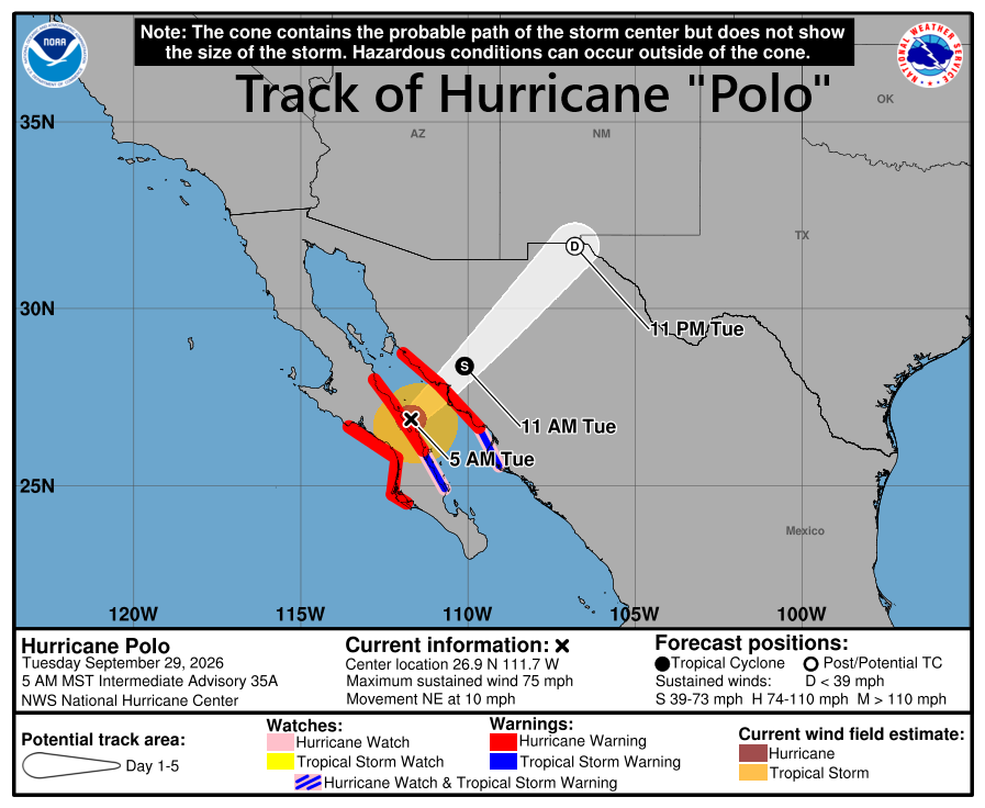
“Polo” is currently in the process of weakening from a minimal hurricane to a tropical storm; however, its vast moisture field will push north and east into the US and it will be a big contributing factor to a widespread heavy rain event from the SW US to the central Plains. Map courtesy NOAA/NHC
This tropical moisture field had its origins over the eastern Pacific Ocean, and it won’t be the only tropical moisture getting involved in this unfolding weather pattern. Moisture from the Gulf region will also push northward into the US and contribute towards heavy rainfall across places like Texas and Oklahoma where severe thunderstorm activity may become quite prevalent on Wednesday and Thursday.
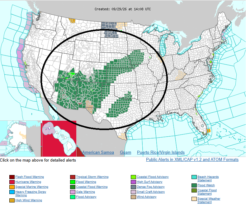
Flash flooding risks are quite high in a large portion of the nation all the way from the southwestern states to the central Plains. Those areas shown in green on this “weather warnings map” have flash flood watches in effect as issued by the NOAA’s National Weather Service.
Much of the Southwest and Central US are experiencing drought conditions and most residents would welcome some rainfall, but this may be a bit excessive. This combination a slow-moving upper-level low with tropical moisture left behind by “Polo” and some Gulf air will result in a prolonged period of showers and thunderstorms and recent rains have resulted in rain-soaked soil. As a result, there is a moderate to high risk of flash flooding all the way from the southwestern states to the central Plains in coming days so stay tuned to local advisories...this is not your “run-of-the-mill” rainfall event.
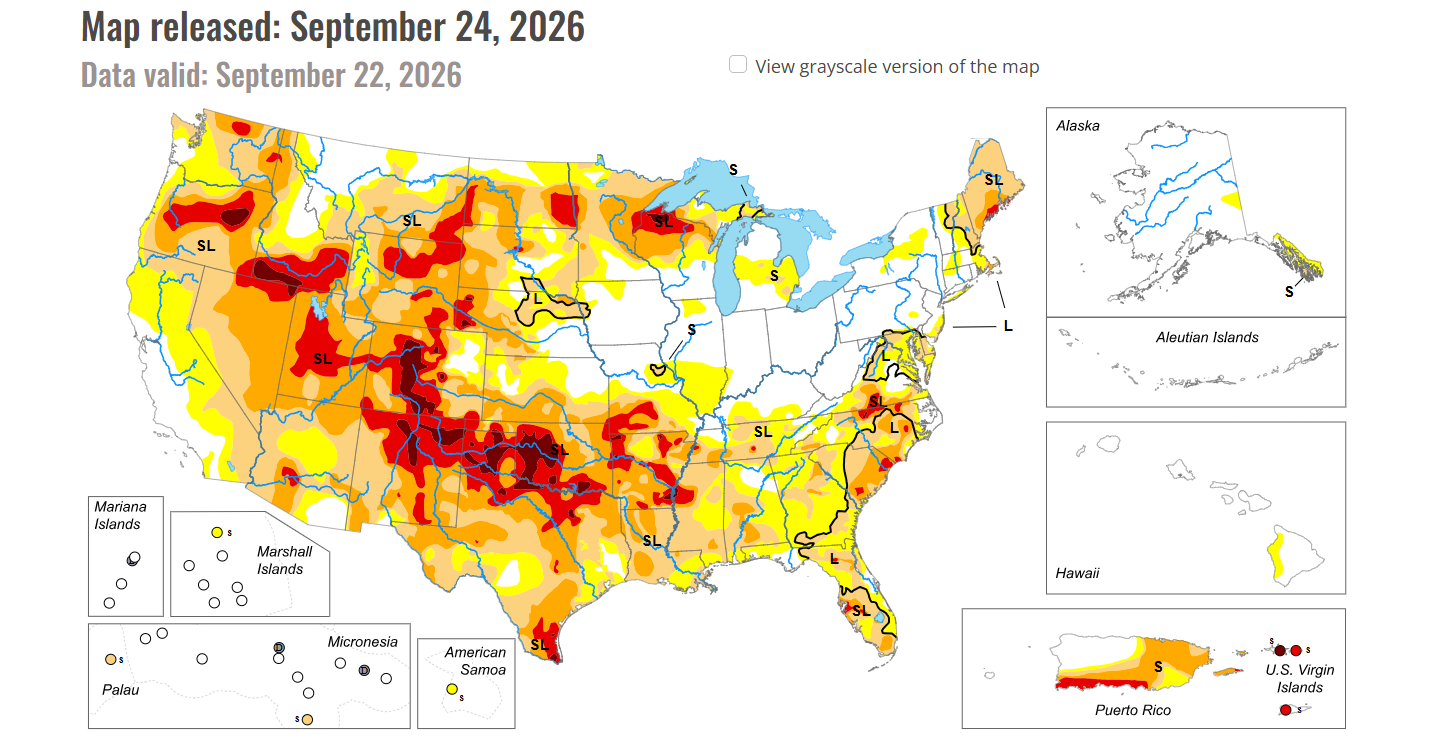
Much of the western and central US are still classified as being drought-stricken and this heavy rainfall event will certainly help to alleviate those conditions. However, this rain may be too much of a good thing with excessive amounts of several inches in some spots raising the risk of flash flooding. Map courtesy NOAA
Meteorologist Paul Dorian
Arcfield
arcfieldweather.com