Contact Us

Use the form on the right to contact us.

You can edit the text in this area, and change where the contact form on the right submits to, by entering edit mode using the modes on the bottom right. 


123 Street Avenue, City Town, 99999

(123) 555-6789

email@address.com


You can set your address, phone number, email and site description in the settings tab.
Link to read me page with more information.

backlit-stratus-clouds-2013-04-05.jpg

Blog

Weather forecasting and analysis, space and historic events, climate information

Filtering by Category: DC

7:00 AM | Hot today and Tuesday with a shower/storm threat

Paul Dorian

6-Day DC Forecast

Today

Mainly sunny, hot, humid, chance for an afternoon shower or thunderstorm, highs in the middle 90’s

Tonight

Chance for an evening shower or thunderstorm; otherwise, partly cloudy skies, mild, muggy, lows in the lower 70's

Tuesday

Partly sunny, still pretty hot, humid, chance for a shower or thunderstorm, near 90 degrees

Tuesday Night

Chance for an evening shower or thunderstorm then becoming partly cloudy, turning cooler late with lows by morning in the mid-to-upper 60's

Wednesday

Mainly sunny, more comfortable, mid-to-upper 80’s

Thursday

Mainly sunny, warm, mid 80’s

Friday

Mainly sunny, warm, mid-to-upper 80’s

Saturday

Mainly sunny, warm, mid-to-upper 80’s

Discussion

Hot air torched the I-95 corridor on Sunday and it’ll stay quite hot around here today and tomorrow with the chance for a shower or thunderstorm each afternoon and evening. A cool front pushes through by later tomorrow night and this will pave the way for a much more comfortable second half of the week.

7:00 | Another nice day as we end the work week...weekend turns hot - perhaps the hottest yet - and storms threaten on Saturday and Monday and some can be on the strong side

Paul Dorian

6-Day DC Forecast

Today

Partly sunny, still quite comfortable, highs near 85 degrees

Tonight

Becoming mostly cloudy, mild, showers possible late, maybe even a thunderstorm, lows in the upper 60’s

Saturday

More clouds than sun, becoming quite warm, much more humid, showers and thunderstorms likely at just about anytime during the day, some of the storms can be on the strong side, upper 80's

Saturday Night

Mostly cloudy, mild, muggy, chance for lingering evening showers and thunderstorms, low 70's

Sunday

Hot with mainly sunny skies, humid, slight chance of showers and thunderstorms, mid 90’s

Monday

More clouds than sun, hot, humid, showers and thunderstorms likely, some of the storms can be on the strong side, low 90’s

Tuesday

Mainly sunny, quite warm, upper 80’s

Wednesday

Mainly sunny, quite warm, upper 80’s

Discussion

After a nice day to end the work week, the comfortable weather will quickly vanish quickly this weekend and temperatures on Sunday afternoon should reach at least the middle 90's - perhaps the hottest yet this year. A warm frontal system will bring back the threat for showers and thunderstorms to our area later tonight and just about anytime on Saturday and some of these storms can be on the strong side. Following the passage of the warm front on Sunday, hot air will come pouring into the I-95 corridor and temperatures will soar well up into the 90's. The hot weather will continue into Monday, but a strong cool front will approach from the northwest giving us the shot at more showers and thunderstorms and some of those storms can be on the strong side. More comfortable air returns by Tuesday and Wednesday of next week following the passage of the cool frontal system.

7:00 AM | A very nice break in the pattern

Paul Dorian

6-Day DC Forecast

Today

Sunny, comfortable, highs not far from 80 degrees

Tonight

Mostly clear skies, comfortable, lows near 65 degrees

Friday

Mainly sunny, still pretty nice, low-to-mid 80’s

Friday Night

Becoming mostly cloudy, maybe a shower or thunderstorm late, upper 60’s

Saturday

Partly sunny, hot, more humid, chance of showers and thunderstorms, low 90’s

Sunday

Partly sunny, hot, humid, chance of showers and thunderstorms, low 90’s

Monday

More clouds than sun, hot, humid, showers and thunderstorms likely late in the day or at night, low 90’s

Tuesday

Partly sunny, very warm, upper 80's

Discussion

A nice break in the action today and Friday in the Mid-Atlantic region as high pressure takes control with comfortable conditions for this time of year. Temperatures will be slightly cooler-than-normal for the next two days and humidity levels will be at unusually low levels for mid-July. Another frontal system will enter the picture this weekend and the result will be an increasing chance for showers and thunderstorms, but much of the time will be rain-free. In addition, temperatures should climb this weekend with 90+ degrees possible for highs on each day along with an increase in humidity. By Monday, another strong frontal system is likely to generate widespread showers and thunderstorms late in the day or at night and some of that rainfall can be on the heavy side.

7:00 AM | Threat continues today for more showers and thunderstorms

Paul Dorian

6-Day DC Forecast

Today

More clouds than sun, warm, humid, showers and thunderstorms likely this afternoon, some of the rain can be heavy at times, highs in the mid 80’s

Tonight

Becoming partly cloudy, much more comfortable late, lows by morning in the low-to-mid 60’s

Thursday

Mainly sunny, pleasant, low 80’s

Thursday Night

Mostly clear skies, comfortable, mid 60’s

Friday

Mainly sunny, nice, low-to-mid 80’s

Saturday

Mainly sunny, hot, humid, chance of showers and thunderstorms, low 90's

Sunday

Mainly sunny, hot, humid, chance of showers and thunderstorms, low 90's

Monday

Partly sunny, hot, humid, chance of showers and thunderstorms, low 90's

Discussion

A stalled out frontal system along the east coast will act as a pipeline for low pressure to ride along later today and this will enhance our chances for showers and thunderstorms this afternoon and some of the rain can be heavy at times. Once this low pressure system grudgingly pulls away from the area, high pressure will build into the region and the result will be a couple of rather nice, comfortable days for this time of year. The weather will become more unsettled again over the weekend and quite hot as another frontal system pushes towards the Mid-Atlantic.

7:00 AM | Threat exists for more heavy rainfall and strong PM thunderstorms both today and Wednesday

Paul Dorian

6-Day DC Forecast

Today

Mainly cloudy, warm, humid, scattered showers and afternoon thunderstorms possible, some of the rain will be heavy at times, highs in the mid-to-upper 80’s

Tonight

Mostly cloudy skies, mild, muggy, additional showers likely and possible thunderstorms, some of the rain can be heavy at times, lows not far from 70 degrees

Wednesday

Partly sunny, warm, humid, showers and thunderstorms still possible and some of the rain can be heavy at times, highs in the mid 80’s

Wednesday Night

Becoming partly cloudy, mild, mid 60’s by early morning

Thursday

Mainly sunny, comfortable, low 80’s

Friday

Mainly sunny, warm, mid 80’s

Saturday

Partly sunny, quite warm, humid, chance of showers and thunderstorms late in the day or at night, near 90 degrees

Sunday

Mostly sunny, quite warm, humid, chance of showers and thunderstorms, near 90 degrees

Discussion

A slow-moving warm front will advance northward today through the I-95 corridor and low pressure will push along the boundary zone acting to slow it down even further. By later tomorrow, a cold front will sag across the region and it’ll have enough push behind it to clear it out around here on Thursday as high pressure builds into the region. The combination of the two fronts will generate scattered showers and thunderstorms for the Mid-Atlantic region both today and Wednesday some of the rain will be on the heavy side exacerbating local flooding concerns. Nicer weather is in store for the I-95 corridor on Thursday and Friday as building high pressure system takes firm control of the overall weather pattern.

Video

httpv://youtu.be/Hn_S4dbChbY

7:00 AM | A shot at some heavy rainfall each day during the first half of the week

Paul Dorian

6-Day DC Forecast

Today

Cloudy, not as warm, humid, occasional showers and maybe a thunderstorm or two, some of the rain can be heavy at times primarily southwest of the District, highs not far from 80 degrees

Tonight

Mostly cloudy skies, mild, muggy, chance for more showers and thunderstorms, lows in the upper 60’s

Tuesday

Mainly cloudy, warm, humid, showers and thunderstorms likely, some of the rain can be heavy at times, mid 80’s

Tuesday Night

Mostly cloudy skies, mild, muggy, showers and thunderstorms likely, some of the rain can be heavy at times, near 70 degrees

Wednesday

Partly sunny, warm, humid, chance for showers and thunderstorms, mid 80’s

Thursday

Mainly sunny, warm, mid 80’s

Friday

Mostly sunny, warm, mid-to-upper 80’s

Saturday

Partly sunny, quite warm, humid, chance of showers and thunderstorms, near 90 degrees

Discussion

After a quiet second half of the weekend, unsettled weather returns to the region with occasional showers today, possibly a thunderstorm, and some of the rain can be heavy at times. Another disturbance will reach the region tomorrow and this will give us another opportunity for more heavy rainfall and strong thunderstorms from Tuesday into Wednesday.

7:00 AM | Quieter weather to end the work week...weekend starts off wet with heavy rain possible

Paul Dorian

6-Day DC Forecast

Today

A mix of clouds and sun, warm, less humid, a bit of a breeze, highs in the mid 80’s

Tonight

Becoming cloudy, mild, showers likely towards morning, lows in the mid 60’s

Saturday

Mainly cloudy, cooler, showers likely; primarily, in the morning, maybe even a thunderstorm, some of the rain can be heavy at times, near 80 degrees

Saturday Night

Mostly cloudy skies, mild, still the chance for a shower or thunderstorm, mid-to-upper 60’s

Sunday

Becoming mainly sunny, warm, mid-to-upper 80’s

Monday

More clouds than sun, quite warm, humid, chance for showers and thunderstorms late, upper 80’s

Tuesday

Mostly cloudy, warm, humid, chance of showers and thunderstorms, upper 80’s

Wednesday

Partly sunny, warm, humid, chance of showers and thunderstorms, mid-to-upper 80’s

Discussion

Much quieter weather is in store for the Mid-Atlantic region as we close out the work week with lower humidity, but yet another disturbance is likely to generate some rain in the DC metro area late tonight and for the first part of the weekend and some of the rain can be heavy at times. The best chance for rain from this next disturbance comes late tonight/early Saturday with improvement likely tomorrow afternoon and then Sunday looks like an overall nice day. The clouds and showers on Saturday will keep temperatures confined to near the 80 degree mark for afternoon highs. The weather will turn unsettled again early next week with the chance for showers and thunderstorms again by late Monday or Monday night.

1:50 PM | **Here we go again...severe thunderstorm threat for early tonight ; especially, near and north of the PA/MD border**

Paul Dorian

low level jet
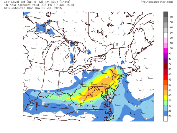
[Forecast map of low-level jet at 8pm this evening; map courtesy AccuWeather, Inc.]

Discussion

The atmosphere is quite juicy this afternoon and numerous thunderstorms are breaking out across western PA, western NY, and West Virginia and some of this activity will spill over into the immediate I-95 corridor region from DC-to-Philly-to-NYC later today and early tonight. As low clouds have eroded somewhat today, the atmosphere has destabilized rapidly and high dew points have contributed to the firing up of very impressive-looking thunderstorms. Some of these storms will likely reach strong-to-severe levels over the next few hours raising the possibility of heavy downpours, damaging wind gusts, hail, and even isolated tornadoes in the I-95 corridor. Of particular concern is the deep wind shear (increasing winds with altitude) in the region near and north of the PA/MD border which tends to promote longer and more intense thunderstorms, damaging wind gusts and even the formation of tornadoes. The wind forecast map for early tonight (above) shows an impressive low-level jet near and to the west of Route I-95 and this will contribute to the instability in the atmosphere.

Closer to the coastline, marine air may reduce the chances for severe weather as it remains a bit cooler compared to inland locations, but heavy rain is still a threat early tonight. The threat for severe weather will diminish late tonight and the next three days should be much quieter with primarily rain-free conditions. The timetable for the potential severe weather in the I-95 corridor has been pushed back a bit into the 5-10pm time period. Stay tuned.

7:00 AM | *Late day/early evening threat for strong-to-severe thunderstorms and heavy rainfall*

Paul Dorian

6-Day DC Forecast

Today

More clouds than sun, quite warm and humid, a few showers this morning and then a fresh round of showers and thunderstorms late in the day, some of the rain can be heavy and some of the storms can be on the strong-to-severe side with gusty winds, highs not far from 90 degrees

Tonight

Chance for additional showers and thunderstorms this evening, some of the rainfall can be heavy at times and some of the storms can be on the strong-to-severe side; otherwise, mainly cloudy skies, mild, muggy, lows not far from 70 degrees

Friday

Becoming partly sunny, warm, mid-to-upper 80’s

Friday Night

Partly cloudy skies, mild, mid-to-upper 60’s

Saturday

Mainly sunny, warm, mid-to-upper 80’s

Sunday

Partly sunny, quite warm, chance for showers and thunderstorms at night, upper 80’s

Monday

Mostly cloudy, quite warm, chance of showers and thunderstorms, upper 80’s

Tuesday

Partly sunny, warm, chance of showers and thunderstorms, mid-to-upper 80’s

Discussion

A cool front moved into the I-95 corridor on Wednesday with some shower and thunderstorm activity, and we’re not in the clear yet as a disturbance will ride along the frontal boundary zone today generating more showers and thunderstorms. The atmosphere continues to be full of tropical moisture and lifting action by this approaching disturbance will likely “squeeze” out some heavy rainfall later today and early tonight throughout the region. The most likely timetable in the I-95 corridor for these likely heavy showers and strong-to-severe thunderstorms is 4-9pm. Once this system pushes through late tonight, quieter weather will return to the I-95 corridor for Friday, Saturday and most of Sunday with rain-free conditions.

Video

httpv://youtu.be/m-XQdT5DQe4

7:00 AM | Back-to-back days with showers and thunderstorms and some of the rainfall can be heavy

Paul Dorian

6-Day DC Forecast

Today

Mostly cloudy, quite warm and humid, occasional showers likely with possible afternoon thunderstorms, some of the rainfall can be heavy at times, highs near 90 degrees

Tonight

Evening showers likely along with possible thunderstorms, some of the rainfall can be heavy at times; otherwise, mainly cloudy skies, mild, muggy, lows not far from 70 degrees

Thursday

Mostly cloudy, quite warm and still humid, chance for more showers and thunderstorms during the mid-to-late afternoon and some of the rainfall can be heavy at times, upper 80’s

Thursday Night

Mostly cloudy skies with the chance for additional showers and thunderstorms during the evening hours and some of the rainfall can be heavy, mild, muggy, near 70 degrees

Friday

Mostly sunny, warm, mid-to-upper 80’s

Saturday

Mostly sunny, warm, mid-to-upper 80’s

Sunday

Partly sunny, quite warm, chance of showers and thunderstorms late in the day or at night, upper 80’s

Monday

Partly sunny, quite warm, chance of showers and thunderstorms, near 90 degrees

Discussion

Today will be another unsettled day in the Mid-Atlantic as yet another cool front approaches the region. It’ll stay quite warm ahead of the front and there will be occasional showers and possible afternoon thunderstorms. Some of the rainfall can be heavy at times this afternoon and early evening with flash flooding a possibility in areas. Low pressure will ride along the tail end of the slow-moving frontal system on Thursday and this action should cause additional showers and thunderstorms in the region and some of this rainfall can be heavy at times as well.