1:30 PM | “Season-changing” type of frontal passage late Friday/early Saturday
Paul Dorian
Discussion
A powerful cold front is barreling towards the east coast and it could be a “season-changer”. The month of September ended yesterday with high temperatures flirting around the 80 degree mark along the I-95 corridor and last weekend featured temperatures in the low-to-middle 80’s from DC-to-Philly-to-New York City. It’ll likely be a real struggle to see those kinds of temperatures again this fall season - at least for a sustained basis - following the passage of the approaching strong cold frontal system.
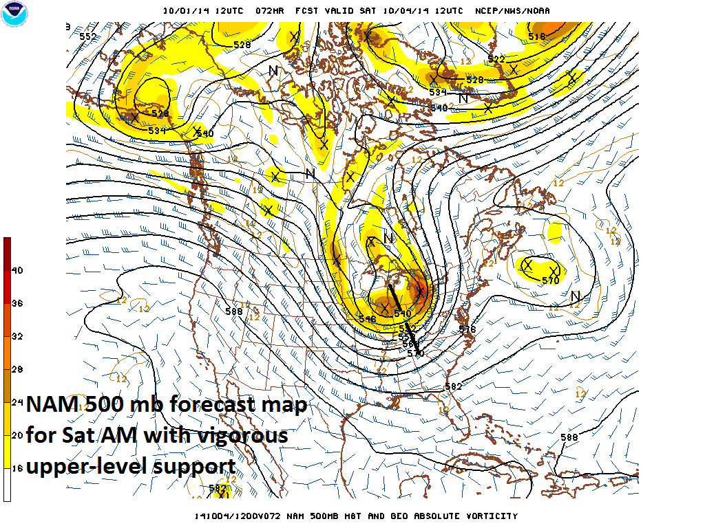
The upcoming frontal system will bring with it the threat for downpours late Friday night and early Saturday along with embedded thunderstorms and gusty winds and it will be supported by vigorous upper-level energy (see forecast map). In fact, the upper level trough associated with the front will become “negatively-tilted” (i.e., oriented northwest-to-southeast) and this will lead to intensification and a "slowing-down" of its eastward movement. Slow clearing will likely hold off until later Saturday and it’ll take place from southwest-to-northeast (i.e., DC clears out well before NYC) as much cooler air pours into the Mid-Atlantic region. Sunday will feature temperatures way below normal for early October and the cool weather pattern will continue early next week - no low-to-middle 80's in sight.