1:50 PM | *Cold air blasts into the Mid-Atlantic region this weekend as strong storm forms off the coast*
Paul Dorian
Discussion
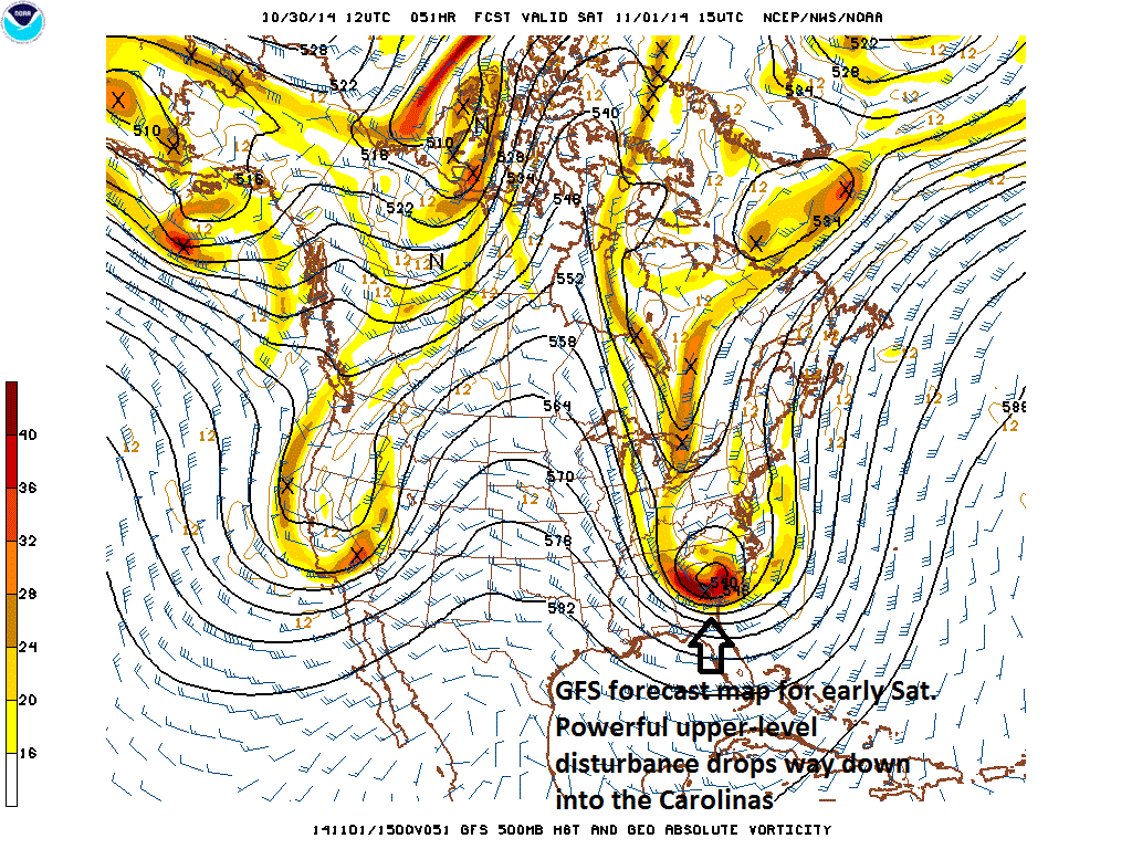
An unusually strong upper-level disturbance dropping southeastward from south-central Canada over the next couple of days will combine with Arctic air to help spawn a strong storm off the Mid-Atlantic coastline on Saturday. This series of events will generate snow this weekend for some higher elevation locations of the Mid-Atlantic region with significant accumulations possible in mountainous regions like eastern West Virginia, western Virginia, and western North Carolina. In addition, cold air will flood the I-95 corridor region from DC-to-Philly-to-NYC on Saturday night and Sunday riding in on increasingly strong winds as the storm intensifies off the coastline and ultimately begins a turn towards the northeast. The storm will probably be too far off the coast to produce heavy precipitation in the immediate I-95 corridor, but rain showers can occur at any time from late Friday night into early Saturday night and it is not out of the question that snowflakes mix in at times; especially, in higher elevation locations to the north and west Philly and DC.
Winds will be sustained at 20 to 30 mph up and down the east coast from Saturday night through Sunday with gusts to 40 mph possible at times. Coastal areas are likely to get buffeted by wind gusts over 50 mph on Saturday night and Sunday. Temperatures will likely flirt with the freezing mark on two occasions this weekend in the I-95 corridor: late Saturday night/early Sunday and – perhaps even more likely - late Sunday night/early Monday. Also, since the upper-level disturbance will drop so far to the south over the next couple of days from south-central Canada into the Carolinas (see GFS 500 millibar forecast map for Saturday morning), the cold air will plunge way down into the Southeast US and records could be broken this weekend from the Carolinas-to-Florida. There will be a gradual warm up in the Mid-Atlantic region during the first half of next week.
One final note...the weather looks dry and cool for Halloween trick-or-treating early tomorrow night as any rain showers in the area will likely hold off until later at night.