12:15 PM | *Cold and snow threat for Thanksgiving Eve/Day time period*
Paul Dorian
 [Surface forecast map for Thursday morning by the 12Z GFS-parallel model; map courtesy tropicaltidbits.com]
Discussion
Overview Yes, a significant warm up is about to take place in the Mid-Atlantic region; however, it will be short-lived and colder air will return to the area by the middle of next week. In addition, there are reasons to believe that a storm may organize near the Mid-Atlantic coastline during the middle-to-latter part of next week at the same time colder air is becoming more and more established in the region.
The warm up Temperatures will climb into the 50’s on Sunday in the I-95 corridor and then peak on Monday well up in the 60’s with an outside shot at a record-breaking 70 degrees in some isolated spots. A cold front will pass through the region by Tuesday and that frontal passage will begin a downward trend in the overall temperature pattern. High temperatures around here should drop to the 50’s on Tuesday and then the 40’s on Wednesday. Once this cold front moves off the east coast early next week, it’ll tend to stall out in a north-to-south orientation and this boundary zone may then play a pivotal role in the weather pattern later next week.
Cold and snow threat By the middle of next week, colder air will become better established in the Mid-Atlantic region and abundant moisture will become aligned with the stalled-out frontal boundary zone just off the east coast. One upper-level short wave will ride up the east coast in the Wednesday time frame and then a second wave will follow close behind. It is this second upper-level short-wave (bigger circled area on 500 millibar height forecast map below) that will become the crucial player later next week as it ultimately will help to allow low pressure to ride up along the east coast. Depending on the exact timing of the interaction between this second wave and all that moisture sitting along the coastline, the result could be some snowfall in the I-95 corridor anytime from early Wednesday to later Thursday. Not all computer forecast models are in agreement with this threat and we'll see how things evolve over the next few days. The forecast maps in this posting come from today's 12Z updated GFS computer forecast model (called "GFS-parallel") and the latest 12Z European forecast model also contains a snow threat for later next week. Stay tuned.
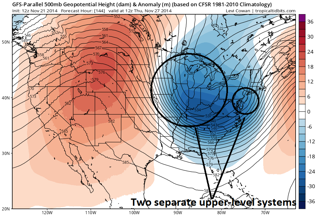 [500 millibar height forecast map for Thursday morning by the 12Z GFS-parallel model; map courtesy tropicaltidbits.com]