3:50 PM | *Potential continues for strong storm in the Northeast US early next week*
Paul Dorian
 [12Z Canadian surface forecast map for next Tuesday morning; map courtesy tropicaltidbits.com]
Discussion
The signs continue for a significant storm during the first half of next week in the Northeast US. Indications are that the 500 millibar upper-level pattern will feature blocking high pressure extending from the Northern Plains into southeastern Canada by early next week at the same time upper-level troughing will be digging into the Southeast US. The additional element of a strong upper-level jet streak (bottom) across the southern states early next week raises the chances of important intensification of surface low pressure off the coast in the late Monday/Tuesday/early Wednesday time frame. There will likely be some well-entrenched cold air sitting across New England and southeastern Canada at this time anchored by strong surface high pressure. It is still too early to tell if this pattern will result in a “New York City/New England” type of storm or if it could have an important impact farther south along the I-95 corridor and it is still too early to tell if snow will be confined to interior sections of the Northeast US.
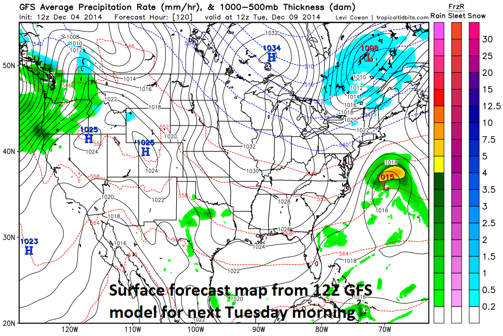 [12Z GFS surface forecast map for next Tuesday morning; map courtesy tropicaltidbits.com]
There continue to be some big disagreements amongst the worldwide computer models; however, NOAA’s GFS is pretty much an outlier at this point in time with a rather innocuous-looking forecast as compared with other computer forecast models including the Canadian, Euro, and UKMET (United Kingdom). The surface forecast maps which verify next Tuesday morning (top, middle) show big differences between the latest GFS and Canadian computer forecast models (maps courtesy tropicaltidbits.com). The 250 millibar 12Z Canadian model forecast for next Tuesday morning (bottom) displays a strong upper-level jet streak (circled area) that could play a vital role in the potential formation of a strong storm. Stay tuned, the overall weather pattern favors the Canadian, Euro and UKMET model forecast solutions and perhaps the GFS will change significantly over the next few days.
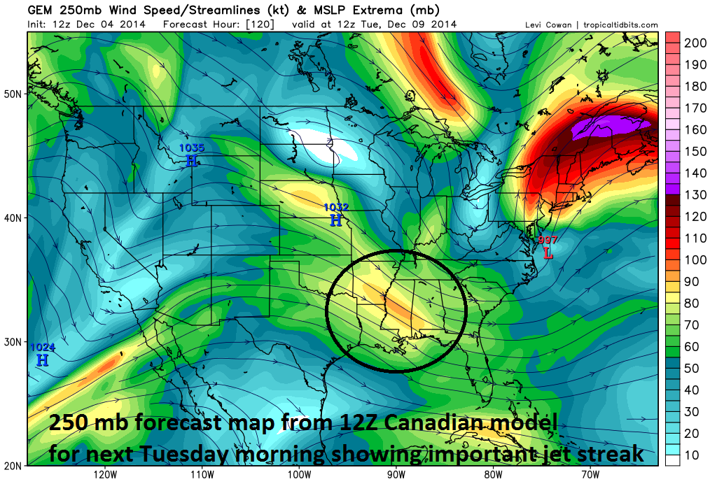 [12Z Canadian 250 millibar forecast map for next Tuesday morning; map courtesy tropicaltidbits.com]