12:45 PM | *"Wrap-around" snow showers intensifying on radar*
Paul Dorian
 [Latest radar image from Penn State Campus Weather Service]
Discussion
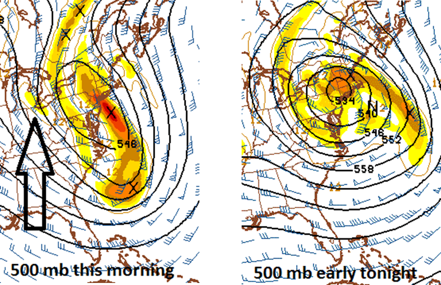
The major coastal storm that pushed slowly northward yesterday along the Mid-Atlantic coastline has stalled out over southern New England and colder air in the mid and upper atmosphere is “wrapping around” the surface low pressure system. At the same time, a little piece of upper-level energy (arrow) is rotating around the surface system from the Ohio Valley and this is strengthening the upper-level low at 500 mb which is creating very unstable conditions. As a result, snow showers are intensifying on radar across NE PA and NW, NJ and they will pivot southwestward into many of the northern and western suburbs of Philly over the next couple of hours and small accumulations are possible. There can even be a few heavier snow squalls mixed in the picture given the increasingly unstable environment.
Snow showers are already creating some problems in the NYC metro region with some reported accumulations, and the Poconos in NE, PA have experienced moderate-to-heavy snow bands in the past couple of hours. Most of the snow shower activity will remain north of the PA/MD border; however, a few snow showers can drop as far south as the northern suburbs of Washington, DC by later this evening and again on Thursday. This "wrap-around" snow shower threat will continue through the night in much of the Mid-Atlantic region with more small accumulations likely and some slick spots on the roadways; especially, north of the PA/MD border, and the threat will continue right through the day on Thursday. After that, the surface low pressure system will finally relinquish to high pressure on Friday and dry weather is likely during the upcoming weekend.
