3:25 PM | ****Snow showers/snow squalls this evening to usher in record-breaking cold for the eastern US on Thursday/Friday****
Paul Dorian
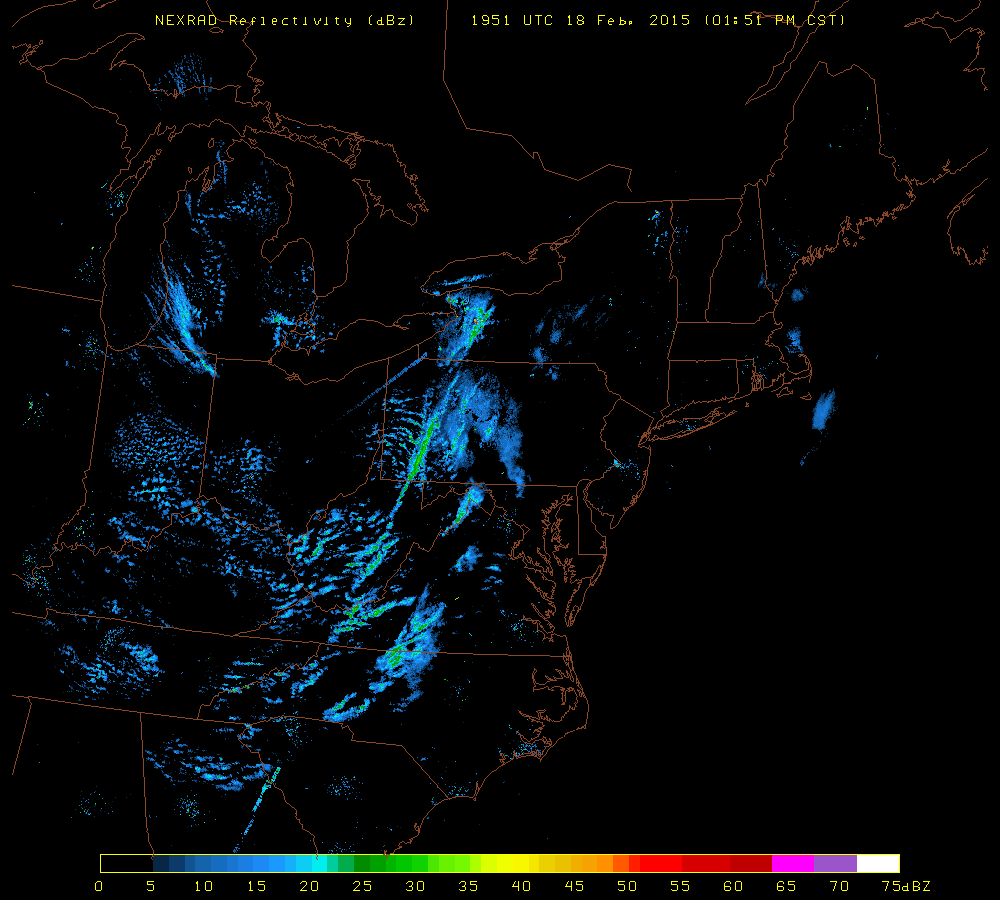 [Latest NEXRAD radar image showing snow bands setting up to the west of the I-95 corridor; map courtesy University of Wisconsin]
Discussion
Snow showers/snow squalls The coldest air mass of the season so far is plowing towards the eastern US and its arrival this evening will generate snow showers and snow squalls in the I-95 corridor. Just like the previous Arctic frontal passage this past weekend, heavy snow bursts can quickly have an impact on visibility and road conditions and a coating to an inch of snow accumulation can take place in a hurry. The arrival of the snow is likely around 5-7PM in DC, 7-9PM in Philly and 9-11PM in NYC, but the threat for snow showers will continue well into the night and there can actually be more snow showers on Thursday.
Record-breaking cold As far as temperatures are concerned, this air mass is likely to break many records in the eastern US between Thursday and Saturday with sub-zero low temperatures likely in much of the I-95 corridor; especially on Friday and Saturday mornings. In fact, in many parts of the I-95 corridor, this cold air outbreak could produce temperatures not seen around here since January 1994. All of this is courtesy of an air mass that crossed over the North Pole from Siberia and is about to pounce on the eastern US. Temperatures moderate noticeably late Saturday after a bitter cold start to the day and they could actually surpass 40 degrees in much of the I-95 corridor on Sunday before yet another Arctic blast occurs early next week.
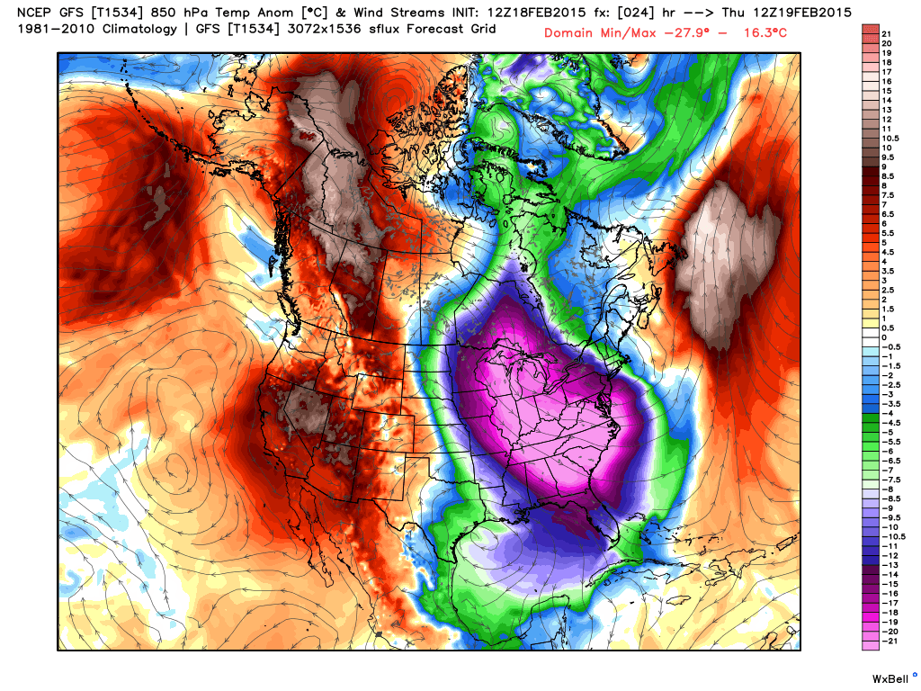 [Lower atmosphere (850 mb) temperature anomalies for Thursday; map courtesy Weather Bell Analytics]