8:45 AM | ***Accumulating snow and the threat for a significant buildup of ice***
Paul Dorian
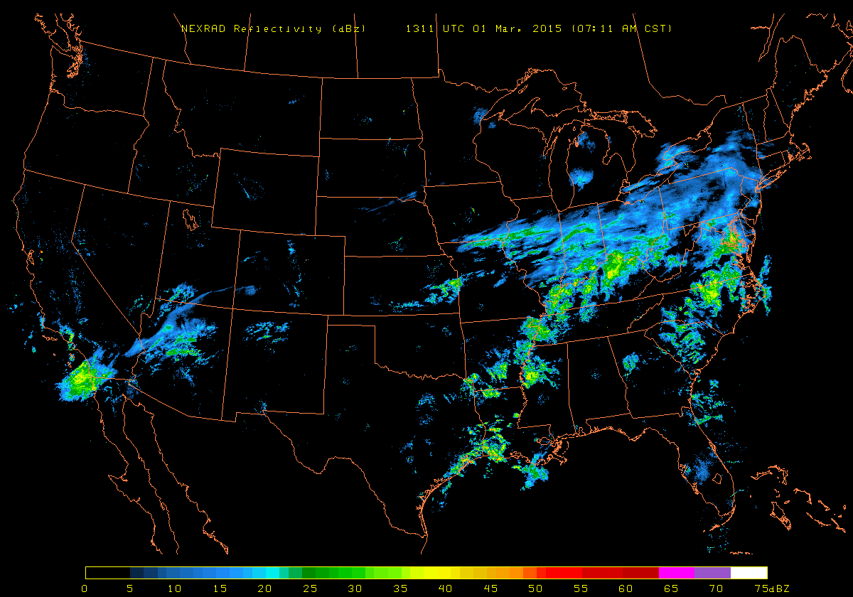 [US radar image with plenty of moisture headed to the Mid-Atlantic region; NEXRAD image courtesy University of Wisconsin]
Discussion
Overview Dense, cold Arctic air sits on top of the Mid-Atlantic region this morning and copious amounts of moisture (radar map) is streaming in from the west – a bad combination that spells big trouble for the I-95 corridor region from DC-to-Philly-to-NYC. Accumulating snow is likely in all areas along I-95 at the onset of today's precipitation event, but that ultimately will not be the biggest problem. Milder air moving northward in the upper part of the atmosphere will generate a changeover from the snow to sleet and then to freezing rain in most areas and there can be a significant buildup of ice on untreated surfaces (e.g., trees, grass, untreated roadways) with slick travel conditions. While the upper atmosphere turns milder, the dense, cold and below-freezing Arctic air at ground level will be reluctant to retreat; thereby, setting the stage for some serious ice buildup later today and early tonight in portions of the area.
Details Snow is likely to break out by mid-morning in the DC metro region perhaps even mixed with some sleet in southern sections, in the late morning to mid-day hours across Philly, and then during the early afternoon in the NYC metro region. Then, after a period of accumulating snow, there will then be a transition later today from south-to-north of the snow to sleet and then to freezing rain although snow will hang on for much of this event in higher elevation locations north of I-80 (e.g., NE PA). Before the changeover to ice, snow should accumulate from a coating to an inch or two in and around the DC metro region, 1-3 inches in the Philly metro region, and 2-4 inches in the NYC metro region. The higher amounts in those snowfall accumulation estimates will occur to the north in a given metro region and the lesser amounts to the south. A significant ice-buildup (quarter to half an inch) is possible later today into early tonight in the entire I-95 region from DC-to-Philly-to-NYC. Precipitation winds down by or shortly after midnight in most of the I-95 corridor.
“Banding” could enhance snow (or ice) totals in parts of the area One final word of caution on today’s event…there will be an impressive thermal gradient in the Mid-Atlantic region and strong upward motion in the atmosphere as a powerful upper-level jet streak (purple area on 300 millibar map) plows through the region from west-to-east. As a result, in this type of dynamic atmosphere, “banding” is likely to develop in the precipitation field later today causing varying rates of precipitation and there could be an enhancement of the snow (or ice) in a given area in a short period of time. We’ll monitor the precipitation pattern as the day progresses and make adjustments to accumulation totals if necessary.
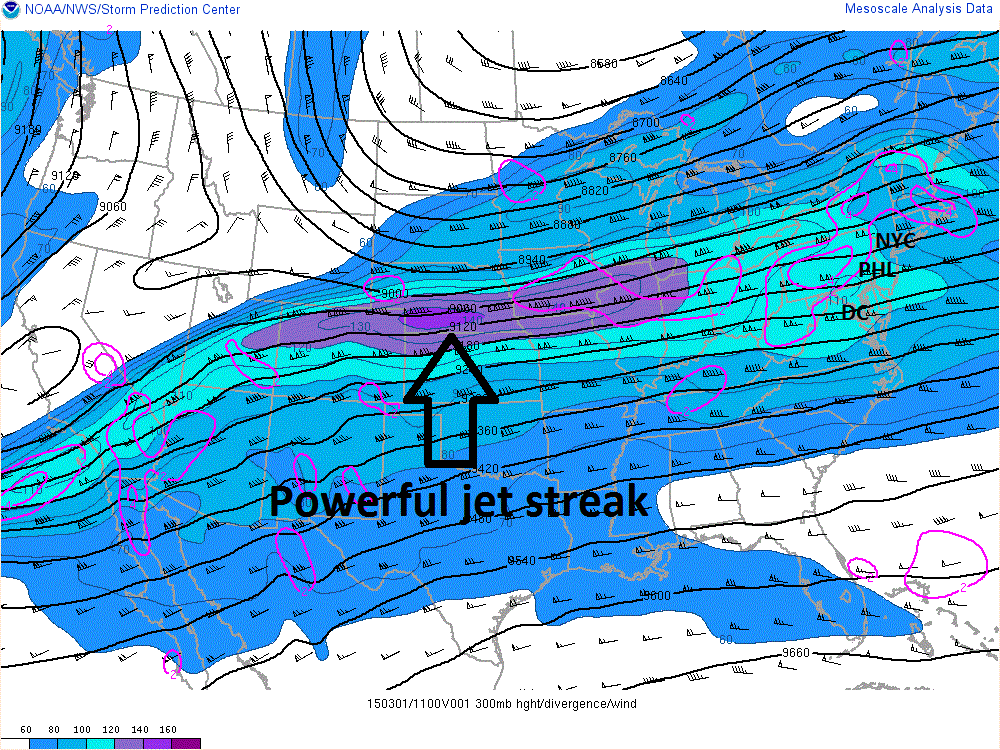 [Sunday AM 300 millibar winds showing powerful jet streak (purple) which is headed right into the Mid-Atlantic region; courtesy NOAA]
Another interesting and complicated threat at mid-week Another complicated precipitation event is likely to occur in the I-95 corridor from Tuesday into Thursday. Precipitation ahead of another strong Arctic frontal system is likely to arrive late Tuesday and it could start as a wintry mix in the I-95 corridor. However, as milder air pumps in from the south, the precipitation is likely to change to plain rain for Tuesday night and early Wednesday and some of the rain can be heavy. Temperatures could climb into the 50’s in portions of the I-95 corridor during the day Wednesday before colder air returns. The Arctic frontal system may then stall as it reaches the east coast on Wednesday night and there is a chance low pressure develops along the frontal boundary and rides up along it into the I-95 corridor region. If this takes place, it could very well turn cold enough for significant snow around here in the late Wednesday night/Thursday time frame. Stay tuned on that one.