12:55 PM | Strong-to-severe thunderstorm threat for later today along the I-95 corridor
Paul Dorian
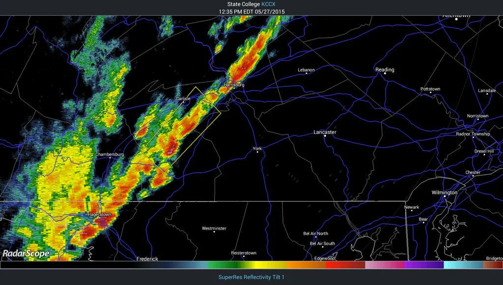
 [Latest PA/MD radar image; courtesy NOAA, RadarScope]
Discussion
Latest radar (above) shows an impressive line of thunderstorms forming from central Pennsylvania to western Maryland in a pre-frontal trough of low pressure. Skies have partially cleared along the I-95 corridor from the morning low cloud deck and this will allow for afternoon de-stabilization of the atmosphere with increasing low-level heating. A high-resolution computer forecast model (HRRR, below) shows a pretty solid line of thunderstorms at 6pm this evening ranging from DC-to-Philly-to-NYC. Any thunderstorm this afternoon and early evening can contain damaging wind gusts and brief heavy downpours. There are currently no severe thunderstorm watches issued by the National Weather Service for the I-95 corridor, but that could very well change over the next couple of hours. The window of opportunity for any strong-to-severe thunderstorm activity is approximately 2 to 8pm.
 [HRRR computer forecast model map for 6pm this evening; courtesy NOAA]

