
12:00 PM | Potential for heavy rainfall from tonight into early Thursday and then again late Saturday night/early Sunday
Paul Dorian
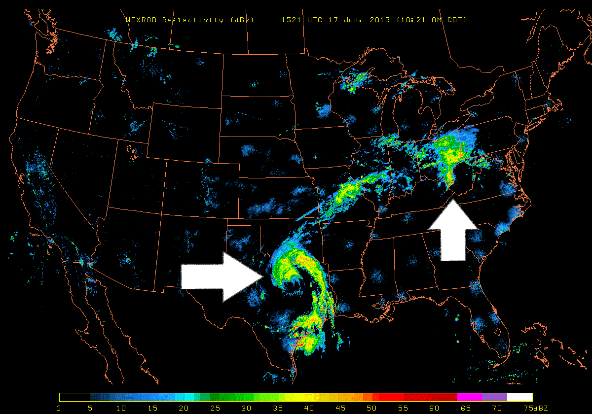
 [Mid-day NEXRAD (radar) image; courtesy University of Wisconsin]
Discussion
The latest NEXRAD image across the US shows two impressive moisture fields and both could end up affecting the I-95 corridor region from DC-to-Philly-to-NYC. The first area of interest is seen at mid-day over the Ohio Valley and it is associated with an advancing warm frontal system. This area of rainfall is moving eastward at a pretty good clip and could very well produce downpours in much of the I-95 corridor from tonight into early Thursday. The second area of interest can be seen as a "spiral" over eastern Texas at mid-day and it is associated with the remains of Tropical Storm Bill. It is quite likely that this area of moisture moves northeast over the next few days and reaches the I-95 corridor late Saturday night and early Sunday with more heavy rainfall and possible strong thunderstorm activity. Stay tuned.