2:45 PM | Persistent onshore flow, full “supermoon”, and potential coastal low pose problems this weekend/early next week for at least parts of the Mid-Atlantic region
Paul Dorian
 [12Z GFS forecast map for Monday morning; courtesy NOAA]
Discussion
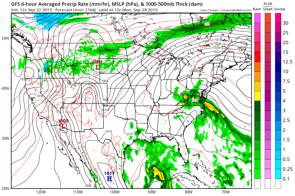
High pressure will reassert itself in the Mid-Atlantic region during the next couple of days and sunshine should return in full force which will help boost afternoon temperatures to noticeably warmer levels. At the same time, abundant moisture will continue to reside just off the east coast. This area of moisture will push northward at a snail’s pace over the next few days at the same time strong high pressure slides to our north. Eventually, a significant rain event could very well occur in at least parts of the Mid-Atlantic region. The possible timing for this rain event is in the Sunday/Monday time period, but a quicker arrival of the moisture cannot be ruled out. The 12Z GFS forecast map above for Monday morning shows an area of precipitation (greens, yellows) in the southern part of the Mid-Atlantic region and there is an impressively strong flow of moist ocean air right into the area.
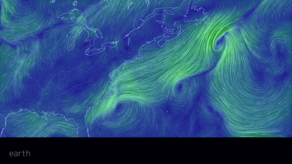 [Current "wind flow" map shows large fetch over the Atlantic Ocean; courtesy earth.nullschool.net]
Whether this significant rain event ever materializes, this persistent ocean flow of air will likely to lead to heavy surf, rip currents and beach erosion along coastal sections by the weekend. The wind flow map above shows a long fetch of onshore flow already in place along the Mid-Atlantic coastline (courtesy earth.nullschool.net). All of these coastal effects will be made worse this weekend by higher-than-normal tides as the moon will reach full “supermoon” status on Sunday. A “supermoon” occurs 6 times this year and is defined as when the new or full moon comes within 224,834 miles of Earth as measured from the centers of the moon and Earth. A full “supermoon” is 12 to 14 percent brighter than a full moon in its most distant approach to Earth. Stay tuned...especially along coastal locations.