
11:20 AM | "April can be the cruelest month"
Paul Dorian

Total snowfall for the next ten days using the 00Z GFS; map courtesy tropicaltidbits.com
Overview
Let me paraphrase poet T.S. Eliot and say “April can be the cruelest month”. The long winter season is over, baseball is about to begin, trees are blossoming, and colorful early season flowers dot the landscape, yet all it takes this time of year is the passage of a strong cold front to put the Northeast US back in the deep freeze. Or, a simple shift of low-level winds to an onshore direction can bring about a quick twenty degree drop in temperatures as the ocean remains quite cold this time of year (i.e., the dreaded back door cold front). Indeed, just when it appeared that we were on the door step of sustained warmth in the Northeast US, it looks like the first ten days or so of April will feature multiple cold air outbreaks and there may be numerous chances for snow.

Forecast map for early Sunday morning using the 00Z GFS (blue=snow, green=rain); map courtesy tropicaltidbits.com, NOAA
Details
A strong cold front arrives in the eastern US on Friday with showers and possible thunderstorms and it’ll turn cooler behind it for the first half of the weekend. An even stronger cold front arrives Saturday night and winds will pick up dramatically across the Northeast US as a more significant cold shot arrives. In fact, rain showers early Saturday night could change to snow showers late Saturday night/early Sunday morning in much of the Northeast US to go along with those strong - and possibly damaging - NW winds.
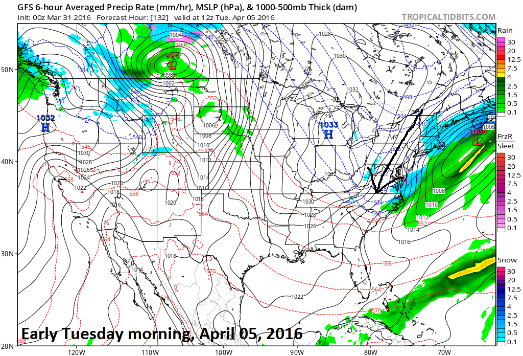
Forecast map for early Tuesday morning using the 00Z GFS (blue=snow, green=rain); map courtesy tropicaltidbits.com, NOAA
The forecast map for early Sunday morning (above) shows a strong N-NW push of air into the Mid-Atlantic region (as indicated by arrow) and, unfortunately, this type of cold wind pattern will likely repeat itself by early Tuesday following the passage of another cold front and again at the end of next week following the passage of yet another strong cold front. Indeed, that late week cold frontal system may be accompanied by a strong coastal storm that will have to be monitored closely in the days to come. As far as snowfall is concerned, total snowfall forecast map for the next ten days (top) from last night’s 00Z GFS model run has an ominous look to it for areas north of the Mason-Dixon Line and in the Ohio Valley.

Forecast map for early Friday afternoon using the 00Z GFS (blue=snow, green=rain); map courtesy tropicaltidbits.com, NOAA
Sustained warmth may have to wait until at least the middle of the month of April – cruel.
Meteorologist Paul Dorian
Vencore, Inc.