Friday 12:00 PM | **Snow continues well into the afternoon in DC-to-Philly corridor...many slick spots given the bitter cold**
Paul Dorian

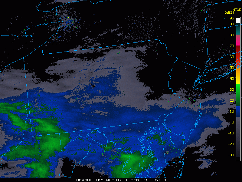
Mid-day radar loop with snow still falling across western PA and West Virginia; courtesy NOAA, College of DuPage
There is still some snow falling at mid-day across western Pennsylvania and West Virginia and it’ll continue at varying rates for another few hours in the DC-to-Philly corridor. Ground-level temperatures remain quite cold during this snow event and this is a main contributing factor to the slick road conditions – even on treated surfaces - as salt is less effective at these very cold levels. In general, surface temperatures in the DC metro region at mid-day fall near 20 degrees and between 10 and 15 degrees in the Philly metro region. This system will stay primarily to the south of the NYC metro area with nothing more than some possible flurries – i.e., a “DC-to-Philly” special. Accumulations in the DC-to-Philly corridor should end up in the “coating to an inch or two” range.

The threat threat continues well into the afternoon in the DC-to-Philly corridor (HRRR model run); courtesy NOAA, tropicaltidbits.com
Once today’s snow passes, a pattern change will begin this weekend with milder conditions working back into the Mid-Atlantic region. Temperatures on Saturday, for example, should rebound to the 30’s in many areas and then the 40’s are likely for highs on Sunday with the 50’s possible on Monday. This break in the action will continue until around Thursday or so of next week and colder air is likely to return by the end of next week….winter is far from over.
Meteorologist Paul Dorian
Perspecta, Inc.
perspectaweather.com