10:00 AM (Friday) | **Strong-to-severe thunderstorm threat later today/early tonight…strong winds late tonight and Saturday will follow the passage of a strong cold frontal system**
Paul Dorian
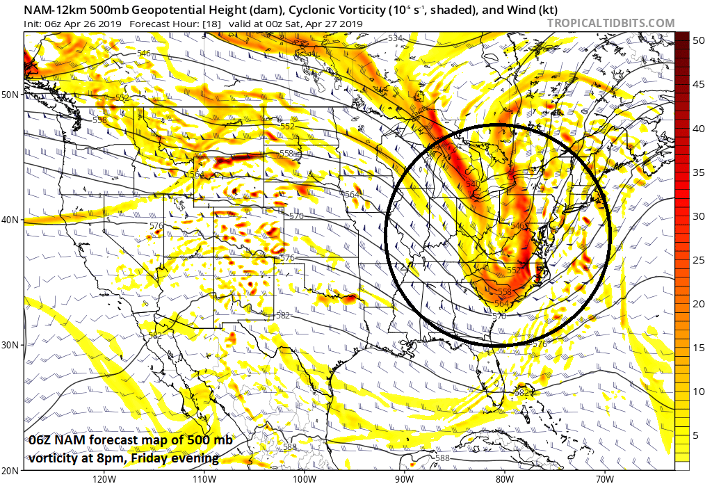
A strong wave of energy aloft will be a key player in any severe weather that develops later today in the Mid-Atlantic region; courtesy NOAA/EMC, tropicaltidbits.com
Overview
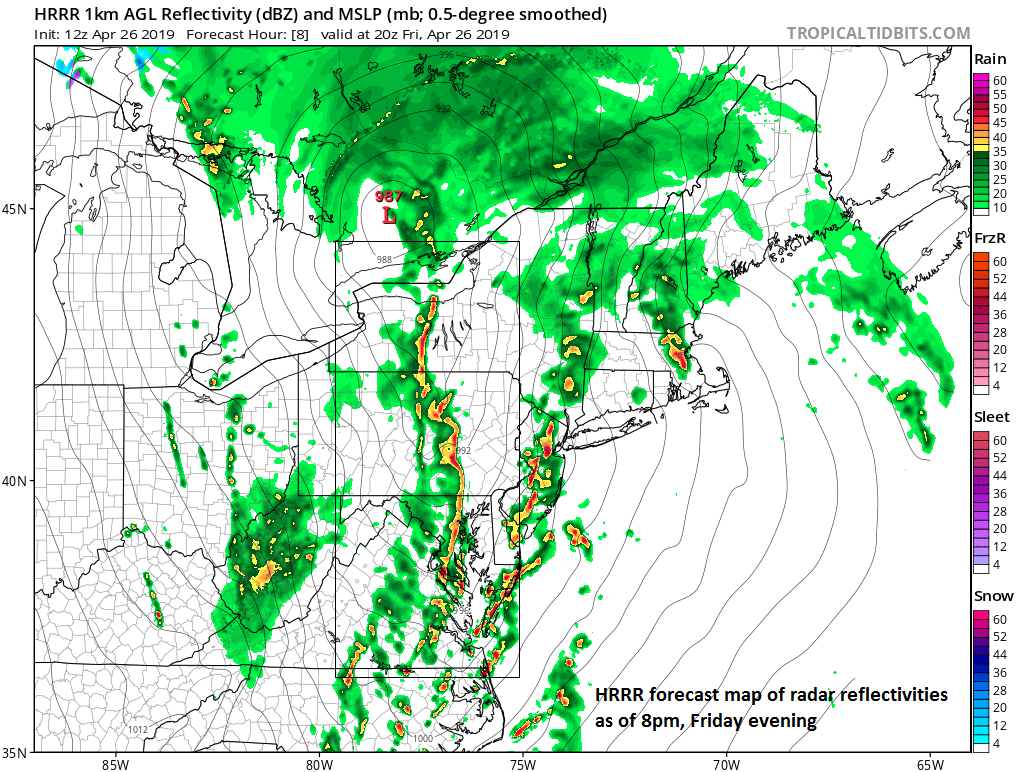
There will be numerous bands of showers and thunderstorms today in the Mid-Atlantic as the combination of strong surface low pressure, a warm front and a cold front impacts the region. One line of storms in particular could reach the I-95 corridor region later in the afternoon and early evening hours with strong-to-severe thunderstorm activity and any these cells can produce damaging wind gusts, hail and flooding rainfall. Following the passage of the cold front, temperatures will drop dramatically in the overnight hours and winds will become very strong from a northwesterly direction. The strong winds will continue on Saturday to go along with cooler conditions and partly-to-mainly sunny skies.
High-resolution forecast map at 8pm features a line of storms near the I-95 corridor; courtesy NOAA/EMC, tropicaltidbits.com
Details
An on-going active pattern in the upper atmosphere will result in a strong wave of energy now over the Ohio Valley that digs southeastward late today across the southern Appalachians and towards the Carolinas. At the surface, a warm front is struggling to push northward in the Mid-Atlantic region at mid-day and a couple of cold fronts are getting ready to consolidate into one strong system to the west of the I-95 corridor. The combination of the advancing cold front, strong upper-level energy, strong surface low pressure and lots of low-level moisture could result in a line of strong-to-severe thunderstorms later today that will likely reach the DC-to-Philly corridor in the 3-9 PM time period. While there can be heavy rain at times during the next several hours along with scattered thunderstorms, the best chance for severe weather will come late in the afternoon and into the early evening. Any thunderstorm in this 3-9 pm time period can produce damaging wind gusts, hail, flooding rainfall and there can even be a few isolated tornadoes.
NOAA’s Storm Prediction Center (SPC) in Norman, Oklahoma has the Mid-Atlantic region in an “enhanced” risk zone for severe weather; courtesy NOAA/SPC
One of the keys to the possibility of severe weather later today will be the advancement of warmer air in the lower levels of the atmosphere along the I-95 corridor. As it turns warmer in the low-levels of the atmosphere, the atmosphere destabilizes and this is usually a necessary ingredient for severe weather. Indeed, the warmer air is likely not to advance as far north as the NYC metro region so that area is less likely to have any severe weather later today and early tonight compared to the DC and Philly metro areas.. Late morning temperatures in the Philly and DC metro regions have reached 60 degrees and should get close to 70 degrees by late in the day with a S-to-SE low-level breeze and potentially some sunshine. Meanwhile, temperatures are holding in the low-to-mid 50’s at this hour across NYC with an east wind and they’ll be hard-pressed to climb well into the 60’s later today….something to monitor.
Meteorologist Paul Dorian
Perspecta, Inc.
perspectaweather.com


