11:00 AM (Wednesday) | **Potential severe thunderstorm activity late tomorrow/tomorrow night in the Mid-Atlantic/Northeast US and it includes the risk of tornadoes**
Paul Dorian

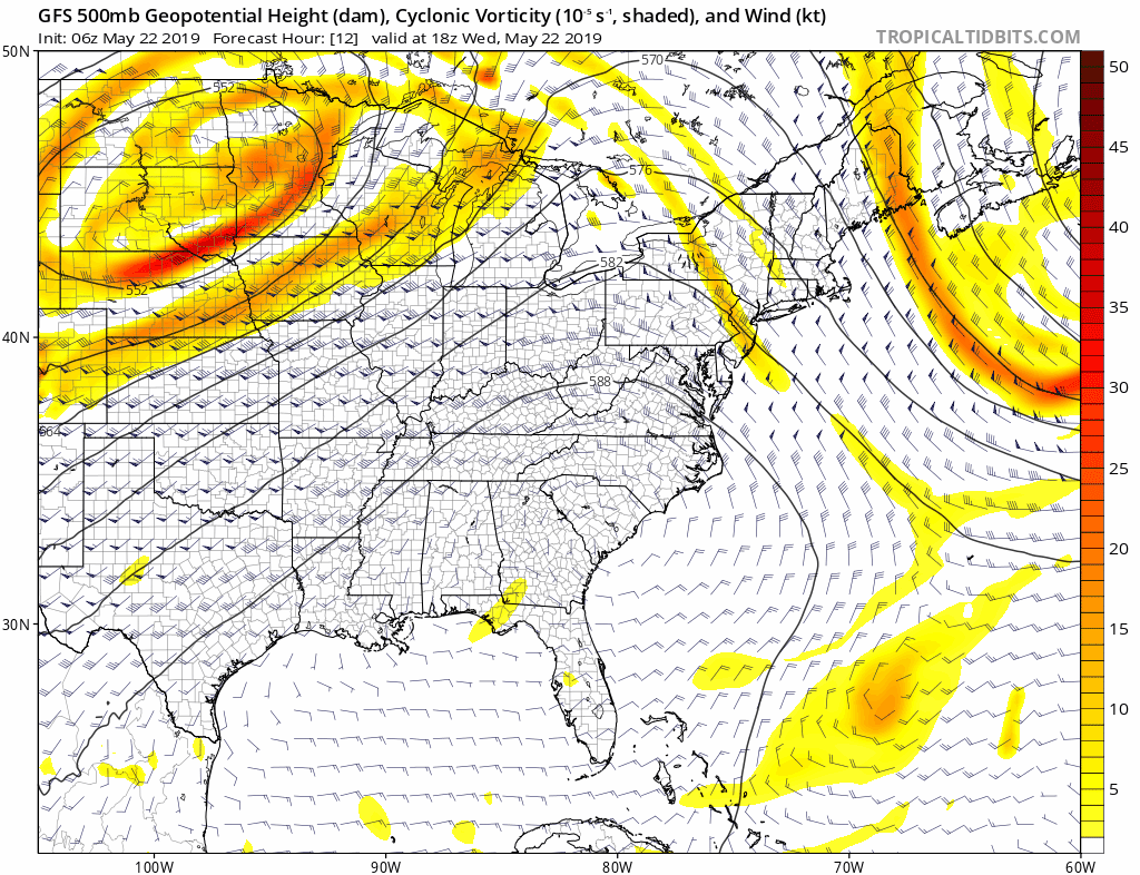
06Z GFS loop of 500 mb forecast maps from later today into early Friday (forecast hours 12-54); courtesy NOAA/EMC, tropicaltidbits.com
Overview
This may not be the conventional pattern for severe weather in the Mid-Atlantic and Northeast US, but it bears close watching. An upper-level disturbance and associated surface low pressure system will actually travel northeastward later today from the Northern Plains to the western Great Lakes and then take a sharp right turn to the southeast and head right towards the Northeast US. At the same time, a warm frontal system will pass from south-to-north through the Mid-Atlantic region in the overnight hours and this will set the stage for a much warmer and more humid day on Thursday. All of this could very well end up resulting in severe thunderstorms late tomorrow and tomorrow night across the Mid-Atlantic and Northeast US with damaging wind gusts and large hail as the primary severe weather risks and there is certainly the potential for tornadoes as well.

Severe weather outlook for Thursday as depicted by NOAA’s Storm Prediction Center (SPC).
Discussion
Today is another comfortable day in the Mid-Atlantic region and Northeast US as high pressure to the north remains in control. In the overnight hours, however, a warm front will press northward through the Mid-Atlantic and this could produce some showers after midnight, perhaps even a thunderstorm in the DC-to-Philly-to-NYC corridor. The bigger impact of the warm front will be quite noticeable on Thursday as temperatures will soar into the 80’s and dew points will rise significantly - ending our comfortable stretch of weather as overall humidity climbs to uncomfortable levels. As a cold front and the upper-level wave of energy approach from the northwest late tomorrow and early tomorrow night, thunderstorms are likely to break out and some can reach severe levels. The severe weather threat includes damaging wind gusts and large hail and there is reason for concern about tornadoes as well during this event. This system will ride around the top of a strong upper-level ridge of high pressure that is now parked over the southeast US where there is an on-going heat wave. The greatest chance for severe weather late tomorrow and tomorrow night will likely take place north of the PA/MD border; however, it is certainly on the table for places as far south as the DC metro region.
Following the active weather of later tomorrow and tomorrow night, high pressure will again take control on Friday and there will be a noticeable drop in humidity to end the work week along with comfortably warm conditions. A somewhat similar active weather pattern may repeat itself later Saturday and Saturday night with a renewed threat of strong-to-severe thunderstorm activity in the Mid-Atlantic/NE US as another wave of energy rides around the top of the relatively stationary strong upper-level ridge of high pressure based in the southeastern states.
Meteorologist Paul Dorian
Perspecta, Inc.
perspectaweather.com