
12:45 PM (Tuesday) | *Scattered strong-to-severe thunderstorms this afternoon/evening across eastern PA, New Jersey, southern NY*
Paul Dorian
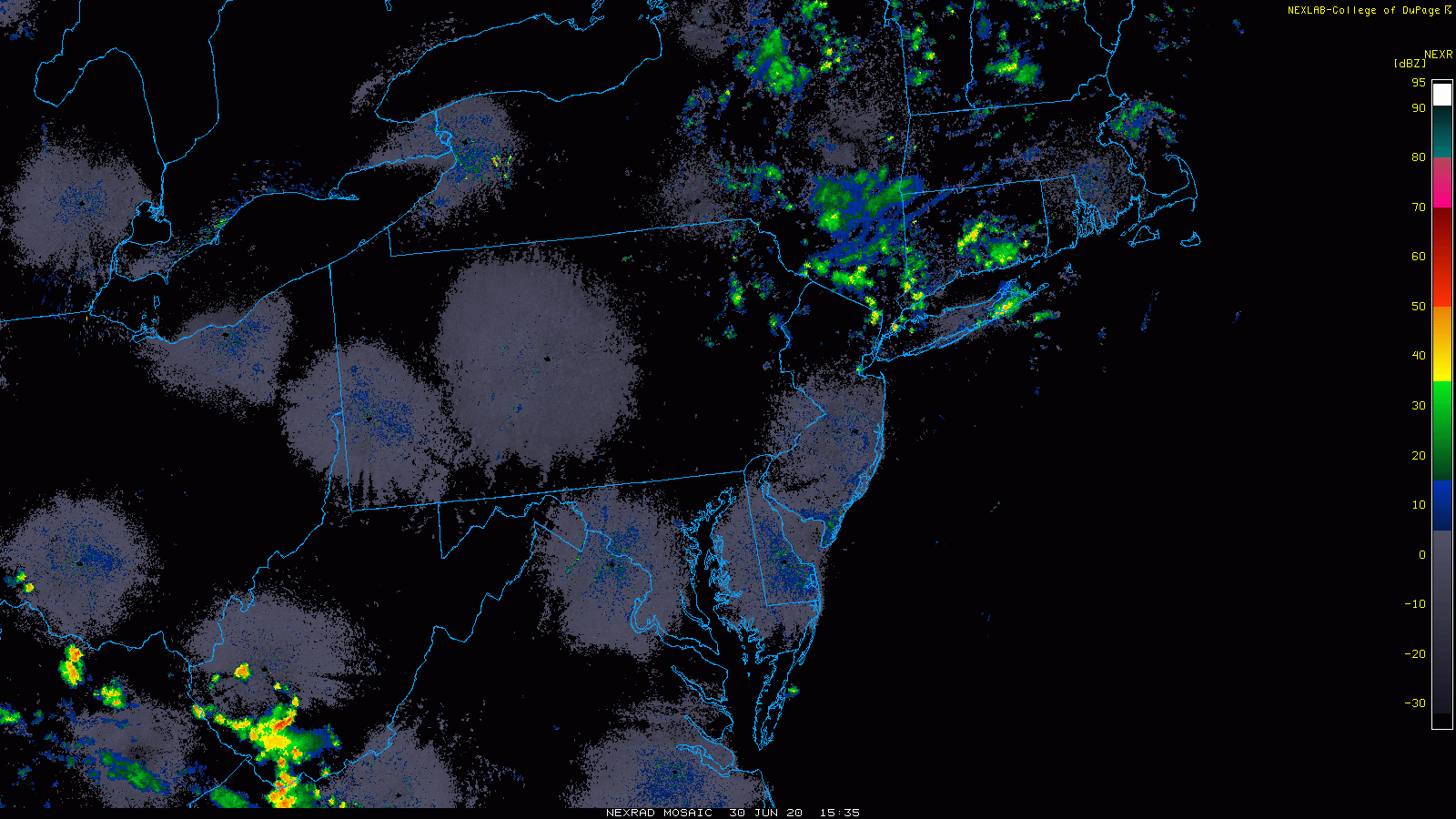
Scattered showers and thunderstorms are rotating around an upper-level low. Images courtesy NOAA, College of DuPage
Overview
An upper-level low is spinning over the Northeast US and showers and thunderstorms are pin wheeling around this system. Some of the thunderstorms will reach strong-to-severe levels over the next few hours with highly unstable conditions given the chilly air aloft combined with the rather warm lower levels of the atmosphere. Any thunderstorm can contain gusty winds, heavy downpours and small hail as the freezing level is rather low in this scenario. The best chance for the shower and thunderstorm activity will be north and east of the PA/MD border to northern New England, but a few storms can make it all the way down into northern Maryland, northern Virginia, and the Washington, D.C. metro region.
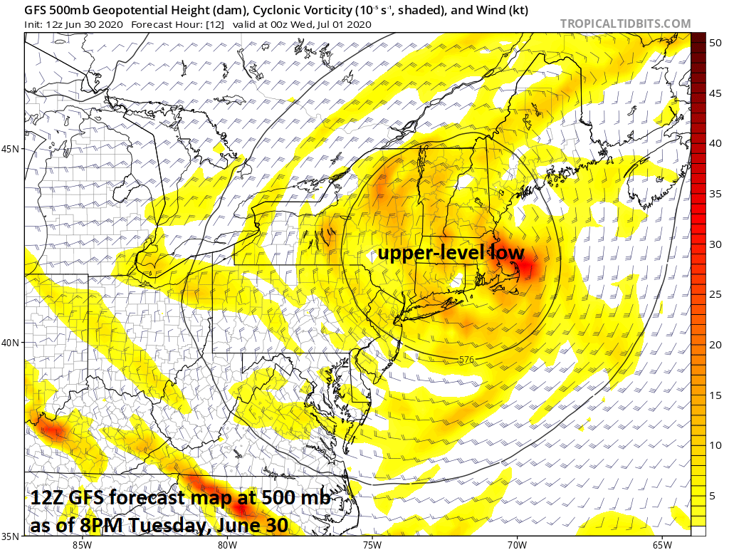
An upper-level low is meandering over the Northeast US and is resulting in some strong-to-severe thunderstorm activity. Map courtesy NOAA, tropicaltidbits.com
Discussion
Temperatures will be quite comfortable today in the Mid-Atlantic/NE US with highs only in the low-to-mid 80’s, for example, in places like Philadelphia and New York City. It is actually colder-than-normal in upper parts of the atmosphere and this is helping to create unstable conditions and showers and thunderstorms are the result. The best chance for showers and storms will be in those areas closest to the upper-level low and that extends from eastern PA to New England. While there can be some shower and thunderstorm activity across northern Maryland, northern Virginia and Washington, D.C., by early tonight, the highest probabilities will likely be north of the Mason-Dixon Line.
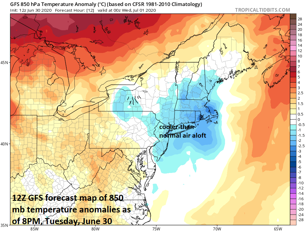
The upper-level low is associated with chilly air for this time of year and this is leading to unstable atmospheric conditions in the Northeast US; map courtesy NOAA, tropicaltidbits.com
This upper-level feature will continue to have an impact on Wednesday in the Northeast US as we begin the month of July. There was no sustained heat wave in the in much of the Mid-Atlantic region during the month of June with numerous outbreaks of rather seasonal air and overall monthly temperatures were not too far from normal in places like Philadelphia and NYC. Later this week, there is the chance for some hot weather, but it looks like it too will not be part of any sustained heat wave. Nonetheless, temperatures could shoot up into the 90’s on Friday in the I-95 corridor, but are likely to drop back some this weekend following the passage of a weak cool frontal system.
Meteorologist Paul Dorian
Perspecta, Inc.
perspectaweather.com
Follow us on Facebook, Twitter, YouTube
Video discussion: