9:50 AM | ***Remnants of a Mesoscale Convective System (MCS) headed to the Mid-Atlantic region…strong-to-severe thunderstorms possible from this afternoon into tonight***
Paul Dorian

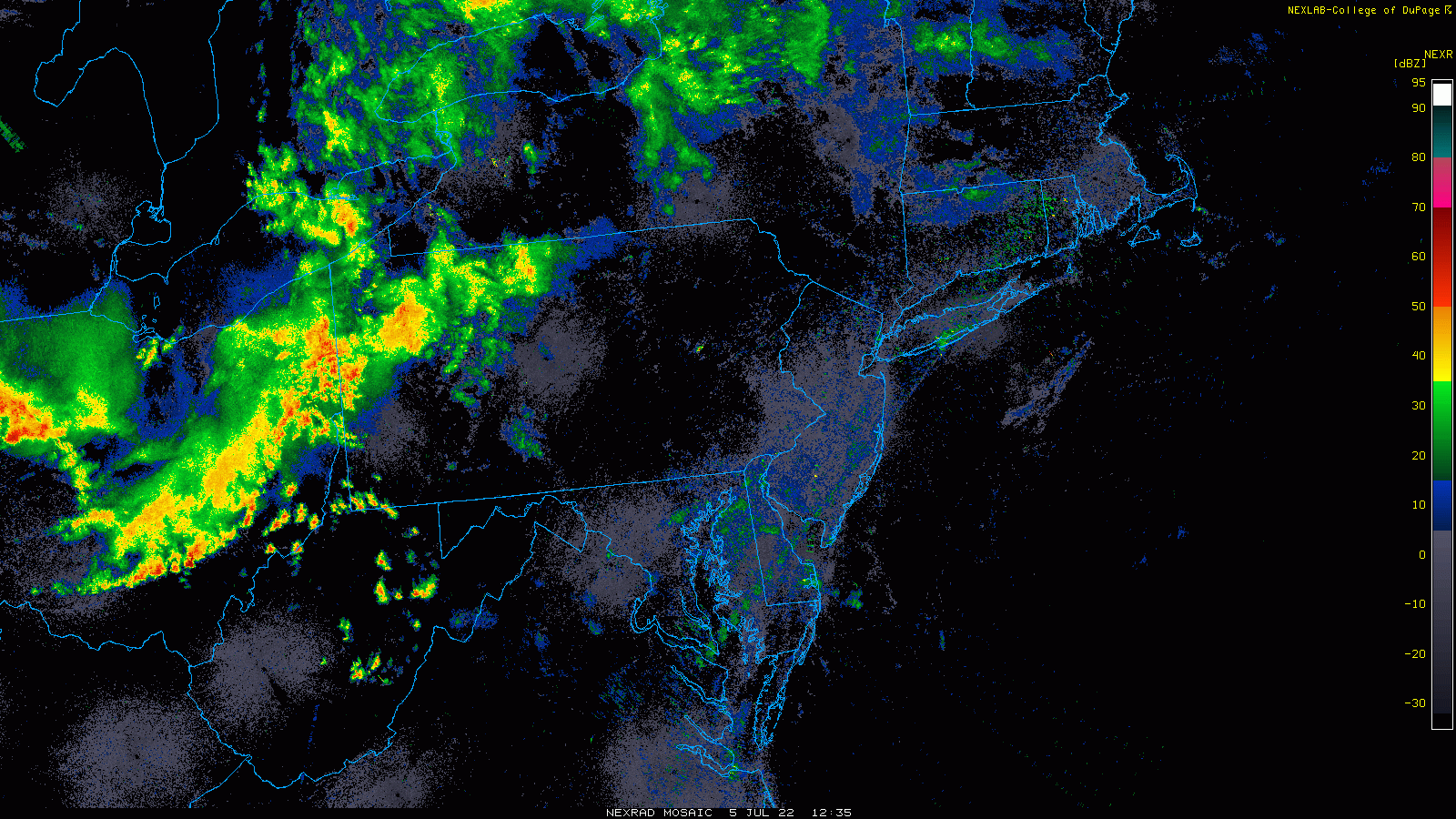
Lots of showers and thunderstorms this morning are riding along in the northwesterly flow of air that is in the upper part of the atmosphere and headed right to the Mid-Atlantic region. Images courtesy College of DuPage, NOAA
Overview
Large scale northwesterly flow in the upper part of the atmosphere this time of year in the Mid-Atlantic region often results in severe weather threats and there is just such a possibility from this afternoon into tonight. The zone with the best chance of strong-to-severe thunderstorm activity later today will likely be from the DC metro region/Delmarva Peninsula on the southern end to central/eastern Pennsylvania on the northern end as the remnants of an overnight “mesoscale convective system (MCS) appear to be headed right towards that region. Northwesterly flow aloft in this part of the nation usually is the result of strong high pressure ridging to the southwest of here and embedded shortwaves often move in a northwest-to-southeast fashion in the outer perimeter of this kind of system.

High-resolution model (HRRR) pushes the remnants of the “MCS” to the DC metro region/Delmarva Peninsula by later today. The threat of an impact by this area of showers and thunderstorms also exists across central and eastern Pennsylvania. Maps courtesy NOAA, tropicaltidbits.com
Details
High pressure ridging in the upper part of the atmosphere continues to be centered over the Lower Mississippi Valley/Tennessee Valley regions bringing excessive heat over the next few days to such places as St. Louis, Missouri and Huntsville, Alabama where temperatures will climb towards the 100 degree mark for afternoon highs. Meanwhile, on the outer periphery of this strong high pressure system, northwesterly flow aloft has prevented any kind of extended hot spell in the Great Lakes, Mid-Atlantic and Northeast US so far this spring and during the early summer season. As an example, Reagan National Airport (DCA) in Washington, D.C. did not have three consecutive days of 90+ degrees for highs during the entire month of June which is somewhat unusual for that urban area.

Strong high pressure ridging has been centered over the Lower Mississippi Valley/Tennessee Valley in recent days promoting a northwesterly flow of air over the Great Lakes/Mid-Atlantic/Northeast US. Map courtesy NOAA, tropicaltidbits.com
In addition to its limiting factor for sustained heat in the Mid-Atlantic region, northwesterly flow aloft has kept the weather quite active as the periphery region of a strong high pressure system often features embedded shortwaves that move from northwest-to-southeast. This kind of pattern has indeed resulted in many “upstream” batches of showers and thunderstorms that dropped to the south and east from the Upper Midwest to the Mid-Atlantic region - and that is exactly what is on the table for the afternoon and evening hours. An early morning MCS extended from Detroit-to-Chicago and its remnants are now pushing through the eastern part of the Ohio Valley and right towards the I-95 corridor region in the Mid-Atlantic. It appears this batch of showers and storms is headed directly towards the region extending from the DC metro/Delmarva Peninsula on the south side to central and eastern Pennsylvania on the north side. The likely arrival time of showers and embedded thunderstorms is early-to-mid afternoon in the region from DC metro to central PA and then mid-to-late afternoon from the Delmarva Peninsula to eastern PA. Any thunderstorms can produce heavy downpours and gusty winds.

Yet another comfortable air mass can works its way into the northeastern states this weekend with the continuation of northwesterly flow in the upper part of the atmosphere. Map courtesy NOAA, tropicaltidbits.com
The remainder of the work week is likely to see a continuation of this overall active weather pattern in this part of the nation with little chance of sustained heat. Specifically, there will be a daily chance of showers and thunderstorms on Wednesday, Thursday and Friday as the frontal system meanders nearby and northwesterly flow continues in the upper part of the atmosphere. Another cooler-than-normal air mass for this time of year can move into the northeastern states during the upcoming weekend.
Meteorologist Paul Dorian
Arcfield
arcfieldweather.com