2:30 PM | ***Some snow late tonight/early Wednesday in DC, Philly and NYC from system now producing severe icing in Arkansas/Texas…short-lived, but brutally cold Arctic air mass headed to the NE US***
Paul Dorian

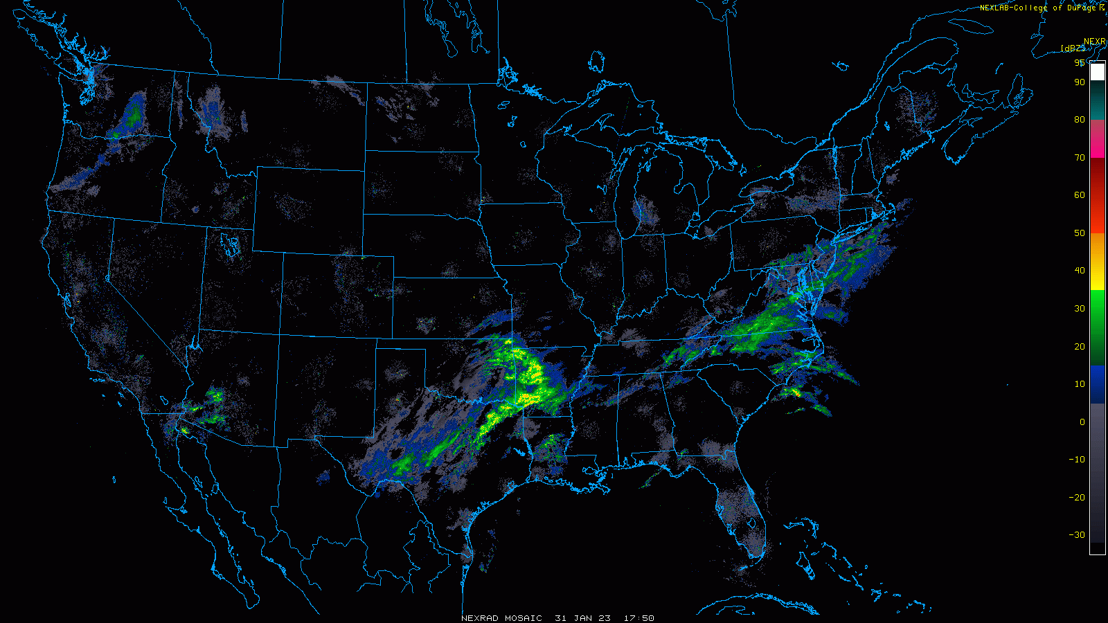
One wave of low pressure is causing some rain and snow in the Mid-Atlantic region this afternoon while a second system is resulting in some serious icing problems for Arkansas and Texas. This second low will push northward this evening and generate some snow in the DC-to-Philly-to-NYC corridor late tonight/early Wednesday. Images courtesy College of DuPage, NOAA
Overview
It won’t be a big deal, but compared to the snow (or lack thereof) so far this winter season, the coating to an inch or so of snow that can fall late tonight/early Wednesday in the DC-Philly-to-NYC corridor may seem like quite a bit. Low pressure that is now creating significant icing problems across Arkansas and Texas will move along a stalled-out frontal boundary zone and it should make it far enough to the north to produce some snow in the Mid-Atlantic region from later tonight into early Wednesday. After a moderately cold day on Thursday, an Arctic front will blast through the Mid-Atlantic/Northeast US by early Friday and this frontal passage will usher in a brutally cold air mass for Friday and Saturday. In fact, single digit lows are likely on Friday night all the way down to the Philly metro region and zero degrees is on the table for New York City. In addition, wind chills will cause some pain in this short-lived, but very impressive Arctic blast.

A high-resolution surface forecast map (17Z HRRR) for 3AM, Wednesday, features snow (in blue) across much of the DC-to-Philly-to-NYC corridor. While not a big deal, it may be more than experienced so far this winter season in many spots. Map courtesy NOAA, tropicaltidbits.com
Snow threat
Snow has been virtually non-existent this winter so far in the DC-to-Philly-to-NYC corridor, but there could be an end to the drought over the next 12-18 hours. One wave of low pressure already has produced some rain in the I-95 corridor today and, as colder air filters in from the northwest, snow showers are likely this afternoon and early evening in many areas. A second and stronger wave of low pressure will then push northeastward early tonight and it should be able to produce small accumulations of snow in the DC-to-Philly-to-NYC corridor from late tonight into early tomorrow on the order of a coating to an inch or so. This system is currently creating all kinds of icing problems in Arkansas and Texas where roads have become quite dangerous and a follow-up ice storm is likely there on Wednesday.

A short-lived, but severely cold Arctic blast is headed to the Northeast US for Friday and Saturday. Temperatures late Friday night could flirt with the zero degree mark in NYC, bottom out in the single digits across Philly, and the low-to-middle teens in the DC metro region. Farther to the north, 25-30 degrees below zero overnight lows are quite likely across upstate New York and northern New England. Map courtesy ECMWF, Pivotal Weather
Severe Arctic blast
After a moderately cold day on Thursday, attention will turn to an Arctic blast that will be rather short-lived (two-days) in the Northeast US, but brutally cold. In fact, temperatures could bottom out on Friday night near zero degrees in New York City, in single digits in and around Philly, and in the low-to-middle teens across the DC metro region. Farther to the north, temperatures could plunge to 25 or even 30 degrees below zero in much of upstate New York and northern New England. In addition to the biting cold, wind chills will cause some pain from Friday into Saturday as a tight pressure gradient will result in strong N-NW winds making it feel much colder outside than the actual air temperatures. The good news is that this upcoming severe Arctic cold blast will be rather short-lived and temperatures should get back to much closer-to-normal by the second half of the weekend.
Meteorologist Paul Dorian
Arcfield
arcfieldweather.com