1:45 PM | *Low pressure system on Tuesday will pack a little bit of punch…watch for some decent rainfall in a limited portion of the Mid-Atlantic region...nice for the 2nd half of the week*
Paul Dorian

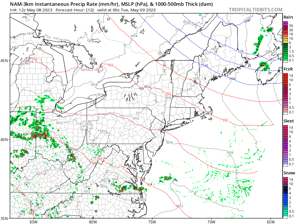
An area of rain and thunderstorms will track from northwest-to-southeast on Tuesday as low pressure slides along a stalled-out frontal boundary zone. Maps courtesy NOAA, tropicaltidbits.com
Overview
While it won’t be a widespread or long-lasting event, a fast-moving low pressure system will pack a little bit of a punch on Tuesday and it could produce some decent rainfall for a limited portion of the Mid-Atlantic region. The best chance for the locally heavy rainfall will likely extend from the southwestern part of Pennsylvania to the DC metro region and then eastward to the Delmarva Peninsula and southeastern Virginia. In addition to the production of some rainfall, this system will bring cooler conditions to the Mid-Atlantic region on Tuesday with and east-to-northeast low-level flow of air likely to develop on the north side of the southeastward-moving storm system.

A cold front has slipped into the Mid-Atlantic region today and it will stall out across Virginia by later tonight. This frontal boundary zone will act as a conduit for low pressure to track along on Tuesday likely resulting in some decent rainfall along its path. Map courtesy NOAA/WPC
Details
Low pressure will track along a stalled-out frontal boundary zone later tonight and likely be positioned near the West Virginia/SW Pennsylvania border region as the day begins on Tuesday. From this location, the low will continue to move in a general southeastward direction and its precipitation field should move from SW PA/West Virginia to the DC metro region region and ultimately makes its way to the Delmarva Peninsula and southeastern Virginia. In the immediate I-95 corridor, the DC metro region has the highest chance at some decent rainfall with more scattered showers possible in and around Philly and little, if any, chance of rain up across New York City.

After a warm day to start the new work week, it will turn cooler on Tuesday with east-to-northeast low-level flow of air likely to form on the north side of a southeastward-moving low pressure system. Temperatures well up in the 70’s today across the Mid-Atlantic region may spend much of the time on Tuesday stuck in the upper 50’s or lower 60’s then drop to the 40’s late tomorrow night on the back side of the low pressure system. Map courtesy NOAA, tropicaltidbits.com
In addition to the rain, this potent low pressure system will have an impact on temperatures on Tuesday. Temperatures today have climbed well up into the 70’s in many areas and could very well spend most of the time tomorrow in the upper 50’s or lower 60’s as an east-to-northeast flow of air develops on the north side of the storm track. Once the low pushes off the coast tomorrow night, skies are likely to clear from northwest-to-southeast and overnight temperatures will drop into the chilly low-to-mid 40’s in many spots. High pressure builds back into the Mid-Atlantic region at mid-week and it’ll become increasingly warm during the second half of the week with highs not far from 80 degrees on Thursday and Friday afternoons in the DC-to-Philly-to-NYC corridor.
Meteorologist Paul Dorian
Arcfield
arcfieldweather.com
Follow us on Facebook, Twitter, YouTube
Morning video discussion: