9:30 AM (Sunday) | ***Torrential rain threat continues for another day in the Mid-Atlantic region after numerous downpours on Saturday…severe thunderstorms a possibility as well***
Paul Dorian

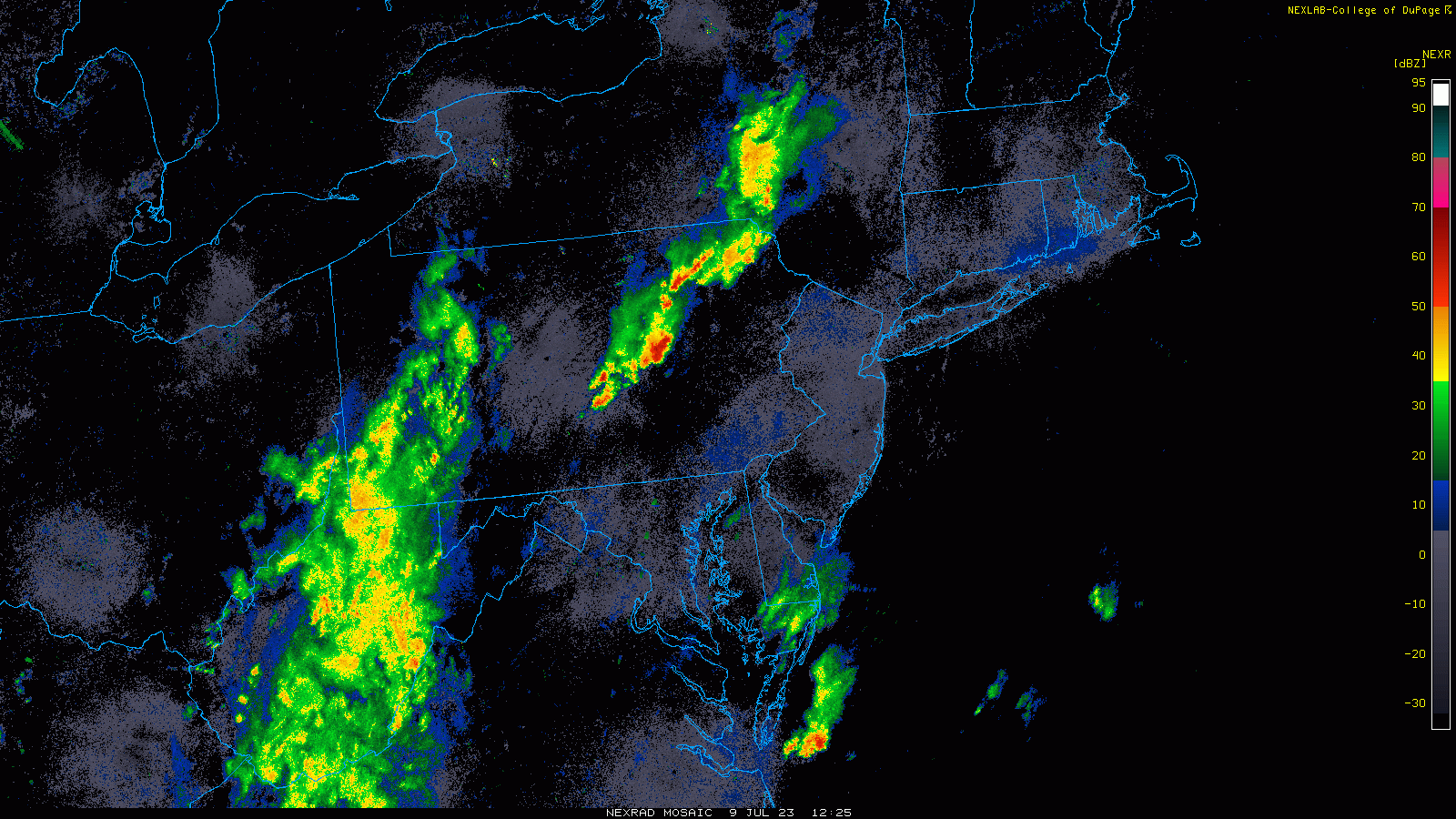
Strong thunderstorms are pushing towards NE PA and a widespread area of showers and embedded thunderstorms is pushing east from the western part of the Mid-Atlantic. The DC-to-Philly-to-NYC corridor will have the threat of torrential rainfall later today into tonight and also the possibility of severe thunderstorm activity. Images courtesy College of DuPage, NOAA
Overview
Many parts of the Mid-Atlantic region were hit by downpours on Saturday and the threat for more torrential rain continues today as we close out the weekend. A vigorous system sliding east across the Ohio Valley will enhance upward motion in the region and low-level moisture remains high. As a result, any shower or thunderstorm that forms later today and tonight can produce significant rainfall amounts on top of what fell yesterday leading to flash flooding concerns. In addition, enough destabilization may occur in the atmosphere to help generate sever thunderstorm activity which could bring damaging wind gusts to many areas.

A vigorous wave slides east today across the Ohio Valley and towards the Mid-Atlantic. This system will enhance upward motion in the region raises the chance for more torrential downpours and severe thunderstorm activity. Map courtesy NOAA, tropicaltidbits.com
Details
Many parts of the Mid-Atlantic region were pounded by showers and thunderstorms on Saturday resulting in several inches of rainfall in some spots. One of the culprits for the torrential rain on Saturday was a weak wind field and little in the way of steering flow. As a result, thunderstorms tended to hang around for a couple of hours in many areas (e.g., Chester/Delaware Counties in SE PA) producing significant rainfall amounts. Unfortunately, many of the same areas that were hit hard yesterday can experience more torrential rainfall later today leading to big-time concerns for flash flooding. The slow-movement of yesterday’s storm systems which increased rainfall amounts may not be the issue again today; however, “training” of cells may result in excessive rainfall amounts as showers and thunderstorms potentially roll over same areas for an extended period of time.

NOAA’s Storm Prediction Center has placed much of the Mid-Atlantic region in the “slight” risk zone for severe weather later today and tonight.
In addition to the heavy rain threat, severe thunderstorms are a possibility later today as the vigorous wave aloft slides to the east. Upward motion will increase markedly causing a destabilization in the atmosphere and severe thunderstorms may be the result. Any thunderstorm that does form later in the day can produce damaging wind gusts in addition to heavy downpours. The upper-level system causing today’s problems will slide to the east of the Mid-Atlantic on Monday and less humid air should become noticeable by later tomorrow and tomorrow night.
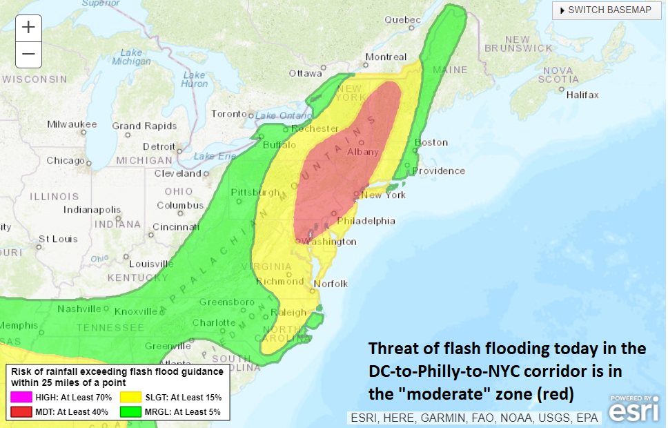
The threat of flash flooding continues today in the Mid-Atlantic region (shown in red for “moderate” risk) as highlighted here by NOAA’s Weather Prediction Center.
Looking ahead, the weather looks more settled for Tuesday and Wednesday with little-to-no chance of rain on those two days and quite warm conditions. The humidity (and threat of showers and storms) will build back up again later in the week.
Meteorologist Paul Dorian
Arcfield
arcfieldweather.com