Contact Us

Use the form on the right to contact us.

You can edit the text in this area, and change where the contact form on the right submits to, by entering edit mode using the modes on the bottom right. 


123 Street Avenue, City Town, 99999

(123) 555-6789

email@address.com


You can set your address, phone number, email and site description in the settings tab.
Link to read me page with more information.

backlit-stratus-clouds-2013-04-05.jpg

Blog

Weather forecasting and analysis, space and historic events, climate information

Filtering by Category: DC

7:00 AM | Cannot rule out a couple of showers today or a thunderstorm...threat for some heavy rainfall later tomorrow as cool front approaches

Paul Dorian

6-Day DC Forecast

Today

More sun than clouds, hot and humid, slight chance for showers and thunderstorms, highs not far from 90 degrees

Tonight

Slight chance for evening showers and thunderstorms; otherwise, partly cloudy, mild, muggy, lows in the low-to-mid 70’s

Wednesday

More clouds than sun, hot and humid, showers and thunderstorms likely, some of the rainfall can be heavy at times, near 90 degrees

Wednesday Night

Mostly cloudy skies with evening showers and thunderstorms possible, mild, muggy, near 70 degrees

Thursday

Partly sunny, still quite warm, chance for more showers and thunderstorms, upper 80’s

Friday

Partly sunny, warm, mid 80’s

Saturday

Partly sunny, warm, mid-to-upper 80’s

Sunday

Partly sunny, quite warm, chance of showers and thunderstorms, upper 80’s

Discussion

The atmosphere is ripe with moisture and there certainly can be some more heavy rainfall in the I-95 corridor during the next few days. It’ll turn quite warm today with high temperatures likely reaching the 90 degree mark and humidity levels will remain at uncomfortable levels. As a result, a shower or thunderstorm can break out at just about any time today and although much of the time will be rain-free, any rain that falls can come down hard for a brief time. A cool front will approach the I-95 corridor later tomorrow and this will likely result in another fresh round of showers and thunderstorms and some of the rainfall can be heavy at times.

7:00 AM | An unsettled first half of the week which can include some heavy rainfall

Paul Dorian

6-Day DC Forecast

Today

A mix of clouds and sun, warm and humid, occasional showers are likely and there can be a thunderstorm or two this afternoon, some of the rain can be heavy, highs in the low-to-mid 80’s

Tonight

Chance for more showers and thunderstorms and some of the rainfall can be heavy, mild, muggy, lows not far from 70 degrees

Tuesday

Partly sunny, hot and humid, slight chance for showers and thunderstorms, highs in the low 90’s

Tuesday Night

Mostly cloudy skies with the slight chance for showers and thunderstorms, mild, muggy, low 70’s

Wednesday

Partly sunny, hot and humid, showers and thunderstorms likely and some of the rainfall can be heavy, near 90 degrees

Thursday

Partly sunny, not as hot, still the chance for showers and thunderstorms, upper 80’s

Friday

Partly sunny, quite warm, upper 80’s

Saturday

Partly sunny, quite warm, upper 80’s

Discussion

Quite an unsettled first half of the week is in store for the Mid-Atlantic region and the overall short-term weather pattern can produce heavy rainfall including as soon as later today. Low pressure this morning over North Carolina will move northward towards the Delmarva Peninsula and the result will be the breakout of showers and thunderstorms at just about any time and some of the rainfall can be heavy. A cold frontal system approaches at mid-week and a wave of low pressure riding along the boundary zone will keep it unsettled around here with the threat for some more heavy rainfall.

Video

httpv://youtu.be/9cZEvUSSc9M

7:00 AM | Still unsettled and temperatures remain on the cool side

Paul Dorian

6-Day DC Forecast

Today

Mainly cloudy, cooler than normal, chance for showers and thunderstorms late, highs in the upper 70’s

Tonight

Mainly cloudy with a chance of showers and maybe some fog, mild, lows in the mid 60’s

Saturday

Mainly cloudy, still on the cool side, showers likely primarily early and mid-day, maybe a thunderstorm, upper 70's

Saturday Night

Slight chance for showers early; otherwise, mostly cloudy skies, mild, mid 60’s

Sunday

Partly sunny, comfortable, low 80’s

Monday

Partly sunny, warm, chance for showers and thunderstorms, mid 80’s

Tuesday

Mainly sunny, warm, mid 80’s

Wednesday

Partly sunny, warm, chance for showers and thunderstorms, mid-to-upper 80’s

Discussion

A stalled out frontal system will keep it unsettled around here as we head into the weekend with late day showers possible today and then more showers are likely early and mid-day on Saturday perhaps even a thunderstorm. Temperatures will remain on the cool side for this time of year with no 90 degree highs expected right through the weekend and highs confined to the 70's for the holiday.

7:00 AM | Stalled out cool front keeps us unsettled

Paul Dorian

6-Day DC Forecast

Today

Mostly cloudy, warm, chance for showers and thunderstorms at just about any time, highs in the low-to-mid 80’s

Tonight

Chance for showers and thunderstorms this evening; otherwise, mostly cloudy, mild, lows in the mid 60’s

Friday

Mostly cloudy, cooler, rather humid, showers and thunderstorms likely, upper 70's

Friday Night

Chance for showers and thunderstorms early; otherwise, mostly cloudy skies, mild, mid 60’s

Saturday

More clouds than sun, still on the cool side of normal, cannot rule out a couple of showers and thunderstorms, low 80’s

Sunday

Partly sunny, warm, chance for showers and thunderstorms, low-to-mid 80’s

Monday

Partly sunny, warm, mid 80’s

Tuesday

Partly sunny, warm, chance for showers and thunderstorms late, upper 80’s

Discussion

A cool frontal system has stalled out in the southern Mid-Atlantic region and this close proximity will keep it unsettled around here as we head into the weekend. While much of the time over the next few days will be rain-free, showers and thunderstorms cannot be ruled out on any of these days and can occur at just about any time. Temperatures will remain moderate for this time of year with no 90 degree highs expected.

7:00 AM | Stays somewhat unsettled today as cool front approaches, but only isolated showers/storms expected

Paul Dorian

6-Day DC Forecast

Today

Mainly sunny, warm, rather humid, slight chance for showers and thunderstorms, highs in the mid 80’s

Tonight

Slight chance of evening showers and thunderstorms; otherwise, becoming partly cloudy, mild, lows in the mid-to-upper 60’s

Thursday

Partly sunny, warm, rather humid, chance for showers and thunderstorms, mid 80’s

Thursday Night

Chance for showers and thunderstorms early; otherwise, mostly cloudy skies, mild, mid 60’s

Friday

Mostly cloudy, cooler, rather humid, showers and thunderstorms possible, near 80 degrees

Saturday

Partly sunny, warm, chance for showers and thunderstorms, low 80’s

Sunday

Partly sunny, warm, chance for showers and thunderstorms, mid 80’s

Monday

Partly sunny, warm, chance for showers and thunderstorms, mid-to-upper 80’s

Discussion

Low pressure over the Great Lakes region will push a cool front our way later today and it is likely to spark a few showers and thunderstorms in the Mid-Atlantic region, but nothing as widespread as late yesterday and last night. The cool front will then stall out just to the south and east of the I-95 corridor and this close proximity will keep the weather somewhat unsettled later in the week and into the weekend.

1:30 PM | **Here we go again...the threat for severe thunderstorms and flash flooding**

Paul Dorian

ne3comp
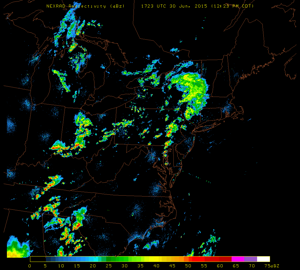
[NEXRAD radar image; courtesy University of Wisconsin]

Discussion

The atmosphere is quite juicy this afternoon and numerous thunderstorms are breaking out just to the west of Route I-95 and some of this activity will spill over into the immediate I-95 corridor region from DC-to-Philly-to-NYC later this afternoon. As low clouds have eroded today, the atmosphere has destabilized rapidly and high dew points have contributed to the firing up of very impressive-looking thunderstorms. Some of these storms will likely reach strong-to-severe levels over the next couple of hours raising the possibility of heavy downpours, damaging wind gusts over 60 mph, hail, frequent lightning and even isolated tornadoes.

One concern this afternoon is the possibility of “training” in parts of the I-95 corridor which occurs when thunderstorms "roll over" the same area in a given short time period. This action could lead to flash flooding as heavy rainfall piles up in a given location from multiple thunderstorm cells. In the I-95 corridor, eastern Pennsylvania is probably the region where “training” is most likely to occur later today. Also, the greatest threat for severe weather will likely occur in much of this same region (i.e., eastern PA) - generally in areas to the north and east of the DC metro region and to the south and west of New York City. The threat for severe weather and flash flooding will continue into the overnight hours and we may have new problems to deal with on Wednesday afternoon.

7:00 AM | Warm front renews the chances for showers and strong-to-severe thunderstorms

Paul Dorian

6-Day DC Forecast

Today

Partly sunny, warm, chance for afternoon showers and thunderstorms, some of the thunderstorms that form this afternoon can be on the strong-to-severe side, highs in the mid-to-upper 80’s

Tonight

Showers and thunderstorms likely and some of the storms can be on the strong-to-severe side, mild, lows in the upper 60's

Wednesday

Partly sunny, warm, humid, chance for showers and thunderstorms, mid-to-upper 80’s

Wednesday Night

Chance for showers and thunderstorms early; otherwise, partly cloudy skies, mild, upper 60’s

Thursday

Mostly cloudy, warm, chance for showers and thunderstorms, mid 80’s

Friday

Mostly cloudy, warm, chance for showers and thunderstorms, low-to-mid 80’s

Saturday

Partly sunny, warm, chance for showers and thunderstorms, mid-to-upper 80’s

Sunday

Partly sunny, warm, chance for showers and thunderstorms, mid-to-upper 80’s

Discussion

Low pressure will move eastward across the Great Lakes over the next day or so and this system will first push a warm front across the area today and then sweep a cool front through late tomorrow. As a result, the threat for showers and strong thunderstorms will increase later today/tonight and weather conditions will stay somewhat unsettled on Wednesday as well. In fact, it should stay somewhat unsettled through the remainder of the week and into the weekend as the cool front stalls out nearby.

Video

httpv://youtu.be/PY90M8OXvHE

7:00 AM | Pretty nice start to the week...front renews the threat for showers/storms later tomorrow

Paul Dorian

6-Day DC Forecast

Today

Mostly sunny, warm, highs in the low-to-mid 80's

Tonight

Partly cloudy, mild, lows in the upper 60’s

Tuesday

Partly sunny, quite warm, chance for showers and thunderstorms late, upper 80’s

Tuesday Night

Chance for evening showers and thunderstorms, mild, low 70's

Wednesday

Partly sunny, warm, humid, chance for showers and thunderstorms, upper 80's

Thursday

Partly sunny, warm, chance for showers and thunderstorms late in the day and at night, low 80’s

Friday

Mostly cloudy, warm, chance for showers and thunderstorms, mid 80’s

Saturday

Partly sunny, warm, chance for showers and thunderstorms, upper 80’s

Discussion

High pressure builds into the Mid-Atlantic region today and temperatures will respond nicely by jumping into the 80's. A frontal system will approach the area later tomorrow and it should spark a few showers and thunderstorms later in the day or early tomorrow night. This front will stall nearby at mid-week and then lift northward late in the week keeping the weather somewhat unsettled into the weekend.

7:00 AM | **Excessive rainfall alert Saturday/Saturday night...major storm to pound the region with flash flooding potential**

Paul Dorian

6-Day DC Forecast

Today

Mostly cloudy with another shower or two possible although skies can brighten at times, a bit cooler than yesterday, highs not far from 80 degrees

Tonight

Cloudy, showers likely later tonight and possibly a thunderstorm, mild, lows near 70 degrees

Saturday

Cloudy, cooler, becoming windy, periods of rain with embedded thunderstorms, some of the rain will be heavy at times, highs confined to the upper 70’s

Saturday Night

Cloudy, windy, cool, periods of rain and possible thunderstorms, some of the rain will be heavy at times, upper 60's

Sunday

Partly sunny, breezy, still a bit on the cool side of normal, upper 70’s

Monday

Mostly sunny, warmer, low-to-mid 80’s

Tuesday

Partly sunny, warm, chance for showers and thunderstorms late, mid-to-upper 80’s

Wednesday

Partly sunny, warm, chance for showers and thunderstorms, mid-to-upper 80’s

Discussion

A major rain event is on the way...low pressure generated some rain in the Mid-Atlantic region last night as we began a transition to a cooler weather pattern, but a much more significant system will affect us on Saturday and Saturday night with as much as 1.50 to 3.00 inches of rain. Last night's system will pull away from the region this morning and high pressure will briefly try to build into the area. Another - and much more impressive - low pressure system will track along a frontal boundary this weekend from the Ohio Valley into southwestern New York State and it is likely to generate heavy rain for much of the I-95 corridor on Saturday and Saturday night. Embedded thunderstorms will also play a role in this unfolding large system; especially, in southern sections of the Mid-Atlantic region. Lingering showers are possible early Sunday and it’ll stay on the cool side of normal, but it'll turn warmer with more sunshine as we begin the new work week.

Video

httpv://youtu.be/2IPvGAb5CLY

7:00 AM | *Cooler, wet pattern takes over for Friday, Saturday, Sunday...rain could get heavy later today into early Friday and excessive rainfall is possible Saturday/Saturday night from powerful storm*

Paul Dorian

6-Day DC Forecast

Today

Increasing clouds, warm, chance for showers and thunderstorms at the end of the day, highs in the upper 80’s

Tonight

Showers and thunderstorms likely this evening, maybe a period of steadier rain late tonight, some of the rain can be heavy at times, mild, lows in the lower 70's

Friday

Mostly cloudy, a bit cooler than today, occasional showers still possible and maybe a thudnerstorm, near 80 degrees

Friday Night

Mainly cloudy, mild, chance for showers and thunderstorms, upper 60’s

Saturday

Cloudy, cool, periods of rain and maybe a few thunderstorms, some of the rain will be heavy at times, mid-to-upper 70’s

Sunday

Mostly cloudy-to-partly sunny, still on the cool side, maybe a lingering shower or two, mid 70’s

Monday

Partly sunny, warmer, low 80's

Tuesday

Partly sunny, warm, chance for showers and thunderstorms, mid 80’s

Discussion

The overall weather pattern is undergoing a change that will produce cooler conditions in the Mid-Atlantic region for tomorrow, Saturday and Sunday following a seasonably warm day today. The transition here to cooler weather will be accompanied by significant rainfall as a couple different low pressure areas generate some steady, heavy rain over the next few days. In fact, by the time we reach early next week, parts of the Mid-Atlantic region may receive 3 or 4 inches of rainfall between the two storms.

The first low pressure system is likely to produce showers and thunderstorms late today/early tonight and then quite likely a period of steadier, heavier rain from later tonight into early tomorrow. A second and very impressive wave of low pressure for this time of year will push across the Great Lakes region this weekend and it will generate significant rain around here on Saturday and Saturday night and some of the rain will be heavy at times. There can also be a few thunderstorms mixed into the picture on Saturday associated with this unfolding large storm system; especially, in southern sections of the Mid-Atlantic region. Lingering showers are possible early Sunday and it'll stay on the cool side of normal.