
3:00 PM | *Tropical connection is a late week/weekend concern*
Paul Dorian

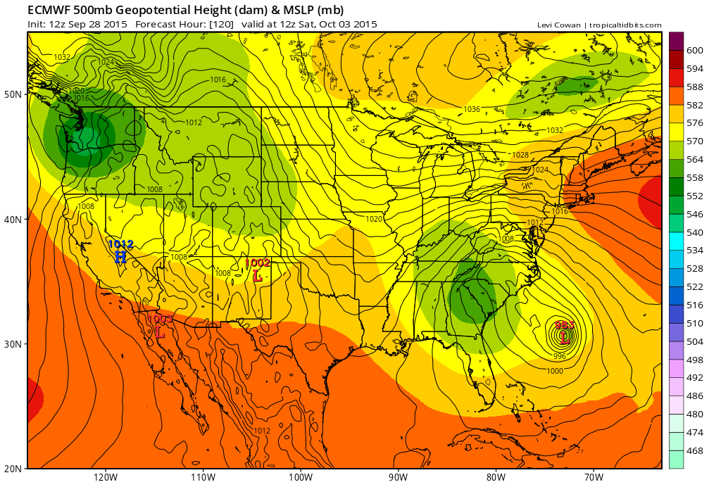 [12Z Euro model forecast for Saturday morning; courtesy tropicaltidbits.com]
Discussion
Our relatively dry weather pattern in the Mid-Atlantic region is coming to an end this week and there is some reason to be concerned about a potential heavy rain threat at the end of the week or over the weekend that could have a tropical connection. A strong cold front will push through the region on Wednesday generating heavy rain in the area along with possible thunderstorms. This front will stall out near the coastline and low pressure is likely to ride along the frontal boundary zone. There is a currently a tropical depression (#11) sitting well off the Southeast US coastline and it may get wrapped into this unfolding pattern. In fact, the latest Euro model (above) suggests the tropical system could strengthen later this week and then push back towards the Mid-Atlantic coastline (ala Sandy) over the weekend with heavy rain in its path. The key to this Euro model scenario is its forecast of a strong upper-level low in the Southeast US at the end of the week which "captures" the surface low pressure system and pulls it back towards the coast. Another model – NOAA's HWRF – which is specifically designed for hurricane forecasting has the track farther north than the 12Z Euro ultimately pushing the system into northern New Jersey (below) or thereabouts. Strong high pressure across southeastern Canada later this week does certainly allow for the possibility of a tropical system to “back in” towards the east coast, but the movement of the strengthening upper-level low is a difficult part of the forecast. Stay tuned.
 [Storm track of tropical system by NOAA HWRF model (in purple); courtesy NOAA]