1:45 PM | ***Snow/ice problems from about midnight-to-noon in the DC-to-Philly-to-NYC corridor***
Paul Dorian
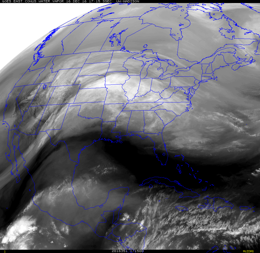
GOES-E satellite image of the water vapor channel with brighter regions (i.e., more moist) extending all the way from the Pacific Ocean near the southern tip of Baja California into the Midwest-much of this moisture field is headed in our direction; image courtesy NOAA/GOES-E
Overview
Arctic air is firmly entrenched in the Mid-Atlantic region and moisture is headed our way – not a good combination. Mid-day temperatures at the big cities of DC, Philly and NYC are holding in the low-to-mid 20’s, clouds are beginning to thicken, and dew points are hanging near zero. The extreme dryness of this air mass as indicated by those very low dew points is one sign that this is indeed true Arctic air from the Northern Canadian tundra region. The cold, dense Arctic air will grudgingly retreat to the north later tonight and early Saturday, but not before moisture arrives in the Mid-Atlantic region. The result will be snow and ice problems for about a twelve hour period from midnight-to-noon. After that, temperatures will likely climb into the 40’s on Saturday afternoon, perhaps even to 50+ degrees on Sunday, but then another Arctic air mass will filter in late Sunday and the beginning of next week will be quite cold.
The breakdown by region as it currently stands:
Record or near record lows this morning throughout the Northeast US (indicated by blue circles); map courtesy coolwx.com
DC area:
Slippery travel conditions are likely late tonight and early Saturday. Precipitation is likely to begin shortly after midnight as a brief period of snow, but then sleet and freezing rain will become the predominate type towards daybreak and into the early morning hours. A changeover to plain rain is then likely by late morning or mid-day. The snow can accumulate a coating to an inch or so before the wintry mix takes over and then there is likely to be added a layer of ice on top of the snow creating slippery road conditions. During the afternoon and evening hours, the breeze will pick up, temperatures can climb well into the 40’s, and the rain will tend to slacken off into just an occasional shower or some drizzle. On Sunday, temperatures can climb to 50+ degrees and more rain is likely as the next Arctic front approaches. The rain can change briefly to snow and/or sleet by early Sunday night as the next Arctic air mass filters into the I-95 corridor. The best chance for the changeover early Sunday night will be across the northern and western suburbs.
Philly and NYC areas:
Snow breaks out around midnight or shortly thereafter and continues into the overnight hours. There can be a snow accumulation of an inch or so by daybreak tomorrow. On Saturday, the snow is likely to transition to a period of sleet and freezing rain around mid-morning, and then finally to plain rain by mid-day or early afternoon. Before the changeover to a wintry mix or plain rain, there can be an additional inch or so of snow resulting in a total snowfall of a coating (south, east) to 1-3 inches (north, west) during this event in the Philly and NYC metro regions. A layer of ice on top of the snow will contribute to slippery road conditions for awhile during the Saturday morning hours. During the afternoon and evening hours, the breeze will pick up, temperatures can climb well into the 40’s, and the rain will tend to slacken off into just an occasional shower or some drizzle. On Sunday, temperatures can climb to 50+ degrees and more rain is likely as the next Arctic front approaches. The rain can change briefly to snow and/or sleet by early Sunday night as the next Arctic air mass filters into the I-95 corridor. The best chance for the changeover early Sunday night will be across the northern and western suburbs.
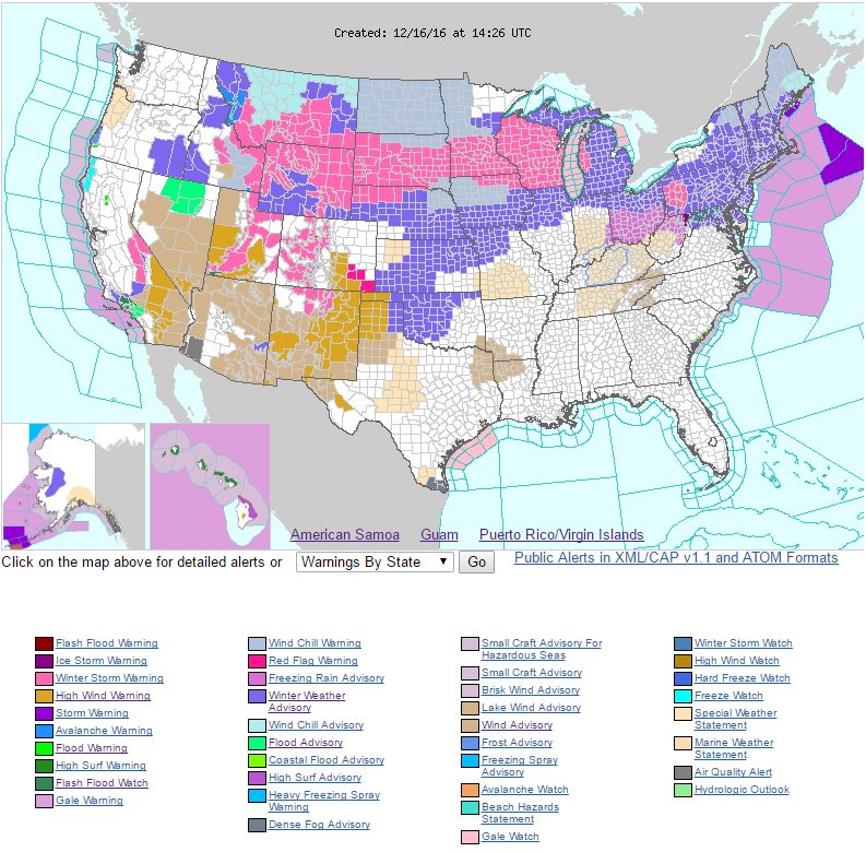
Mid-day "weather warnings" map from NOAA
Elsewhere
We are not the only ones suffering from the early winter weather. NOAA's latest “weather warnings” map shows much of the northern US is currently under "Winter Storm Watches/Warnings" or "Winter Weather Advisories". Also, this morning's low temperatures reached record or near record values in many parts of the Northeast US. One place that is suffering even more than us is Chicago, Illinois where current temperatures are near ten degrees and high temperatures on Sunday (with the next Arctic blast) may do no better than zero and this will very likely result in one of the coldest Chicago Bears game ever. Their overnight lows early Monday morning could be in the 10-15 degree below zero range. An interesting final note, Dallas, Texas may actually reach 80 degrees on Saturday and then could bottom out near 20 degrees on Sunday after the passage of the Arctic front.
Meteorologist Paul Dorian
Vencore, Inc.
vencoreweather.com


