12:20 PM | *Some frozen precipitation possible with Tuesday's system to the N and W…coldest air mass yet arrives late in the week and more Arctic blasts will follow*
Paul Dorian
Forecast map for early Tuesday evening from the high-resolution (12-km) version of the NAM model (blue=snow, green/yellow=rain); map courtesy tropicaltidbits.com, NOAA
Overview
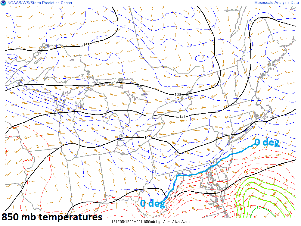
Low pressure will track northeastward on Tuesday towards the Mid-Atlantic region and will ultimately transfer its energy to an intensifying secondary low near the North Carolina/Virginia coastline. At the same time, strong high pressure situated over the Northeast US will be reluctant to give up its ground on Tuesday as it anchors a cold air mass. As a result, moist air pushing to the northeast will overrun the cold air in place and evaporative cooling will cause low-level temperatures to drop at the onset and then dynamical cooling will cause upper-level temperatures to drop later in the event. The end result of this unfolding scenario is that some frozen precipitation in the form of sleet and/or snow is liable to fall at times during this event across some of the northern and western suburbs of the big cities along I-95. Precipitation will taper off from SW-to-NE late Tuesday night/early Wednesday as the coastal low moves out to sea. After that, the coldest air mass so far this season will head our way for the late week and weekend. This late week Arctic blast will very likely be just the first of many in the eastern US over the next few weeks.
Current look at the 850 mb (~5000 foot level) temperatures with 0 degree line shown in blue; map courtesy NOAA/SPC
Details
Rain today will expand to the northeast across the Deep South as low pressure forms over the Gulf of Mexico. On Tuesday, the precipitation is likely to arrive in the DC metro region during the morning hours, early afternoon in Philly, and late afternoon across the NYC metro region. It could be just cold enough for some of the precipitation to fall as sleet or even snow on Tuesday; especially, to the N and W of the big cities. Surface-level high pressure is anchored across the Northeast US and cold air exists just above the surface-level, and this combination could help to create some frozen precipitation on Tuesday to the N and W of the metro regions. With the expected transfer of energy to a newly developing coastal low, the cold air in the upper atmosphere will not have much of a chance to erode to the north and east and this raises prospects for some frozen precipitation at times in the northern and western suburbs of the metro regions.
Current look at the mid-level lapse rate with some instability across PA indicating there is cold air aloft; map courtesy NOAA/SPC
After a bit of a warm up on Wednesday, winds will increase in intensity on Thursday out of the northwest as Arctic air arrives and there can be a few rain (early) or snow showers (late) in the I-95 corridor. By Friday, the full brunt of this Arctic air mass will have arrived and temperatures will struggle to climb above the middle 30’s during the afternoon hours – well below normal for this time of year - and strong winds will generate even lower wind chills. The weekend will also feature well below normal temperatures with afternoon highs generally confined to the 30’s.
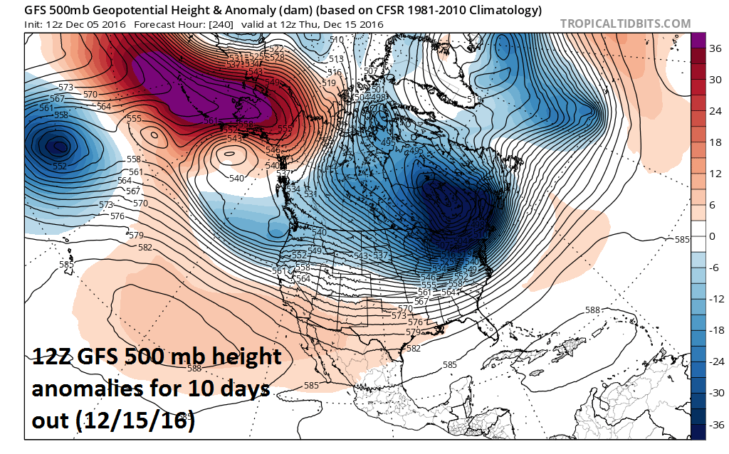
Looking ahead, this late week Arctic blast looks like it will only be the first of perhaps many to reach the eastern US over the next few weeks. The 12Z GFS 500 mb height anomaly forecast map (below) at 240 hours shows a significant negative anomaly over the Northeast US/SE Canada by the middle of next week (12/15/16) and this has the look of very cold weather for the Mid-Atlantic region.
Meteorologist Paul Dorian
Vencore, Inc.
vencoreweather.com


